  Main Spillway Releases Ongoing As snowmelt season begins, the Department of Water Resources (DWR) continues to perform flood protection releases from Lake Oroville using the main spillway and Hyatt Powerplant. Releases from Lake Oroville during the spring months help maintain storage capacity in the reservoir to capture runoff from mountain snowmelt, while optimizing storage for the benefit of water supply, recreation, and fish and wildlife enhancement. DWR coordinates releases closely with the U.S. Army Corps of Engineers and other water operators and adjusts releases as needed to maintain balance throughout the water system. The information below reflects current reservoir level estimates. Forecasts can change quickly and may affect the estimates provided.
Lake Oroville is the largest storage facility in the State Water Project, providing flood protection while supporting environmental and water delivery needs to 27 million Californians. In 2023, Oroville Dam’s main spillway passed over 2,370,000 acre-feet of water, 67 percent of Lake Oroville’s capacity, with flows as high as 36,000 cfs. The main spillway continues to perform well and operate as designed. DWR continues to monitor lake levels, weather forecasts, and mountain snow levels to optimize water storage while meeting environmental requirements and allowing for carryover storage into next year.  ABOVE AVERAGE SNOWPACK RECORDED DURING APRIL SNOW SURVEY DWR conducted the all-important April snow survey on April 2, the fourth measurement of the season at Phillips Station. The manual survey recorded 64 inches of snow depth and a snow water equivalent of 27.5 inches, which is 113 percent of average for this location. The snow water equivalent measures the amount of water contained in the snowpack and is a key component of DWR’s water supply forecast. The April measurement is critical for water managers as it’s considered the peak snowpack for the season and marks the transition to spring snowmelt into the state’s rivers and reservoirs. DWR’s electronic readings from 130 stations placed throughout the state indicate that the statewide snowpack’s snow water equivalent is 28.6 inches, or 110 percent of the April 1 average, a significant improvement from just 28 percent of average on January 1. California’s reservoirs remain in good shape thanks to state efforts to capture and store as much water as possible from record storms in 2023 and again this season. The State Water Project has increased storage by 700,000 acre-feet at Lake Oroville and by 154,000 acre-feet at San Luis Reservoir since January 1. As of April 2, statewide reservoir levels were at 116 percent of average. Read more about the April snow survey in DWR’s press release.  OROVILLE WILDFLOWER & NATURE FESTIVAL The Feather River Recreation & Park District (FRRPD) is hosting its annual Wildflower & Nature Festival at Riverbend Park in Oroville on Saturday, April 6 from 10 a.m. to 4 p.m. Admission is free to the festival with activities highlighting the area’s natural resources and booths showcasing handmade Butte County products. Activities and entertainment will be available for all ages including children’s crafts, river kayak tours, live music, food trucks, and a beer and wine garden. Make sure to stop by DWR’s booth for information about the Lake Oroville Visitor Center and Lake Oroville State Recreation Area, and a craft activity for kids – making wildflower seed paper. More information about the Wildflower & Nature Festival is available on FRRPD’s website. 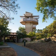 EARTH DAY ACTIVITIES Celebrate Earth Day all April with DWR and the Lake Oroville Visitor Center. Our Visitor Center guides are currently hosting a coloring contest for kids ages 5 to 12. Pick up coloring sheets at the Visitor Center and return them or your own original Earth Day artwork by Wednesday, April 17. Winners will have their art displayed publicly in the Visitor Center’s front lobby. In addition, DWR is hosting an Earth Day chalk art event at the Lake Oroville Visitor Center on Saturday, April 20 from 10 a.m. to 3 p.m. Join our guides in creating beautiful chalk art showcasing your love for our planet and its precious resources. The event is open to all ages and chalk will be provided. Located at 917 Kelly Ridge Rd. in Oroville, the Visitor Center is open daily from 9 a.m. to 5 p.m.  OROVILLE RECREATION
DWR, the California Department of Parks and Recreation, and the California Department of Fish and Wildlife (CDFW) maintain over 92 miles of trails in the Oroville area. An interactive map of recreation facilities, including open trails and their permitted uses (hike, bike, horse, multi), is available on DWR’s Lake Oroville Recreation webpage. A paper trail map is available at various locations, including most entrance kiosks and the Lake Oroville Visitor Center. Lake Oroville is one of the State Water Project’s premier recreational destinations and one of California’s best fishing spots. The lake provides both warm-water and cold-water fisheries and is a popular destination for bass tournaments. Below the Oroville Dam, the Thermalito Afterbay and the Feather River offer additional excellent fishing opportunities. The marinas at Bidwell Canyon and Lime Saddle are open daily and provide a variety of services including a convenience store, gas, and boat rentals. Upstream migrating fish totals through the Feather River Fish Monitoring Station between Jan. 1 and March 30 are:
CURRENT LAKE OPERATIONS Lake Oroville is at 873 feet elevation and storage is approximately 3.12 million acre-feet (MAF), which is 88 percent of its total capacity and 123 percent of the historical average. Feather River flows are at 1,000 cfs through the City of Oroville with 9,000 cfs being released from the Thermalito Afterbay River Outlet (Outlet) for a total Feather River release of 10,000 cfs downstream. Total Feather River releases may be reduced over the weekend depending on observed storm impacts. DWR continues to assess releases to the Feather River daily. Visitors to Oroville Dam may also notice minor amounts of water flowing from drains built into the emergency spillway, which is normal and expected with the emergency spillway design. The dam and emergency spillway continue to operate as intended. The public can track precipitation, snow, reservoir levels, and more at the California Data Exchange Center. The Lake Oroville gage station is identified as “ORO.” All data as of midnight 4/4/2024. 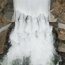 Main Spillway Releases Ongoing As snowmelt season begins, the Department of Water Resources (DWR) continues to perform flood protection releases from Lake Oroville using the main spillway and Hyatt Powerplant. Releases from Lake Oroville during the spring months help maintain storage capacity in the reservoir to capture runoff from mountain snowmelt, while optimizing storage for the benefit of water supply, recreation, and fish and wildlife enhancement. DWR coordinates releases closely with the U.S. Army Corps of Engineers and other water operators and adjusts releases as needed to maintain balance throughout the water system. The information below reflects current reservoir level estimates. Forecasts can change quickly and may affect the estimates provided.
Lake Oroville is the largest storage facility in the State Water Project, providing flood protection while supporting environmental and water delivery needs to 27 million Californians. In 2023, Oroville Dam’s main spillway passed over 2,370,000 acre-feet of water, 67 percent of Lake Oroville’s capacity, with flows as high as 36,000 cfs. The main spillway continues to perform well and operate as designed. DWR continues to monitor lake levels, weather forecasts, and mountain snow levels to optimize water storage while meeting environmental requirements and allowing for carryover storage into next year. 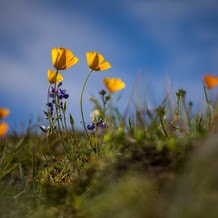 OROVILLE WILDFLOWER & NATURE FESTIVAL The Feather River Recreation & Park District (FRRPD) is hosting its annual Wildflower & Nature Festival at Riverbend Park in Oroville on Saturday, April 6 from 10 a.m. to 4 p.m. Admission is free to the festival with activities highlighting the area’s natural resources and booths showcasing handmade Butte County products. Activities and entertainment will be available for all ages including children’s crafts, river kayak tours, live music, food trucks, and a beer and wine garden. Make sure to stop by DWR’s booth for information about the Lake Oroville Visitor Center and Lake Oroville State Recreation Area, and a craft activity for kids – making wildflower seed paper. More information about the Wildflower & Nature Festival is available on FRRPD’s website.  EARTH DAY ACTIVITIES Celebrate Earth Day all April with DWR and the Lake Oroville Visitor Center. Our Visitor Center guides are currently hosting a coloring contest for kids ages 5 to 12. Pick up coloring sheets at the Visitor Center and return them or your own original Earth Day artwork by Wednesday, April 17. Winners will have their art displayed publicly in the Visitor Center’s front lobby. In addition, DWR is hosting an Earth Day chalk art event at the Lake Oroville Visitor Center on Saturday, April 20 from 10 a.m. to 3 p.m. Join our guides in creating beautiful chalk art showcasing your love for our planet and its precious resources. The event is open to all ages and chalk will be provided. Located at 917 Kelly Ridge Rd. in Oroville, the Visitor Center is open daily from 9 a.m. to 5 p.m. 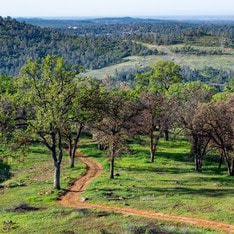 OROVILLE RECREATION
DWR, the California Department of Parks and Recreation, and the California Department of Fish and Wildlife (CDFW) maintain over 92 miles of trails in the Oroville area. An interactive map of recreation facilities, including open trails and their permitted uses (hike, bike, horse, multi), is available on DWR’s Lake Oroville Recreation webpage. A paper trail map is available at various locations, including most entrance kiosks and the Lake Oroville Visitor Center. Lake Oroville is one of the State Water Project’s premier recreational destinations and one of California’s best fishing spots. The lake provides both warm-water and cold-water fisheries and is a popular destination for bass tournaments. Below the Oroville Dam, the Thermalito Afterbay and the Feather River offer additional excellent fishing opportunities. The marinas at Bidwell Canyon and Lime Saddle are open daily and provide a variety of services including a convenience store, gas, and boat rentals. Upstream migrating fish totals through the Feather River Fish Monitoring Station between Jan. 1 and March 18 are:
CURRENT LAKE OPERATIONS Lake Oroville is at 870 feet elevation and storage is approximately 3.08 million acre-feet (MAF), which is 87 percent of its total capacity and 124 percent of the historical average. Feather River flows are at 1,000 cfs through the City of Oroville with 9,000 cfs being released from the Thermalito Afterbay River Outlet (Outlet) for a total Feather River release of 10,000 cfs downstream. DWR continues to assess releases to the Feather River daily. Visitors to Oroville Dam may also notice minor amounts of water flowing from drains built into the emergency spillway, which is normal and expected with the emergency spillway design. The dam and emergency spillway continue to operate as intended. The public can track precipitation, snow, reservoir levels, and more at the California Data Exchange Center. The Lake Oroville gage station is identified as “ORO.” All data as of midnight 3/28/2024. 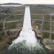 Main Spillway Releases Ongoing The Department of Water Resources (DWR) continues to perform flood protection releases from Lake Oroville using the main spillway and Hyatt Powerplant. Releases from Lake Oroville during the winter and spring months help maintain storage capacity in the reservoir for rain capture and future snowmelt. DWR coordinates releases closely with the U.S. Army Corps of Engineers and other water operators and adjusts releases as needed to account for continuing runoff. The information below reflects current reservoir level estimates. Forecasts can change quickly and may affect the estimates provided.
Crews may also be seen working near the main spillway for several weeks. Sections of the spillway’s underdrain system are being re-inspected to capture additional video footage. In addition, crews will be performing maintenance and repairs to the spillway’s lighting system. Lake Oroville is the largest storage facility in the State Water Project, providing flood protection while supporting environmental and water delivery needs to 27 million Californians. In 2023, Oroville Dam’s main spillway passed over 2,370,000 acre-feet of water, 67 percent of Lake Oroville’s capacity, with flows as high as 36,000 cfs. The main spillway continues to perform well and operate as designed. DWR continues to monitor lake levels, weather forecasts, and mountain snow levels to optimize water storage while meeting environmental requirements and allowing for carryover storage into next year. 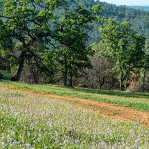 TEMPORARY TRAIL CLOSURE IN POTTER’S RAVINE AREA DWR and the California Department of Parks and Recreation (State Parks) have temporarily closed a section of Dead Cow Ravine Trail in the Potter’s Ravine area at the Lake Oroville State Recreation Area. Recreation users can still access the north section of Dead Cow Ravine Trail to Gobbler’s Knob from the Potter’s Point trail. The trail is anticipated to remain closed and be considered an environmentally sensitive area through July 31, 2024. Additionally, wire theft and vandalism have rendered the lighting system within the Brad Freeman Bike Trail’s historic train tunnel inoperable and beyond repair. DWR is designing an entirely new lighting system with construction anticipated in late 2024. The trail will remain open, but users are advised to bring their own light to navigate the train tunnel. DWR, State Parks, and the California Department of Fish and Wildlife (CDFW) maintain over 92 miles of trails in the Oroville area. An interactive map of recreation facilities, including open trails and their permitted uses (hike, bike, horse, multi), is available on DWR’s Lake Oroville Recreation webpage. A paper trail map is available at various locations, including most entrance kiosks and the Lake Oroville Visitor Center. 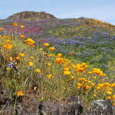 EXPLORE TABLE MOUNTAIN Formed from ancient lava flows, the 3,300-acre North Table Mountain Ecological Reserve is a flat-topped mesa providing spectacular views of the valley below. Following winter rains, fissures along the vast lava caps form natural streams, vernal pools, and waterfalls that cascade off the plateau to the valley below. March is a spectacular time to enjoy miles of hiking trails through the reserve to view an array of wildflowers in bloom and an expansive carpet of green grasses. Cattle grazing on the reserve is used as a management tool to reduce thatch and non-native grass species to benefit native plants. More information about visiting the ecological reserve may be found on the California Department of Fish and Wildlife's (CDFW) website.  OROVILLE RECREATION
The Lake Oroville Visitor Center is open daily from 9 a.m. to 5 p.m. Staffed by knowledgeable guides, the Visitor Center features interpretive displays on Oroville Dam, area geology, wildlife and habitat, hydroelectric power, and cultural and historical artifacts. View videos in the theater about the construction of Oroville Dam, walk or hike along nearby trails, and visit the 47-foot-tall observation tower that provides unsurpassed panoramic views of surrounding areas. Free guided tours for school and community groups are available by reservation. Parking and admission to the Visitor Center are free. Lake Oroville is one of the State Water Project’s premier recreational destinations and one of California’s best fishing spots. The lake provides both warm-water and cold-water fisheries and is a popular destination for bass tournaments. Below the Oroville Dam, the Thermalito Afterbay and the Feather River offer additional excellent fishing opportunities. The marinas at Bidwell Canyon and Lime Saddle are open daily and provide a variety of services including a convenience store, gas, and boat rentals. Upstream migrating fish totals between Jan. 1 and March 9 are:
CURRENT LAKE OPERATIONS Lake Oroville is at 866 feet elevation and storage is approximately 3.03 million acre-feet (MAF), which is 86 percent of its total capacity and 125 percent of the historical average. Feather River flows are at 1,000 cfs through the City of Oroville with 9,000 cfs being released from the Thermalito Afterbay River Outlet (Outlet) for a total Feather River release of 10,000 cfs downstream. Releases may be adjusted over the weekend or early next week to account for storm impacts and higher inflows into Lake Oroville. DWR continues to assess releases to the Feather River daily. Visitors to Oroville Dam may also notice minor amounts of water flowing from drains built into the emergency spillway, which is normal and expected with the emergency spillway design. The dam and emergency spillway continue to operate as intended. The public can track precipitation, snow, reservoir levels, and more at the California Data Exchange Center. The Lake Oroville gage station is identified as “ORO.” All data as of midnight 3/21/2024. 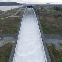 Main Spillway Releases Ongoing The Department of Water Resources (DWR) continues to perform flood protection releases from Lake Oroville using the main spillway and Hyatt Powerplant. Releases from Lake Oroville during the winter and spring months help maintain storage capacity in the reservoir for rain capture and future snowmelt. DWR coordinates releases closely with the U.S. Army Corps of Engineers and other water operators and adjusts releases as needed to account for continuing runoff. The information below reflects current reservoir level estimates. Forecasts can change quickly and may affect the estimates provided.
Crews may also be seen working near the main spillway for several weeks. Sections of the spillway’s underdrain system are being re-inspected to capture additional video footage. In addition, crews will be performing maintenance and repairs to the spillway’s lighting system. Lake Oroville is the largest storage facility in the State Water Project, providing flood protection while supporting environmental and water delivery needs to 27 million Californians. In 2023, Oroville Dam’s main spillway passed over 2,370,000 acre-feet of water, 67 percent of Lake Oroville’s capacity, with flows as high as 36,000 cfs. The main spillway continues to perform well and operate as designed. DWR continues to monitor lake levels, weather forecasts, and mountain snow levels to optimize water storage while meeting environmental requirements and allowing for carryover storage into next year. 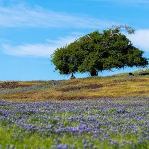 EXPLORE TABLE MOUNTAIN Formed from ancient lava flows, the 3,300-acre North Table Mountain Ecological Reserve is a flat-topped mesa providing spectacular views of the valley below. Following winter rains, fissures along the vast lava caps form natural streams, vernal pools, and waterfalls that cascade off the plateau to the valley below. March is a spectacular time to enjoy miles of hiking trails through the reserve to view an array of wildflowers in bloom and an expansive carpet of green grasses. Cattle grazing on the reserve is used as a management tool to reduce thatch and non-native grass species to benefit native plants. More information about visiting the ecological reserve may be found on the California Department of Fish and Wildlife's (CDFW) website.  THERMALITO AFTERBAY PARTIAL CLOSURE FOR SPEED BOAT TIME TRIALS Speed boat time trials are returning to the Thermalito Afterbay March 16 to March 17. The event requires the closure of the southern portion of the Afterbay (south of Highway 162) and the Monument Hill boat ramp. The Larkin Road cartop boat launch will also be closed the afternoon of Friday, March 15 and will reopen Monday, March 18 in the morning. The Wilbur Road boat ramp and areas north of Hwy 162 will remain open for public use during the boating event. The event is hosted by the Northern California Outboard Association and East Bay Boat Club and will feature a mile-long course. Time trial events are expected Saturday and Sunday between 8 a.m. and 5 p.m. depending on weather and water conditions. More information about the event can be found on the American Power Boat Association webpage.  OROVILLE RECREATION
Trail users on the Brad Freeman Bike Trail that follows the old railroad grade between downtown Oroville and Hyatt Powerplant have long enjoyed the section of trail through the historic train tunnel. Unfortunately, wire theft and vandalism have rendered the train tunnel’s lighting system inoperable and beyond repair. DWR is designing an entirely new lighting system with construction anticipated in late 2024. The trail will remain open, but users are advised to bring their own light to navigate the train tunnel. DWR, the California Department of Parks and Recreation (State Parks), and CDFW maintain over 92 miles of trails in the Oroville area. An interactive map of recreation facilities, including open trails and their permitted uses (hike, bike, horse, multi), is available on DWR’s Lake Oroville Recreation webpage. A paper trail map is available at various locations, including most entrance kiosks and the Lake Oroville Visitor Center. The Lake Oroville Visitor Center is open daily from 9 a.m. to 5 p.m. Staffed by knowledgeable guides, the Visitor Center features interpretive displays on Oroville Dam, area geology, wildlife and habitat, hydroelectric power, and cultural and historical artifacts. View videos in the theater about the construction of Oroville Dam, walk or hike along nearby trails, and visit the 47-foot-tall observation tower that provides unsurpassed panoramic views of surrounding areas. Free guided tours for school and community groups are available by reservation. Parking and admission to the Visitor Center are free. Lake Oroville is one of the State Water Project’s premier recreational destinations and one of California’s best fishing spots. The lake provides both warm-water and cold-water fisheries and is a popular destination for bass tournaments. Below the Oroville Dam, the Thermalito Afterbay and the Feather River offer additional excellent fishing opportunities. The marinas at Bidwell Canyon and Lime Saddle are open daily and provide a variety of services including a convenience store, gas, and boat rentals. Upstream migrating fish totals between Jan. 1 and March 9 are:
CURRENT LAKE OPERATIONS Lake Oroville is at 863 feet elevation and storage is approximately 2.99 million acre-feet (MAF), which is 85 percent of its total capacity and 127 percent of the historical average. Feather River flows are at 1,600 cfs through the City of Oroville with 8,400 cfs being released from the Thermalito Afterbay River Outlet (Outlet) for a total Feather River release of 10,000 cfs downstream. Further changes to flows are planned over the weekend with the low-flow channel being reduced to 1,000 cfs and releases from the Thermalito Afterbay River Outlet being increased to 9,000 cfs by Sunday. DWR continues to assess releases to the Feather River daily. Visitors to Oroville Dam may also notice minor amounts of water flowing from drains built into the emergency spillway, which is normal and expected with the emergency spillway design. The dam and emergency spillway continue to operate as intended. The public can track precipitation, snow, reservoir levels, and more at the California Data Exchange Center. The Lake Oroville gage station is identified as “ORO.” All data as of midnight 3/14/2024.  Main Spillway Releases Ongoing The Department of Water Resources (DWR) continues to release water from Lake Oroville using the main spillway and Hyatt Powerplant. Releases from Lake Oroville during the winter and spring months provide flood protection to downstream communities by maintaining storage capacity in the reservoir for rain capture and future snowmelt. DWR coordinates releases closely with the U.S. Army Corps of Engineers and other water operators and adjusts releases as needed to account for continuing runoff. The information below reflects current reservoir level estimates. Forecasts can change quickly and may affect the estimates provided.
Crews may also be seen working near the main spillway for several weeks. Sections of the spillway’s underdrain system are being re-inspected to capture additional video footage. In addition, crews will be performing maintenance and repairs to the spillway’s lighting system. Lake Oroville is the largest storage facility in the State Water Project, providing flood protection while supporting environmental and water delivery needs to 27 million Californians. In 2023, Oroville Dam’s main spillway passed over 2,370,000 acre-feet of water, 67 percent of Lake Oroville’s capacity, with flows as high as 36,000 cfs. The main spillway continues to perform well and operate as designed. DWR continues to monitor lake levels, weather forecasts, and mountain snow levels to optimize water storage while meeting environmental requirements and allowing for carryover storage into next year.  THERMALITO AFTERBAY PARTIAL CLOSURE FOR SPEED BOAT TIME TRIALS Speed boat time trials are returning to the Thermalito Afterbay March 16 to March 17. The event requires the closure of the southern portion of the Afterbay (south of Highway 162) and the Monument Hill boat ramp. The Larkin Road cartop boat launch will also be closed the afternoon of Friday, March 15 and will reopen Monday, March 18 in the morning. The Wilbur Road boat ramp and areas north of Hwy 162 will remain open for public use during the boating event. The event is hosted by the Northern California Outboard Association and East Bay Boat Club and will feature a mile-long course. Time trial events are expected Saturday and Sunday between 8 a.m. and 5 p.m. depending on weather and water conditions. More information about the event can be found on the American Power Boat Association webpage.  FEATHER RIVER FISH HATCHERY STEELHEAD PLANTING The Feather River Fish Hatchery raised approximately 452,000 yearling steelhead trout around 8.5 to 9.5 inches in length for 2024 releases. Around 7,000 steelhead were released in the Thermalito Afterbay the week of Feb. 12 to support recreational fishing. In addition, 1,011 adult male steelhead were released into the Thermalito Afterbay from December to February after they had been spawned at the hatchery. Hatchery-spawned females were released back to the Feather River. Approximately 445,000 steelhead were released into the Feather River at Boyd’s Pump Boat Launch between Feb. 5 and Feb. 13 to meet mitigation requirements. Releasing the young fish further downstream improves their chances of survival. Like the salmon that populate the Feather River, steelhead trout migrate from the river to the ocean, returning to the river as adults to spawn. Unlike salmon, they can spawn several times during their lifetime. The name “steelhead” comes from their appearance, a more streamlined shape than Chinook salmon with a silvery or brassy color as an adult. The Feather River Fish Hatchery is a California State Water Project (SWP) facility built in the late 1960s to mitigate impacts on fish migration resulting from the construction of Oroville Dam. DWR owns and maintains the facility and provides funding to the California Department of Fish and Wildlife (CDFW) to perform spawning, rearing, and stocking operations.  OROVILLE RECREATION
Trail users on the Brad Freeman Bike Trail that follows the old railroad grade between downtown Oroville and Hyatt Powerplant have long enjoyed the section of trail through the historic train tunnel. Unfortunately, wire theft and vandalism have rendered the train tunnel’s lighting system inoperable and beyond repair. DWR is designing an entirely new lighting system with construction anticipated in late 2024. The trail will remain open, but users are advised to bring their own light to navigate the train tunnel. DWR, the California Department of Parks and Recreation (State Parks), and CDFW maintain over 92 miles of trails in the Oroville area. An interactive map of recreation facilities, including open trails and their permitted uses (hike, bike, horse, multi), is available on DWR’s Lake Oroville Recreation webpage. A paper trail map is available at various locations, including most entrance kiosks and the Lake Oroville Visitor Center. The Lake Oroville Visitor Center is open daily from 9 a.m. to 5 p.m. Staffed by knowledgeable guides, the Visitor Center features interpretive displays on Oroville Dam, area geology, wildlife and habitat, hydroelectric power, and cultural and historical artifacts. View videos in the theater about the construction of Oroville Dam, walk or hike along nearby trails, and visit the 47-foot-tall observation tower that provides unsurpassed panoramic views of surrounding areas. Free guided tours for school and community groups are available by reservation. Parking and admission to the Visitor Center are free. Lake Oroville is one of the State Water Project’s premier recreational destinations and one of California’s best fishing spots. The lake provides both warm-water and cold-water fisheries and is a popular destination for bass tournaments. Below the Oroville Dam, the Thermalito Afterbay and the Feather River offer additional excellent fishing opportunities. The marinas at Bidwell Canyon and Lime Saddle are open daily and provide a variety of services including a convenience store, gas, and boat rentals. Upstream migrating fish totals between Jan. 1 and Feb. 29 are:
CURRENT LAKE OPERATIONS Lake Oroville is at 862 feet elevation and storage is approximately 2.97 million acre-feet (MAF), which is 84 percent of its total capacity and 130 percent of the historical average. Feather River flows are at 2,500 cfs through the City of Oroville with 7,500 cfs being released from the Thermalito Afterbay River Outlet (Outlet) for a total Feather River release of 10,000 cfs downstream. Further reductions to flows in the low-flow channel are planned in the coming week. DWR continues to assess releases to the Feather River daily. Visitors to Oroville Dam may also notice minor amounts of water flowing from drains built into the emergency spillway, which is normal and expected with the emergency spillway design. The dam and emergency spillway continue to operate as intended. The public can track precipitation, snow, reservoir levels, and more at the California Data Exchange Center. The Lake Oroville gage station is identified as “ORO.” All data as of midnight 3/7/2024.  Main Spillway Releases Continue The Department of Water Resources (DWR) continues water releases from Lake Oroville using the main spillway and Hyatt Powerplant. During the winter months, releases from Lake Oroville provide flood protection to downstream communities by maintaining storage capacity in the reservoir for additional rain capture and future snowmelt. DWR coordinates releases closely with the U.S. Army Corps of Engineers and other water operators and adjusts releases as needed to account for continuing runoff. The information below reflects current reservoir level estimates. Forecasts can change quickly and may affect the estimates provided.
Crews may also be seen working near the main spillway for several weeks. Sections of the spillway’s underdrain system are being re-inspected to capture additional video footage. In addition, crews will be performing maintenance and repairs to the spillway’s lighting system. The Lake Oroville reservoir is the largest storage facility in the State Water Project, providing flood protection while supporting environmental and water delivery needs to 27 million Californians. In 2023, Oroville Dam’s main spillway passed over 2,370,000 acre-feet of water, 67 percent of Lake Oroville’s capacity, with flows as high as 36,000 cfs. The main spillway continues to perform well and operate as designed. DWR continues to monitor lake levels, weather forecasts, and mountain snow levels to optimize water storage while allowing for carryover storage into next year.  MARCH SNOW SURVEY DWR conducted the third snow survey of the season at Phillips Station on Feb. 29. The manual survey recorded 47.5 inches of snow depth and a snow water equivalent of 18 inches, which is 77 percent of average for this location. The snow water equivalent measures the amount of water contained in the snowpack and is a key component of DWR’s water supply forecast. Today’s results reflect continued improvement in the snowpack since the slow and dry start to the water year. DWR’s electronic readings from 130 stations placed throughout the state indicate that the statewide snowpack’s snow water equivalent is 18.7 inches, or 80 percent of average for this date, an improvement from just 28 percent of average on Jan. 1. The snowpack is currently only 70 percent of the critical April 1 average, when the snowpack is typically at its peak. An incoming storm is expected to bring several feet of snow to the Sierra Nevada this weekend. More information about the March snow survey may be found in DWR’s press release.  FEATHER RIVER FISH HATCHERY STEELHEAD PLANTING The Feather River Fish Hatchery raised approximately 452,000 yearling steelhead trout around 8.5 to 9.5 inches in length for 2024 releases. Around 7,000 steelhead were released in the Thermalito Afterbay the week of Feb. 12 to support recreational fishing. In addition, 1,011 adult male steelhead were released into the Thermalito Afterbay from December to February after they had been spawned at the hatchery. Hatchery-spawned females were released back to the Feather River. Approximately 445,000 steelhead were released into the Feather River at Boyd’s Pump Boat Launch between Feb. 5 and Feb. 13 to meet mitigation requirements. Releasing the young fish further downstream improves their chances of survival. Like the salmon that populate the Feather River, steelhead trout migrate from the river to the ocean, returning to the river as adults to spawn. Unlike salmon, they can spawn several times during their lifetime. The name “steelhead” comes from their appearance, a more streamlined shape than Chinook salmon with a silvery or brassy color as an adult. The Feather River Fish Hatchery is a California State Water Project (SWP) facility built in the late 1960s to mitigate impacts on fish migration resulting from the construction of Oroville Dam. DWR owns and maintains the facility and provides funding to the California Department of Fish and Wildlife (CDFW) to perform spawning, rearing, and stocking operations. OROVILLE DAM CITIZENS ADVISORY COMMISSION The California Natural Resources Agency hosted its 16th Oroville Dam Citizens Advisory Commission meeting on March 1. In addition to public comment, the Commission received briefings on the process DWR uses to prioritize and select Oroville facility projects, the forecast of expenditures for State Water Project activities at Oroville, and State emergency preparedness coordination and the use of weather forecasting in emergency response. The Citizens Advisory Commission is a forum for questions and feedback from the communities surrounding Oroville Dam. For information on the meeting, please visit the Oroville Dam Citizens Advisory Commission website. A transcript of the meeting will be available on the webpage in the coming weeks.  OROVILLE RECREATION
The Lake Oroville Visitor Center is open daily from 9 a.m. to 5 p.m. Staffed by knowledgeable guides, the Visitor Center features interpretive displays on Oroville Dam, area geology, wildlife and habitat, hydroelectric power, and cultural and historical artifacts. View videos in the theater about the construction of Oroville Dam, walk or hike along nearby trails, and visit the 47-foot-tall observation tower that provides unsurpassed panoramic views of surrounding areas. Free guided tours for school and community groups are available by reservation. Parking and admission to the Visitor Center are free. DWR, the California Department of Parks and Recreation (State Parks), and CDFW maintain over 92 miles of trails in the Oroville area. An interactive map of recreation facilities, including open trails and their permitted uses (hike, bike, horse, multi), is available on DWR’s Lake Oroville Recreation webpage. A paper trail map is available at various locations, including most entrance kiosks and the Lake Oroville Visitor Center. Trail users on the Brad Freeman Bike Trail that follows the old railroad grade between downtown Oroville and Hyatt Powerplant have long enjoyed the section of trail through the historic train tunnel. Unfortunately, wire theft and vandalism have rendered the train tunnel’s lighting system inoperable and beyond repair. DWR is designing an entirely new lighting system with construction anticipated in late 2024. The trail will remain open, but users are advised to bring their own light to navigate the train tunnel. Lake Oroville is one of the State Water Project’s premier recreational destinations and one of California’s best fishing spots. The lake provides both warm-water and cold-water fisheries and is a popular destination for bass tournaments. Below the Oroville Dam, the Thermalito Afterbay and the Feather River offer additional excellent fishing opportunities. The marinas at Bidwell Canyon and Lime Saddle are open daily and provide a variety of services including a convenience store, gas, and boat rentals. Upstream migrating fish totals between Jan. 1 and Feb. 25 are:
CURRENT LAKE OPERATIONS Lake Oroville is at 860 feet elevation and storage is approximately 2.95 million acre-feet (MAF), which is 83 percent of its total capacity and 132 percent of the historical average. Feather River flows remain at 3,650 cfs through the City of Oroville with 10,350 cfs being released from the Thermalito Afterbay River Outlet (Outlet) for a total Feather River release of 14,000 cfs downstream. DWR continues to assess releases to the Feather River daily. Visitors to Oroville Dam may also notice minor amounts of water flowing from drains built into the emergency spillway, which is normal and expected with the emergency spillway design. The dam and emergency spillway continue to operate as intended. The public can track precipitation, snow, reservoir levels, and more at the California Data Exchange Center. The Lake Oroville gage station is identified as “ORO.” All data as of midnight 2/29/2024.  Main Spillway Releases Continue The Department of Water Resources (DWR) is continuing water releases from Lake Oroville using the main spillway and Hyatt Powerplant. During the winter months, releases from Lake Oroville provide flood protection to downstream communities by maintaining storage capacity in the reservoir for additional rain capture and future snowmelt. DWR coordinates releases closely with the U.S. Army Corps of Engineers and other water operators and adjusts releases as needed to account for continuing runoff. The information below reflects current reservoir level estimates. Forecasts can change quickly and may affect the estimates provided.
Crews may also be seen working near the main spillway for several weeks. Sections of the spillway’s underdrain system are being re-inspected to capture additional video footage. In addition, crews will be performing maintenance and repairs to the spillway’s lighting system. The Lake Oroville reservoir is the largest storage facility in the State Water Project, providing flood protection while supporting environmental and water delivery needs to 27 million Californians. In 2023, Oroville Dam’s main spillway passed over 2,370,000 acre-feet of water, 67 percent of Lake Oroville’s capacity, with flows as high as 36,000 cfs. The main spillway continues to perform well and operate as designed. DWR continues to monitor lake levels, weather forecasts, and mountain snow levels to optimize water storage while allowing for carryover storage into next year. Oroville Dam Citizens Advisory Commission The California Natural Resources Agency is hosting its 16th Oroville Dam Citizens Advisory Commission meeting Friday, March 1 from 10 a.m. to noon at the Southside Oroville Community Center located at 2959 Lower Wyandotte Road, Oroville, CA, 95966. The public meeting will include presentations and public comment. The Commission will receive briefings on the process DWR uses to prioritize and select Oroville facility projects, the forecast of expenditures for State Water Project activities at Oroville, and State emergency preparedness coordination and the use of weather forecasting in emergency response. The Citizens Advisory Commission is a forum for questions and feedback from the communities surrounding Oroville Dam. For more information about the meeting, please visit the Oroville Dam Citizens Advisory Commission website.  STATE WATER PROJECT ALLOCATION DWR announced on Feb. 21 an increase in the State Water Project (SWP) allocation forecast for 2024. The forecasted allocation is now 15 percent of requested supplies, up from the 10 percent initial allocation announced in December. This translates to about 200,000 acre-feet of additional water for the 29 public water agencies that serve 27 million Californians. This assessment does not include the results of any of the storms that hit California earlier this month. The State Water Project will review conditions and may revise the forecasted allocation in mid-March. The February allocation forecast update takes into account snow survey measurements and data up until Feb.1 and spring runoff forecasts outlined in the first Bulletin 120 of the season. More information about the allocation announcement is available in DWR’s press release.  OROVILLE RECREATION
DWR, the California Department of Parks and Recreation (State Parks), and the California Department of Fish and Wildlife (CDFW) maintain over 92 miles of trails in the Oroville area. An interactive map of recreation facilities, including open trails and their permitted uses (hike, bike, horse, multi), is available on DWR’s Lake Oroville Recreation webpage. A paper trail map is available at various locations, including most entrance kiosks and the Lake Oroville Visitor Center. The Lake Oroville Visitor Center is open daily from 9 a.m. to 5 p.m. Staffed by knowledgeable guides, the Visitor Center features interpretive displays on Oroville Dam, area geology, wildlife and habitat, hydroelectric power, and cultural and historical artifacts. View videos in the theater about the construction of Oroville Dam, walk or hike along nearby trails, and visit the 47-foot-tall observation tower that provides unsurpassed panoramic views of surrounding areas. Free guided tours for school and community groups are available by reservation. Parking and admission to the Visitor Center are free. Lake Oroville is one of the State Water Project’s premier recreational destinations and one of California’s best fishing spots. The lake provides both warm-water and cold-water fisheries and is a popular destination for bass tournaments. Below the Oroville Dam, the Thermalito Afterbay and the Feather River offer additional excellent fishing opportunities. The marinas at Bidwell Canyon and Lime Saddle are open daily and provide a variety of services including a convenience store, gas, and boat rentals. Upstream migrating fish totals between Jan. 1 and Feb. 18 are:
Feather River flows remain at 650 cfs through the City of Oroville with 9,350 cfs being released from the Thermalito Afterbay River Outlet (Outlet) for a total Feather River release of 10,000 cfs downstream. DWR continues to assess releases to the Feather River daily. Visitors to Oroville Dam may also notice minor amounts of water flowing from drains built into the emergency spillway, which is normal and expected with the emergency spillway design. The dam and emergency spillway continue to operate as intended. The public can track precipitation, snow, reservoir levels, and more at the California Data Exchange Center. The Lake Oroville gage station is identified as “ORO.” All data as of midnight 2/22/2024. 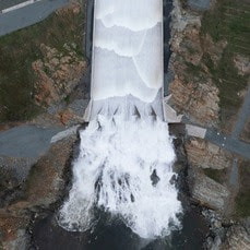 Main Spillway Releases Resume The Department of Water Resources (DWR) increased water releases from Lake Oroville this week in advance of a series of storms. Water releases from Oroville Dam’s main spillway also resumed around 10 a.m. today with continuing releases through the Hyatt Powerplant. During the winter months, releases from Lake Oroville provide flood protection to downstream communities by maintaining storage capacity in the reservoir for additional rain capture. DWR coordinates releases closely with the U.S. Army Corps of Engineers and other water operators and adjusts releases as needed to account for continuing runoff. The information below reflects current reservoir level estimates. Forecasts can change quickly and may affect the estimates provided.
Crews may also be seen working near the main spillway for several weeks. Sections of the spillway’s underdrain system are being re-inspected to capture additional video footage. In addition, crews will be performing maintenance and repairs to the spillway’s lighting system. The Lake Oroville reservoir is the largest storage facility in the State Water Project, providing flood protection while supporting environmental and water delivery needs to 27 million Californians. In 2023, Oroville Dam’s main spillway passed over 2,370,000 acre-feet of water, 67 percent of Lake Oroville’s capacity, with flows as high as 36,000 cfs. The main spillway continues to perform well and operate as designed. DWR continues to monitor lake levels, weather forecasts, and mountain snow levels to optimize water storage while allowing for carryover storage into next year. Temporary Bathroom Closure Extended DWR is alerting Oroville Dam recreation users to extended temporary closures of the Oroville Dam Overlook and Spillway Day-Use Area restrooms for sewer system work. Due to material delays, the bathrooms are expected to remain closed through the week of Feb. 18 with closures possibly extending into the following week. DWR has placed portable toilets and hand washing stations at these locations to continue to provide restroom facilities. 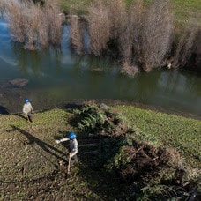 CHRISTMAS TREE HABITAT CONSTRUCTION DWR, the California Conservation Corps (CCC), and the Department of Fish and Wildlife (CDFW) finished constructing fish habitat structures at Lake Oroville and the Thermalito Afterbay using just over 1,000 recycled Christmas trees. The trees were again collected by Chico Boy Scout Troop 2 and delivered free of charge to the Oroville facilities by Recology, a local waste management company. To create the habitat structures at Lake Oroville and the Thermalito Afterbay, members of the CCC team bundle the recycled holiday trees together and anchor them in various locations around the lakebed. At Lake Oroville near the Saddle Dam Recreation Area, 625 trees were assembled into 29 structures. At the Thermalito Afterbay, 426 trees were assembled into 42 structures. Anchoring the trees allows them to remain submerged when the water levels rise, providing juvenile fish safe refuge and improving fish populations. When water levels drop the structures then provide habitat for native animals. This marks the 30th year that DWR has worked with local groups to construct fish habitat structures, making it one of the longest continuously running warmwater fish habitat improvement programs in the State of California. 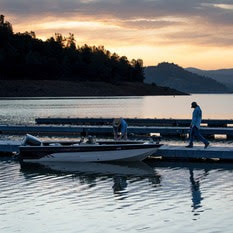 OROVILLE RECREATION
The Lake Oroville Visitor Center is open daily from 9 a.m. to 5 p.m. Staffed by knowledgeable guides, the Visitor Center features interpretive displays on Oroville Dam, area geology, wildlife and habitat, hydroelectric power, and cultural and historical artifacts. View videos in the theater about the construction of Oroville Dam, walk or hike along nearby trails, and visit the 47-foot-tall observation tower that provides unsurpassed panoramic views of surrounding areas. Free guided tours for school and community groups are available by reservation. Parking and admission to the Visitor Center are free. Lake Oroville is one of the State Water Project’s premier recreational destinations and one of California’s best fishing spots. The lake provides both warm-water and cold-water fisheries and is a popular destination for bass tournaments. Below the Oroville Dam, the Thermalito Afterbay and the Feather River offer additional excellent fishing opportunities. The marinas at Bidwell Canyon and Lime Saddle are open daily and provide a variety of services including a convenience store, gas, and boat rentals. Upstream migrating fish totals between Sept. 11, 2023 and Feb. 10, 2024 are:
CURRENT LAKE OPERATIONS Lake Oroville is at 850 feet elevation and storage is approximately 2.81 million acre-feet (MAF), which is 79 percent of its total capacity and 131 percent of the historical average. Feather River flows remain at 650 cfs through the City of Oroville with 7,350 cfs being released from the Thermalito Afterbay River Outlet (Outlet) for a total Feather River release of 8,000 cfs downstream. DWR continues to assess releases to the Feather River daily. Visitors to Oroville Dam may also notice minor amounts of water flowing from drains built into the emergency spillway, which is normal and expected with the emergency spillway design. The dam and emergency spillway continue to operate as intended. The public can track precipitation, snow, reservoir levels, and more at the California Data Exchange Center. The Lake Oroville gage station is identified as “ORO.” All data as of midnight 2/15/2024. 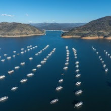 Main Spillway Releases End The Department of Water Resources (DWR) stopped water releases from Oroville Dam’s main spillway at 10 a.m. on Feb. 7 due to low inflow into Lake Oroville. Water releases are still being made through the Hyatt Powerplant to provide flood protection to downstream communities during the winter storm season. DWR coordinates releases closely with the U.S. Army Corps of Engineers and other water operators and adjusts releases as needed to account for continuing runoff. Visitors to Oroville Dam may still see water on the main spillway even when the radial gates are closed as they are not designed to be watertight. The seals do not play a role in the structural integrity of the gates, which continue to operate as intended. DWR periodically maintains and adjusts the seals during low-reservoir conditions to improve their sealing capability. Total releases to the Feather River amount to 3,000 cubic feet per second with 650 cfs being routed down the low-flow channel through the City of Oroville. An additional 2,350 cfs is being released from the Thermalito Afterbay River Outlet, located 5 miles downstream from Oroville. Feather River releases may increase again in the future to account for additional incoming storms and high inflows. Feather River recreation users are advised to remain alert as river flows are expected to be swift and cold and may change based on projected weather forecasts. Starting this week, crews may also be seen working near the main spillway. Sections of the spillway’s underdrain system are being re-inspected to capture additional video footage. In addition, crews will be performing maintenance and repairs to the spillway’s lighting system. The Lake Oroville reservoir is the largest storage facility in the State Water Project, providing flood protection while supporting environmental and water delivery needs to 27 million Californians. In 2023, Oroville Dam’s main spillway passed over 2,370,000 acre-feet of water, 67 percent of Lake Oroville’s capacity, with flows as high as 36,000 cfs. The main spillway continues to perform well and operate as designed. DWR continues to monitor lake levels, weather forecasts, and mountain snow levels to optimize water storage while allowing for carryover storage into next year. Temporary Bathroom Closure DWR is alerting Oroville Dam recreation users to temporary closures of the Oroville Dam Overlook and Spillway Day-Use Area restrooms for sewer system work. The bathrooms will close starting Monday, Feb. 12 and are expected to remain closed for the duration of repairs, approximately one week. During the work, DWR will place portable toilets and hand washing stations at these locations to continue to provide restroom facilities. 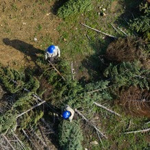 CHRISTMAS TREE HABITAT CONSTRUCTION DWR, the California Conservation Corps (CCC), and the Department of Fish and Wildlife (CDFW) finished constructing fish habitat structures at Lake Oroville and the Thermalito Afterbay using just over 1,000 recycled Christmas trees. The trees were again collected by Chico Boy Scout Troop 2 and delivered free of charge to the Oroville facilities by Recology, a local waste management company. To create the habitat structures at Lake Oroville and the Thermalito Afterbay, members of the CCC team bundle the recycled holiday trees together and anchor them in various locations around the lakebed. At Lake Oroville near the Saddle Dam Recreation Area, 625 trees were assembled into 29 structures. At the Thermalito Afterbay, 426 trees were assembled into 42 structures. Anchoring the trees allows them to remain submerged when the water levels rise, providing juvenile fish safe refuge and improving fish populations. When water levels drop the structures then provide habitat for native animals. This marks the 30th year that DWR has worked with local groups to construct fish habitat structures, making it one of the longest continuously running warmwater fish habitat improvement programs in the State of California.  OROVILLE RECREATION
DWR, State Parks, and the California Department of Fish and Wildlife (CDFW) maintain over 92 miles of trails in the Oroville area. An interactive map of recreation facilities, including open trails and their permitted uses (hike, bike, horse, multi), is available on DWR’s Lake Oroville Recreation webpage. A paper trail map is available at various locations, including most entrance kiosks and the Lake Oroville Visitor Center. The Lake Oroville Visitor Center is open daily from 9 a.m. to 5 p.m. Staffed by knowledgeable guides, the Visitor Center features interpretive displays on Oroville Dam, area geology, wildlife and habitat, hydroelectric power, and cultural and historical artifacts. View videos in the theater about the construction of Oroville Dam, walk or hike along nearby trails, and visit the 47-foot-tall observation tower that provides unsurpassed panoramic views of surrounding areas. Free guided tours for school and community groups are available by reservation. Parking and admission to the Visitor Center are free. Lake Oroville is one of the State Water Project’s premier recreational destinations and one of California’s best fishing spots. The lake provides both warm-water and cold-water fisheries and is a popular destination for bass tournaments. Below the Oroville Dam, the Thermalito Afterbay and the Feather River offer additional excellent fishing opportunities. The marinas at Bidwell Canyon and Lime Saddle are open daily and provide a variety of services including a convenience store, gas, and boat rentals. Upstream migrating fish totals between Sept. 11, 2023 and Jan. 27, 2024 are:
CURRENT LAKE OPERATIONS Lake Oroville is at 845 feet elevation and storage is approximately 2.75 million acre-feet (MAF), which is 78 percent of its total capacity and 131 percent of the historical average. Feather River flows remain at 650 cfs through the City of Oroville with 2,350 cfs being released from the Thermalito Afterbay River Outlet (Outlet) for a total Feather River release of 3,000 cfs downstream. DWR continues to assess releases to the Feather River daily. Visitors to Oroville Dam may also notice minor amounts of water flowing from drains built into the emergency spillway, which is normal and expected with the emergency spillway design. The dam and emergency spillway continue to operate as intended. The public can track precipitation, snow, reservoir levels, and more at the California Data Exchange Center. The Lake Oroville gage station is identified as “ORO.” All data as of midnight 2/8/2024. 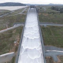 Spillway Releases Begin at Oroville Dam The Department of Water Resources (DWR) began releasing water from Oroville Dam’s main spillway on Jan. 31. Ongoing releases to the Feather River ensure storage space remains in Lake Oroville for flood control protection to downstream communities. DWR coordinates releases closely with the U.S. Army Corps of Engineers and other water operators and adjusts releases as needed to account for continuing rain. The information below reflects current reservoir level estimates. Forecasts can change quickly and may affect the estimates provided.
Starting the week of Feb. 5, crews may also be seen working near the main spillway. Sections of the spillway’s underdrain system are being re-inspected to capture additional video footage. In addition, crews will be performing maintenance and repairs to the spillway’s lighting system. The Lake Oroville reservoir is the largest storage facility in the State Water Project, providing flood protection while supporting environmental and water delivery needs to 27 million Californians. In 2023, Oroville Dam’s main spillway passed over 2,370,000 acre-feet of water, 67 percent of Lake Oroville’s capacity, with flows as high as 36,000 cfs. The main spillway continues to perform well and operate as designed. DWR continues to monitor lake levels, weather forecasts, and mountain snow levels to optimize water storage while allowing for carryover storage into next year. Oroville Recreation Advisory Committee The Oroville Recreation Advisory Committee (ORAC) met Feb. 2 at the Southside Oroville Community Center. ORAC was established by the Federal Energy Regulatory Commission (FERC) to review and provide recreation plan recommendations for Oroville Facilities owned by DWR. The 13-member committee is made up of representatives from state and local government, recreation groups, and business and community organizations. To obtain a summary of the meeting, send a request to [email protected].  FEBRUARY SNOW SURVEY DWR conducted the second snow survey of the season at Phillips Station on Jan. 30. The manual survey recorded 29 inches of snow depth and a snow water equivalent of 10 inches, which is 58 percent of average for this location. The snow water equivalent measures the amount of water contained in the snowpack and is a key component of DWR’s water supply forecast. The results reflect a modest increase in the snowpack since Jan. 1, but overall conditions are still far below normal. DWR’s electronic readings from 130 stations placed throughout the state indicate that the statewide snowpack’s snow water equivalent is 8.4 inches, or 52 percent of average for this date, an improvement from just 28 percent of average on Jan. 1. One year ago, the snowpack statewide was 214 percent of average on Feb. 1. Despite additional precipitation in January, many storms so far this year have been warmer than average, producing rain rather than snow at higher elevations. Overall statewide precipitation is 82 percent of average for this date. Last year’s snowpack was aided by both above average precipitation and below average temperatures, which created a historic snowpack and improved reservoir storage statewide, which is still above average. Lake Oroville, the State Water Project’s largest reservoir, is currently 131 percent of average. More information about the recent snow survey can be found in DWR’s press release.  OROVILLE RECREATION
DWR, State Parks, and the California Department of Fish and Wildlife (CDFW) maintain over 92 miles of trails in the Oroville area. An interactive map of recreation facilities, including open trails and their permitted uses (hike, bike, horse, multi), is available on DWR’s Lake Oroville Recreation webpage. A paper trail map is available at various locations, including most entrance kiosks and the Lake Oroville Visitor Center. The Lake Oroville Visitor Center is open daily from 9 a.m. to 5 p.m. Staffed by knowledgeable guides, the Visitor Center features interpretive displays on Oroville Dam, area geology, wildlife and habitat, hydroelectric power, and cultural and historical artifacts. View videos in the theater about the construction of Oroville Dam, walk or hike along nearby trails, and visit the 47-foot-tall observation tower that provides unsurpassed panoramic views of surrounding areas. Free guided tours for school and community groups are available by reservation. Parking and admission to the Visitor Center are free. Lake Oroville is one of the State Water Project’s premier recreational destinations and one of California’s best fishing spots. The lake provides both warm-water and cold-water fisheries and is a popular destination for bass tournaments. Below the Oroville Dam, the Thermalito Afterbay and the Feather River offer additional excellent fishing opportunities. The marinas at Bidwell Canyon and Lime Saddle are open daily and provide a variety of services including a convenience store, gas, and boat rentals. Upstream migrating fish totals between Sept. 11, 2023 and Jan. 27, 2024 are:
CURRENT LAKE OPERATIONS Lake Oroville is at 842 feet elevation and storage is approximately 2.7 million acre-feet (MAF), which is 76 percent of its total capacity and 131 percent of the historical average. Feather River flows remain at 650 cfs through the City of Oroville with 9,350 cfs being released from the Thermalito Afterbay River Outlet (Outlet) for a total Feather River release of 10,000 cfs downstream. DWR continues to assess releases to the Feather River daily. Visitors to Oroville Dam may also notice minor amounts of water flowing from drains built into the emergency spillway, which is normal and expected with the emergency spillway design. The dam and emergency spillway continue to operate as intended. The public can track precipitation, snow, reservoir levels, and more at the California Data Exchange Center. The Lake Oroville gage station is identified as “ORO.” All data as of midnight 2/1/2024. |
Archives
May 2024
Categories
All
|
 RSS Feed