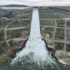
 Lake Oroville Operations Update The Department of Water Resources (DWR) began releasing water from Oroville Dam’s main spillway at 8 a.m. today. Releases to the Feather River ensure storage space remains in Lake Oroville for flood control protection. DWR coordinates releases closely with the U.S. Army Corps of Engineers and other water operators and adjusts releases as needed to account for continuing rain and snowmelt. Digital photos and b-roll from today’s spillway release are available on Pixel and Box. The information below reflects current reservoir level estimates. Forecasts can change quickly and may affect the estimates provided.
The Lake Oroville reservoir is the largest storage facility in the State Water Project, providing flood protection while supporting environmental and water delivery needs to 27 million Californians. In 2023, Oroville Dam’s main spillway passed over 2,370,000 acre-feet of water, 67 percent of Lake Oroville’s capacity, with flows as high as 36,000 cfs. The main spillway continues to perform well and operate as designed. DWR continues to monitor lake levels, weather forecasts, and mountain snow levels to optimize water storage while allowing for carryover storage into next year. 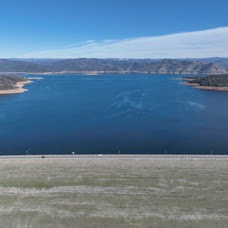 Lake Oroville Operations Update Ahead of forecasted winter storms this week, the Department of Water Resources (DWR) began increasing water releases to the Feather River today from the Oroville-Thermalito Complex. These releases provide flood control protection for downstream communities and are coordinated closely with the U.S. Army Corps of Engineers and other water operators. Feather River recreation users are advised to remain alert as river flows are expected to be swift and cold and may change based on projected weather forecasts. The information below reflects current reservoir level estimates. Forecasts can change quickly and may affect the estimates provided.
Oroville Recreation Advisory Committee The Oroville Recreation Advisory Committee (ORAC) will hold a meeting on Friday, Feb. 2 at 10 a.m. at the Southside Oroville Community Center located at 2959 Lower Wyandotte Road, Oroville, CA, 95966. ORAC was established by the Federal Energy Regulatory Commission (FERC) to review and provide recreation plan recommendations for Oroville Facilities owned by the Department of Water Resources (DWR). The 13-member committee is made up of representatives from state and local government, recreation groups, and business and community organizations.  BROOD PONDS SUPPORT NATIVE WILDLIFE Within the Oroville-Thermalito Complex, DWR maintains several areas that preserve and enhance wildlife habitat. Encompassed within the Thermalito Afterbay’s 17 miles of shoreline and 4,300 surface acres of water are numerous brood ponds that provide prime habitat and breeding areas for waterfowl and giant garter snakes, a protected species. While water levels at the Afterbay may fluctuate based on agriculture and hydropower operations, DWR ensures brood pond habitats remain stable. A flap gate outlet system permits water to flow into brood pond areas, raising water levels, while preventing water from being released and maintaining a stable elevation for waterfowl nests and giant garter snakes. These measures ensure these species continue to thrive, upholding DWR’s commitment to protect, restore, and enhance the natural and human environments. 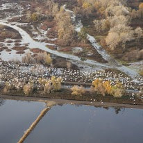 SNOW GOOSE FESTIVAL Celebrate one of the greatest migratory bird pathways in the world at the Snow Goose Festival of the Pacific Flyway happening Jan. 25 to Jan. 28. The festival hosts a variety of activities throughout the four-day event, including guided field trips to view the waterfowl, raptors and Snow Geese that migrate through the Northern Sacramento Valley during the winter months. DWR’s Lake Oroville Visitor Center Guides will host a free educational booth featuring kids’ activities between 9 a.m. and 3 p.m. on Saturday, Jan. 27 and Sunday, Jan. 28 at the Patrick Ranch Museum in Chico. Join festival attendees with visits to the Thermalito Forebay and Afterbay, and Oroville Wildlife Area offering possible sightings of rough-legged hawk, ferruginous hawk, merlin, bald eagle, golden eagle, red-tailed hawk, burrowing owl, ducks, grebes, and other deep-water birds. Check out the Snow Goose Festival website for more details about activities, an avian art exhibit, and guided field trips during the four-day event. 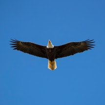 MIDWINTER BALD EAGLE SURVEY Environmental scientists from DWR participated in the National Midwinter Bald Eagle Survey on Jan. 5 and Jan. 8. This nationwide effort, coordinated by the U.S. Army Corps of Engineers, aims to determine bald eagle distribution and identify areas of important winter habitats. This year’s official count was 77 bald eagles for the Lake Oroville Winter Roost and 16 at the Thermalito Complex. Lake Oroville and the Sacramento Valley area provide an ideal habitat for bald eagles. Fish and waterfowl are the eagle’s main food source during this time of the year and large water bodies like Lake Oroville provide a wide variety of fish and the nearby wetlands and flooded rice fields provide an abundant supply of waterfowl for eagle foraging. The many trees and snags (tall dead trees) near water areas provide prime roosting locations for the bald eagles that migrate to and through the area during the winter months. 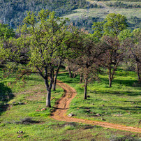 OROVILLE RECREATION DWR, State Parks, and the California Department of Fish and Wildlife (CDFW) maintain over 92 miles of trails in the Oroville area. An interactive map of recreation facilities, including open trails and their permitted uses (hike, bike, horse, multi), is available on DWR’s Lake Oroville Recreation webpage. A paper trail map is available at various locations, including most entrance kiosks and the Lake Oroville Visitor Center. The Lake Oroville Visitor Center is open daily from 9 a.m. to 5 p.m. Staffed by knowledgeable guides, the Visitor Center features interpretive displays on Oroville Dam, area geology, wildlife and habitat, hydroelectric power, and cultural and historical artifacts. View videos in the theater about the construction of Oroville Dam, walk or hike along nearby trails, and visit the 47-foot-tall observation tower that provides unsurpassed panoramic views of surrounding areas. Free guided tours for school and community groups are available by reservation. Parking and admission to the Visitor Center are free. Lake Oroville is one of the State Water Project’s premier recreational destinations and one of California’s best fishing spots. The lake provides both warm-water and cold-water fisheries. Below the Oroville Dam, the Thermalito Forebay, Thermalito Afterbay and the Feather River offer additional excellent fishing opportunities. The marinas at Bidwell Canyon and Lime Saddle are open daily and provide a variety of services including a convenience store, gas, and boat rentals. Upstream migrating fish totals between Sept. 11, 2023 and Jan. 20, 2024 are:
CURRENT LAKE OPERATIONS Lake Oroville is at 838 feet elevation and storage is approximately 2.65 million acre-feet (MAF), which is 75 percent of its total capacity and 131 percent of the historical average. Feather River flows remain at 650 cubic feet per second (cfs) through the City of Oroville with 1,100 cfs being released from the Thermalito Afterbay River Outlet (Outlet) for a total Feather River release of 1,750 cfs downstream. DWR continues to assess releases to the Feather River daily. Winter storms have caused Lake Oroville’s elevation to rise above the level of the spillway’s main gates. While the gates are closed, water may still be seen on the main spillway outlet as the seals on the eight radial gates are not designed to be watertight. The seals do not play a role in the structural integrity of the gates, which continue to operate as intended. DWR periodically maintains and adjusts the seals during low-reservoir conditions to improve their sealing capability. Visitors to Oroville Dam may also notice minor amounts of water flowing from drains built into the emergency spillway, which is normal and expected with the emergency spillway design. The dam and emergency spillway continue to operate as intended. All data as of midnight 1/25/2024. 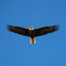 Midwinter Bald Eagle Survey Environmental scientists from the Department of Water Resources (DWR) participated in the National Midwinter Bald Eagle Survey on Jan. 5 and Jan. 8. This nationwide effort, coordinated by the U.S. Army Corps of Engineers, aims to determine bald eagle distribution and identify areas of important winter habitats. This year’s official count was 77 bald eagles for the Lake Oroville Winter Roost and 16 at the Thermalito Complex. Lake Oroville and the Sacramento Valley area provide an ideal habitat for bald eagles. Fish and waterfowl are the eagle’s main food source during this time of the year and large water bodies like Lake Oroville provide a wide variety of fish, and the nearby wetlands and flooded rice fields provide an abundant supply of waterfowl for eagle foraging. The many trees and snags (tall dead trees) near water areas provide prime roosting locations for the bald eagles that migrate to and through the area during the winter months. 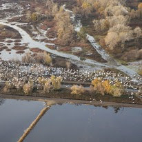 SNOW GOOSE FESTIVAL Celebrate one of the greatest migratory bird pathways in the world at the Snow Goose Festival of the Pacific Flyway happening Jan. 25 to Jan. 28. The festival hosts a variety of activities throughout the four-day event, including guided field trips to view the waterfowl, raptors, and Snow Geese that migrate through the Northern Sacramento Valley during the winter months. DWR’s Lake Oroville Visitor Center Guides will host a free educational booth featuring kids’ activities between 9 a.m. and 4 p.m. Saturday, Jan. 27 and Sunday, Jan. 28 at the Patrick Ranch Museum in Durham. Join festival attendees with visits to the Thermalito Forebay and Afterbay and Oroville Wildlife Area offering possible sightings of Rough-legged Hawk, Ferruginous Hawk, Merlin, Bald and Golden Eagle, Red-tailed Hawk, Burrowing Owl, ducks, grebes, and other deep-water birds. Check out the Snow Goose Festival website for more details about activities, an avian art exhibit, and guided field trips during the four-day event. 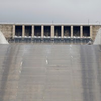 MAIN SPILLWAY GATE TESTING DWR will conduct routine testing on Oroville Dam’s main spillway gate hoist system on Wednesday, Jan. 24 between 10:30 a.m. and noon. During testing, two main spillway gates will be lifted one foot, releasing approximately 800 cubic feet per second of water down the spillway chute. The gates will remain open for approximately 15 minutes before being closed. Due to the minimal amount of water being released, water will appear to trickle from the chute. DWR will sound Oroville Dam’s alarm prior to spillway releases and gate testing. Oroville Dam’s eight main spillway radial gates were also inspected and tested in Nov. 2023. Recent storms have caused Lake Oroville’s elevation to rise above the level of the spillway’s main gates. While the gates are closed, water may still be seen on the main spillway outlet as the seals on the eight radial gates are not designed to be watertight. The seals do not play a role in the structural integrity of the gates, which continue to operate as intended. DWR periodically maintains and adjusts the seals during low-reservoir conditions to improve their sealing capability.  EXERCISING AT OROVILLE DAM While Oroville Dam plays a critical role in providing flood protection to downstream communities, it may not also come to mind as a prime location for physical fitness. However, a 1.3-mile paved road and separated two-lane multi-use path runs the length of the dam’s crest, offering an opportunity for exercise while enjoying scenic views of both Lake Oroville and the valley. Free parking is available on either side of the dam’s crest with restroom facilities located at the intersection of Canyon Drive and Oroville Dam Crest Road. For early birds or late-night fitness enthusiasts, the dam crest path is fully lit, making it a great location for free outdoor recreation during the shorter daylight hours of the winter months. Those looking for additional hiking or biking opportunities may use the Oroville Dam Crest trail to connect to an additional 92 miles of trails throughout the Oroville area. An interactive map of recreation facilities, including open trails and their permitted uses (hike, bike, horse, multi), is available on DWR’s Lake Oroville Recreation webpage. A paper trail map is available at various locations, including most entrance kiosks and the Lake Oroville Visitor Center. 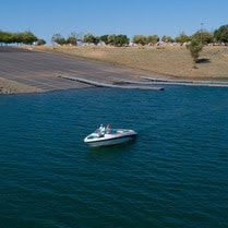 OROVILLE RECREATION The Lake Oroville Visitor Center is open daily from 9 a.m. to 5 p.m. Staffed by knowledgeable guides, the Visitor Center features interpretive displays on Oroville Dam, area geology, wildlife and habitat, hydroelectric power, and cultural and historical artifacts. View videos in the theater about the construction of Oroville Dam, walk or hike along nearby trails, and visit the 47-foot-tall observation tower that provides unsurpassed panoramic views of surrounding areas. Free guided tours for school and community groups are available by reservation. Parking and admission to the Visitor Center are free. Lake Oroville is one of the State Water Project’s premier recreational destinations and one of California’s best fishing spots. The lake provides both warm-water and cold-water fisheries. Below the Oroville Dam, the Thermalito Forebay, Thermalito Afterbay and the Feather River offer additional excellent fishing opportunities. The marinas at Bidwell Canyon and Lime Saddle are open daily and provide a variety of services including a convenience store, gas, and boat rentals. Upstream migrating fish totals between Sept. 11, 2023 and Jan. 13, 2024 are:
CURRENT LAKE OPERATIONS Lake Oroville is at 825 feet elevation and storage is approximately 2.49 million acre-feet (MAF), which is 70 percent of its total capacity and 126 percent of the historical average. Feather River flows remain at 650 cubic feet per second (cfs) through the City of Oroville with 1,100 cfs being released from the Thermalito Afterbay River Outlet (Outlet) for a total Feather River release of 1,750 cfs downstream. DWR continues to assess releases to the Feather River daily. Visitors to Oroville Dam may also notice minor amounts of water flowing from drains built into the emergency spillway, which is normal and expected with the emergency spillway design. The dam and emergency spillway continue to operate as intended. The public can track precipitation, snow, reservoir levels, and more at the California Data Exchange Center. The Lake Oroville gage station is identified as “ORO.” All data as of midnight 1/18/2024.  Exercising at Oroville Dam While Oroville Dam plays a critical role in providing flood protection to downstream communities, it is also a prime location for physical fitness. A 1.3-mile paved road and separated two-lane multi-use path runs the length of the dam’s crest, offering an opportunity for exercise while enjoying scenic views of both Lake Oroville and the valley. Free parking is available on either side of the dam’s crest with restroom facilities located at the intersection of Canyon Drive and Oroville Dam Crest Road. Additional nearby parking is available at the Oroville Dam Crest Overlook, with a short path connecting to the dam crest road. For early birds or late-night fitness enthusiasts, the dam crest path has full lighting, making it a great location for free outdoor recreation during the shorter daylight hours of the winter months. Those looking for additional hiking or biking opportunities may use the Oroville Dam Crest trail to connect to an additional 92 miles of trails throughout the Oroville area. An interactive map of recreation facilities, including open trails and their permitted uses (hike, bike, horse, multi), is available on the Lake Oroville Recreation webpage. A paper trail map is available at various locations, including most entrance kiosks and the Lake Oroville Visitor Center. 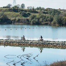 BIKING AROUND LAKE OROVILLE While the spring and summer months may seem ideal for outdoor activities, winter remains a prime period for mountain biking throughout the Oroville area. Bikers not only enjoy cooler weather, but the dirt on recreation trails gets compacted by rainfall, offering increased traction following a few days of dry weather. With more than 70 miles of biking-designated trails throughout the Lake Oroville Recreation and Oroville Wildlife Areas, cyclists have a variety of trails and experiences to choose from. The Brad Freeman Trail loops throughout both recreation areas offering a 41-mile trek from the Oroville Dam Spillway area, past the Thermalito Diversion Pool, around the Thermalito Forebay and Afterbay, and through the remote Oroville Wildlife Area. Along the west side of Lake Oroville, the Potter’s Ravine system is a 15-mile trail with intermittent views of Lake Oroville. Cyclists can also bike another 8 miles from Potter’s Ravine along the North Fork Trail to the Bloomer Cove area showcasing the north fork arm of Lake Oroville. Those seeking a shorter trip may also bike from the Lake Oroville Visitor Center down to the Bidwell Canyon Saddle Dam, offering spectacular views of Lake Oroville during the ride. 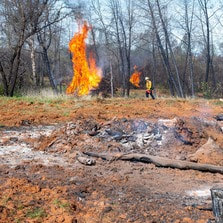 VEGETATION MANAGEMENT ACTIVITIES The Department of Water Resources (DWR) and CAL FIRE crews continue hand cutting, heavy equipment, and pile burning activities. Crews will be working in several areas throughout the Oroville Recreation Area – Loafer Creek along Highway 162 (Oro Quincy Highway) and around the Loafer Creek Campground, near Hyatt Powerplant along Oroville Dam Blvd. East, at the Lake Oroville Visitor Center, and throughout Bidwell Canyon. Work schedules are subject to change depending on weather, crew, and equipment availability. Work may cause intermittent trail closures within project areas. Recreational trail users should be cautious when entering work areas and obey all posted trail signage. Smoke from pile burning activities will be visible in the Oroville area. DWR’s Fuel Load Management Plan works to reduce wildfire risk, increase public safety, and enhance forest health around the Lake Oroville area. Ongoing vegetation management of this critical area remains a high priority for DWR and its partners at CAL FIRE, Butte County Fire Department, Butte County Sheriff’s Office, California Conservation Corps (CCC), California Department of Parks and Recreation (State Parks), and the Butte County Fire Safe Council. 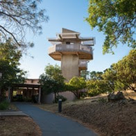 OROVILLE RECREATION The Lake Oroville Visitor Center is open daily from 9 a.m. to 5 p.m. Staffed by knowledgeable guides, the Visitor Center features interpretive displays on Oroville Dam, area geology, wildlife and habitat, hydroelectric power, and cultural and historical artifacts. View videos in the theater about the construction of Oroville Dam, walk or hike along nearby trails, and visit the 47-foot-tall observation tower that provides unsurpassed panoramic views of surrounding areas. Free guided tours for school and community groups are available by reservation. Parking and admission to the Visitor Center are free. Lake Oroville is one of the State Water Project’s premier recreational destinations and one of California’s best fishing spots. The lake provides both warm-water and cold-water fisheries. Below the Oroville Dam, the Thermalito Forebay, Thermalito Afterbay and the Feather River offer additional excellent fishing opportunities for Chinook salmon and steelhead. The marinas at Bidwell Canyon and Lime Saddle are open daily and provide a variety of services including a convenience store, gas, and boat rentals. Upstream migrating fish totals between Sept. 11, 2023 and Jan. 6, 2024 are:
CURRENT LAKE OPERATIONS Lake Oroville is at 821 feet elevation and storage is approximately 2.45 million acre-feet (MAF), which is 69 percent of its total capacity and 127 percent of the historical average. Feather River flows remain at 650 cubic feet per second (cfs) through the City of Oroville with 1,100 cfs being released from the Thermalito Afterbay River Outlet (Outlet) for a total Feather River release of 1,750 cfs downstream. DWR continues to assess releases to the Feather River daily. With rising water levels from recent storms, water may be seen on the main spillway outlet as the seals on the eight radial gates are not designed to be watertight. The gate seals do not play a role in the structural integrity of the gates, which continue to operate as intended. DWR periodically maintains and adjusts the seals during low-reservoir conditions to improve their sealing capability. Visitors to Oroville Dam may also notice minor amounts of water flowing from drains built into the emergency spillway, which is normal and expected with the emergency spillway design. The dam and emergency spillway continue to operate as intended. The public can track precipitation, snow, reservoir levels, and more at the California Data Exchange Center. The Lake Oroville gage station is identified as “ORO.” All data as of midnight 1/11/2024. 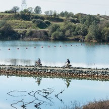 Biking Around Lake Oroville While the spring and summer months may seem ideal for outdoor activities, winter remains a prime period for mountain biking throughout the Oroville area. Bikers not only enjoy cooler weather, but the dirt on recreation trails gets compacted by rainfall, offering increased traction following a few days of dry weather. With more than 70 miles of biking-designated trails throughout the Lake Oroville Recreation and Oroville Wildlife Areas, cyclists have a variety of trails and experiences to choose from. The Brad Freeman Trail loops throughout both recreation areas offering a 41-mile trek from the Oroville Dam Spillway area, past the Thermalito Diversion Pool, around the Thermalito Forebay and Afterbay, and through the remote Oroville Wildlife Area. Along the west side of Lake Oroville, the Potter’s Ravine system is a 15-mile trail with intermittent views of Lake Oroville. Cyclists can also bike another 8 miles from Potter’s Ravine along the North Fork Trail to the Bloomer Cove area showcasing the north fork arm of Lake Oroville. Those seeking a shorter trip may also bike from the Lake Oroville Visitor Center down to the Bidwell Canyon Saddle Dam, offering spectacular views of Lake Oroville during the ride. 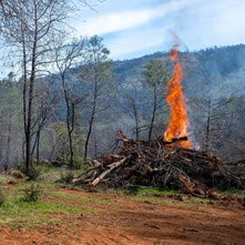 VEGETATION MANAGEMENT ACTIVITIES The Department of Water Resources (DWR) and CAL FIRE crews are resuming hand cutting, heavy equipment, and pile burning activities following the holiday season. Crews will be working in several areas throughout the Oroville Recreation Area – Loafer Creek along Highway 162 (Oro Quincy Highway) and around the Loafer Creek Campground, near Hyatt Powerplant along Oroville Dam Blvd. East, at the Lake Oroville Visitor Center, and throughout Bidwell Canyon. Work schedules are subject to change depending on weather, crew, and equipment availability. Work may cause intermittent trail closures within project areas. Recreational trail users should be cautious when entering work areas and obey all posted trail signage. Smoke from pile burning activities will be visible in the Oroville area. DWR’s Fuel Load Management Plan works to reduce wildfire risk, increase public safety, and enhance forest health around the Lake Oroville area. Ongoing vegetation management of this critical area remains a high priority for DWR and its partners at CAL FIRE, Butte County Fire Department, Butte County Sheriff’s Office, California Conservation Corps (CCC), California Department of Parks and Recreation (State Parks), and the Butte County Fire Safe Council. 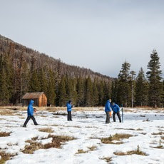 SNOW SURVEY DWR conducted the first snow survey of the season at Phillips Station on Jan. 2. The manual survey recorded 7.5 inches of snow depth and a snow water equivalent of 3 inches, which is 30 percent of average for this location. The snow water equivalent measures the amount of water contained in the snowpack and is a key component of DWR’s water supply forecast. Statewide the snowpack is 25 percent of average for this date. After one of the largest snowpacks on record last season, the start of this water year has been dry despite some recent storms in the last weeks of December that provided a small boost in the snowpack. While state reservoirs are still above average for this time of year and strong El Niño conditions are present in the Pacific Ocean, the outlook for the rest of the winter remains highly uncertain. More information about the first snow survey can be found in DWR’s press release. 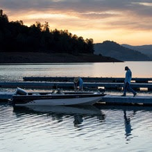 OROVILLE RECREATION DWR, State Parks, and the California Department of Fish and Wildlife (CDFW) maintain over 92 miles of trails in the Oroville area. An interactive map of recreation facilities, including open trails and their permitted uses (hike, bike, horse, multi), is available on DWR’s Lake Oroville Recreation webpage. A paper trail map is available at various locations, including most entrance kiosks and the Lake Oroville Visitor Center. The marinas at Bidwell Canyon and Lime Saddle are open daily and provide a variety of services including a convenience store, gas, and boat rentals. The Lake Oroville Visitor Center is open daily from 9 a.m. to 5 p.m. Staffed by knowledgeable guides, the Visitor Center features interpretive displays on Oroville Dam, area geology, wildlife and habitat, hydroelectric power, and cultural and historical artifacts. View videos in the theater about the construction of Oroville Dam, walk or hike along nearby trails, and visit the 47-foot-tall observation tower that provides unsurpassed panoramic views of surrounding areas. Free guided tours for school and community groups are available by reservation. Parking and admission to the Visitor Center are free. Upstream migrating fish totals between Sept. 11 and Dec. 26 are:
CURRENT LAKE OPERATIONS Lake Oroville is at 820 feet elevation and storage is approximately 2.42 million acre-feet (MAF), which is 69 percent of its total capacity and 129 percent of the historical average. Feather River flows remain at 650 cubic feet per second (cfs) through the City of Oroville with 1,100 cfs being released from the Thermalito Afterbay River Outlet (Outlet) for a total Feather River release of 1,750 cfs downstream. DWR continues to assess releases to the Feather River daily. With rising water levels from recent storms, water may be seen on the main spillway outlet as the seals on the eight radial gates are not designed to be watertight. The gate seals do not play a role in the structural integrity of the gates, which continue to operate as intended. DWR periodically maintains and adjusts the seals during low-reservoir conditions to improve their sealing capability. Visitors to Oroville Dam may also notice minor amounts of water flowing from drains built into the emergency spillway, which is normal and expected with the emergency spillway design. The dam and emergency spillway continue to operate as intended. The public can track precipitation, snow, reservoir levels, and more at the California Data Exchange Center. The Lake Oroville gage station is identified as “ORO.” All data as of midnight 1/4/2024. |
Archives
May 2024
Categories
All
|


 RSS Feed