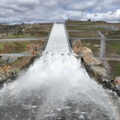
 Lake Oroville Water Releases Continue The Department of Water Resources (DWR) continues to make releases from Lake Oroville using the main spillway at Oroville Dam. Ongoing releases ensure continued storage space in Lake Oroville for spring runoff from snowmelt and are closely coordinated with the U.S. Army Corps of Engineers and downstream water operators. Total releases to the Feather River amount to 10,000 cubic feet per second (cfs) with 650 cfs being routed down the low-flow channel which flows through the City of Oroville. An additional 9,350 cfs is being released from the Thermalito Afterbay River Outlet, located 5 miles downstream from Oroville. Water releases are scheduled to increase to 15,000 cfs on Sunday, May 14. DWR continues to closely monitor lake levels and will adjust releases accordingly to optimize operations for water storage and environmental protection while allowing for carryover storage into next year. Since Dec. 1, Lake Oroville’s storage has increased approximately 230 feet and gained over 2.3 million acre-feet of water. Lake Oroville is currently at 95 percent capacity and is expected to reach full capacity this spring. The Lake Oroville reservoir is the largest storage facility in the State Water Project (SWP) and supports environmental and water delivery needs to 27 million Californians and reduces flood risks to downstream communities. 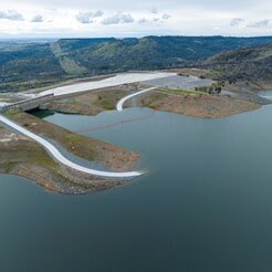 HOURS EXTENDED FOR SPILLWAY DAY-USE AREA As the summer months approach and daylight hours linger, the Spillway Boat Ramp and Day Use Area is now open from 5 a.m. to 11 p.m. All vehicles and trailers are subject to inspection by the California Highway Patrol (CHP) for security purposes. There are five other boat ramps at Lake Oroville that are open 24 hours/day and do not entail CHP inspections: Bidwell Canyon, Loafer Point, Loafer Creek, Lime Saddle and Enterprise.  WATER SAFETY MONTH The State Water Project’s (SWP) reservoirs located throughout California will welcome the upcoming summer months with high water levels. Heavy storms this past winter will also bring fast flows and cold temperatures to rivers and streams as mountain snow melts. When recreating at SWP facilities, you should always keep water safety a top priority and stay alert for cold, fast, and fluctuating water conditions. As part of Water Safety Month, keep these water safety tips in mind to have a fun and safe summer:
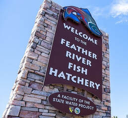
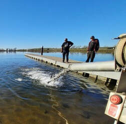
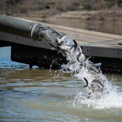 DWR AND CDFW RELEASE SALMON On Monday, May 15, approximately 125,000 Chinook salmon will be planted into Lake Oroville. These fish were raised at the Feather River Fish Hatchery and are part of an ongoing DWR and California Department of Fish and Wildlife (CDFW) program to support recreational fishery at Lake Oroville. OROVILLE RECREATION ADVISORY COMMITTEE The Oroville Recreation Advisory Committee (ORAC) met Friday, May 5 at the Southside Oroville Community Center. ORAC was established by the Federal Energy Regulatory Commission (FERC) to review and provide recommendations regarding the Department of Water Resources (DWR) recreation plan for the Oroville Facilities. The 13-member committee is made up of representatives from state and local government, recreation groups, and business and community organizations. To obtain a summary of the meeting, send a request to [email protected].  OROVILLE RECREATION
The Lake Oroville Visitor Center is open Monday through Friday between 9 a.m. and 5 p.m. The Visitor Center offers numerous educational exhibits, a theater featuring videos about the building of Oroville Dam, and a 47-foot-tall observation tower providing unsurpassed panoramic views. DWR, State Parks, and CDFW maintain over 92 miles of trails in the Oroville area. Paved trails at the Lake Oroville Visitor Center, Spillway Day Use Area, and at the North Forebay Day Use Area offer accessible trails with only slight elevation changes. Other trails, such as the Brad Freeman Trail near Oroville Dam, offer steep elevation changes to challenge hikers and mountain bikers. The Saddle Dam Trailhead has facilities for equestrians including a large parking area to accommodate horse trailers, water troughs, and hitching posts, and easy access to trails designated for hikers and horses. An interactive map of recreation facilities, including open boat ramps, and their permitted uses is available on DWR’s Lake Oroville Recreation webpage. A paper trail map is available at various locations, including most entrance kiosks and the Visitor Center. The marinas at Bidwell Canyon and Lime Saddle are open daily and provide a variety of services such as a shuttle and boat rentals. CURRENT LAKE OPERATIONS Lake Oroville is at 889 feet elevation and storage is approximately 3.37 million acre-feet (MAF), which is 95 percent of its total capacity and 122 percent of the historical average. The Feather River releases are at 10,000 cubic feet per second (cfs). Flows through the City of Oroville are 650 cfs with 9,350 cfs released from the Thermalito Afterbay Outlet (Outlet) for a total of 10,000 cfs downstream of the Outlet. Water releases are scheduled to increase to 15,000 cfs on Sunday, May 14. DWR continues to assess releases to the Feather River daily. The public can track precipitation, snow, reservoir levels, and more at the California Data Exchange Center. The Lake Oroville gage station is identified as “ORO”. All data as of midnight 5/11/2023. 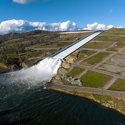 Lake Oroville Water Releases Continue The Department of Water Resources (DWR) continues to make releases from Lake Oroville using the main spillway at Oroville Dam. Ongoing releases ensure continued storage space in Lake Oroville for spring runoff from snowmelt and are closely coordinated with the U.S. Army Corps of Engineers and downstream water operators. Total releases to the Feather River amount to 10,000 cubic feet per second (cfs) with 2,200 cfs being routed down the low-flow channel which flows through the City of Oroville. An additional 7,800 cfs is being released from the Thermalito Afterbay River Outlet, located 5 miles downstream from Oroville. Water releases from Lake Oroville are schedule to be further reduced to 7,000 cfs on Friday, May 5. DWR continues to closely monitor lake levels and will adjust releases accordingly to optimize operations for water storage and environmental protection while allowing for carryover storage into next year. Since Dec. 1, Lake Oroville’s storage has increased more than 220 feet and gained over 2.2 million acre-feet of water. Lake Oroville is currently at 92 percent capacity and is expected to reach full capacity this spring. The Lake Oroville reservoir is the largest storage facility in the State Water Project (SWP) and supports environmental and water delivery needs to 27 million Californians and reduces flood risks to downstream communities. 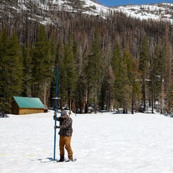 FINAL SNOW SURVEY CONDUCTED DWR conducted the fifth snow survey of the season at Phillips Station this week. The manual survey recorded 59 inches of snow depth and a snow water equivalent of 30 inches, which is 241 percent of average for this location on May 1. The snow water equivalent measures the amount of water still contained in the snowpack and is a key component of DWR’s water supply run-off forecast. DWR’s electronic readings from 130 snow sensors placed throughout the state indicate the statewide snowpack’s snow water equivalent is 49.2 inches, or 254 percent of average for this date. Snow surveys like the one at Phillips Station are critical to planning for impacts of the coming snowmelt runoff on communities. DWR uses the most updated technology to gather data from snow surveys, a network of 130 remote snow sensors, and airborne snow observatory data to gather information on current real-world conditions to create the most accurate snowmelt runoff forecasts possible. These runoff forecasts allow reservoir operators to plan for anticipated inflows and water managers downstream of reservoirs to plan and prepare for flood risks. Read more about the latest snow survey in DWR’s press release.  BLUE GREEN ALGAE MONITORING DWR’s environmental scientists began monitoring for blue-green algae and their toxins last week within the Oroville-Thermalito Complex and the upper Feather River lakes. Monitoring occurs during the summer months with water samples taken at various locations regularly, which are sent to a lab for toxin analysis. There are currently no harmful algal bloom (HAB) advisories for Lake Oroville, Upper Feather River lakes, the Thermalito Forebay, or the Thermalito Afterbay. Blue-green algae (cyanobacteria) is a natural component of ecosystems. Under certain conditions, including warmer temperatures and increased nutrient loads, algae can grow rapidly causing “blooms.” Algal blooms sometimes produce toxins that can be harmful to people and animals. Algal blooms can make the water appear green, blue, or brown in color. Seeing colors, mats, foam, scum, or paint-like streaks in the water may indicate a bloom is present. Keep animals and children away from the water when a suspected bloom is present and report blooms immediately to the California Regional Water Quality Control Board. If elevated levels of cyanobacteria toxins are found while testing, DWR staff will work with California’s Regional Water Quality Control Board and recreation area managers to notify the public and post advisory signs at affected waterbodies. To learn more about HABs, or to report a HAB visit the Water Board’s website.  OROVILLE RECREATION ADVISORY COMMITTEE The Oroville Recreation Advisory Committee (ORAC) will hold a public meeting on Friday, May 5 starting at 10 a.m. at the Southside Oroville Community Center located at 2959 Lower Wyandotte Road, Oroville, CA, 95966. ORAC was established by the Federal Energy Regulatory Commission (FERC) to review and provide recommendations regarding the Department of Water Resources (DWR) recreation plan for the Oroville Facilities. The 13-member committee is made up of representatives from state and local government, recreation groups, and business and community organizations. To obtain a summary of the meeting, send a request to [email protected]. FEATHER FIESTA DAYS For more than 70 years, Feather Fiesta Days has been Oroville’s premier hometown celebration with two weekends filled with activities. Festivities began last weekend with the main activities, including a parade and Gold Rush car show, scheduled for this Saturday, May 6. Stop by DWR’s booth in downtown Oroville on May 6 from 10 a.m. to 4 p.m. to learn about recreation opportunities around Lake Oroville. Activities for kids include making a sailboat and water safety handouts. Learn more about Feather Fiesta Days activities on the Oroville Chamber of Commerce website.  OROVILLE RECREATION
The Lake Oroville Visitor Center is open Monday through Friday between 9 a.m. and 5 p.m. The Visitor Center offers numerous educational exhibits, a theater featuring videos about the building of Oroville Dam, and a 47-foot-tall observation tower providing unsurpassed panoramic views. DWR, State Parks, and CDFW maintain over 92 miles of trails in the Oroville area. An interactive map of recreation facilities, including open boat ramps, and their permitted uses is available on DWR’s Lake Oroville Recreation webpage. A paper trail map is available at various locations, including most entrance kiosks and the Visitor Center. The marinas at Bidwell Canyon and Lime Saddle are open daily and provide a variety of services such as a shuttle and boat rentals. CURRENT LAKE OPERATIONS Lake Oroville is at 882 feet elevation and storage is approximately 3.26 million acre-feet (MAF), which is 92 percent of its total capacity and 119 percent of the historical average. The Feather River releases are at 10,000 cubic feet per second (cfs). Flows through the City of Oroville are 2,200 cfs with 7,800 cfs released from the Thermalito Afterbay Outlet (Outlet) for a total of 10,000 cfs downstream of the Outlet. Water releases from Lake Oroville are schedule to be further reduced to 7,000 cfs on Friday, May 5. DWR continues to assess releases to the Feather River daily. The public can track precipitation, snow, reservoir levels, and more at the California Data Exchange Center. The Lake Oroville gage station is identified as “ORO”. All data as of midnight 5/3/2023.  Lake Oroville Water Releases Continue The Department of Water Resources (DWR) continues to make releases from Lake Oroville using the main spillway at Oroville Dam. On Tuesday, DWR increased releases from Lake Oroville to the Feather River to assist with spring fish planting operations. Releases to the river will be further increased to 15,000 cubic feet per second (cfs) on Saturday and are expected to remain at this level through the weekend to account for higher inflow levels to the reservoir. The increase in water flow is performed to boost survival rates of spring-run Chinook salmon as they migrate from the Feather River to the ocean. Since March 16, DWR and the California Department of Fish and Wildlife (CDFW) have been releasing juvenile spring-run and fall-run Chinook salmon into the Feather River, including 880,000 spring-run Chinook salmon smolts released this week and an additional 500,000 fall-run Chinook salmon pre-smolts. Feather River releases are closely coordinated with the U.S. Army Corps of Engineers and downstream water operators. DWR continues to monitor lake inflow levels from spring snowmelt and will adjust releases accordingly. Since Dec. 1, Lake Oroville’s storage has increased more than 200 feet and gained 2 million acre-feet of water. The Lake Oroville reservoir is the largest storage facility in the State Water Project (SWP) and supports environmental and water delivery needs to 27 million Californians and reduces flood risks to downstream communities. DWR continues to monitor lake levels, weather forecasts, and mountain snow levels to optimize operations for water storage and environmental protection while allowing for carryover storage into next year.  WATER SAFETY With this season’s statewide snowpack at 237% of average as of April 3, California State Parks’ Division of Boating and Waterways (DBW), DWR and the California Department of Forestry and Fire Protection (CAL FIRE) are urging the public to take extra precautions and to be aware of cold-water dangers this spring to avoid a tragedy. The series of winter storms is causing rising river and stream flow levels not seen in years. The eventual spring warm-up will bring fast flows and cold temperatures when all that snow starts to melt. All Californians are being encouraged to wait until summer to recreate in the water, when conditions are safer. “California has one of the largest snowpacks on record,” said DWR Director Karla Nemeth. “As this snowpack melts in the coming months, the waterways will be especially cold, fast and running higher than normal. Be aware of fluctuating water levels. We want everyone to always make safety a top priority when recreating.” All three departments hope to educate not only regular water enthusiasts but occasional visitors to high, fast-running waterways who may venture near the edge to test the water or take selfies. Just one slip or unwatched child can become a devastating drowning statistic. Review key safety points to know before heading outside.  EARTH WEEK ACTIVITIES
Celebrate Earth Week at the Lake Oroville Visitor Center April 17-21. Join our guides for fun, family-friendly activities throughout the week. Each day is an opportunity to show your love for our planet and its precious water through free fun activities, engaging story times, movies, or crafts. Located at 917 Kelly Ridge Rd in Oroville, the Visitor Center is open Monday through Friday from 9 a.m. to 5 p.m.
Lake Oroville is one of the State Water Project’s premier recreational destinations and one of California’s best fishing spots. The lake provides both warm-water and cold-water fisheries. Below the Oroville Dam, the Thermalito Forebay, Thermalito Afterbay and the Feather River offer additional excellent fishing opportunities for Chinook salmon and steelhead. The marinas at Bidwell Canyon and Lime Saddle are open daily and provide a variety of services such as a shuttle and boat rentals. DWR, State Parks, and CDFW maintain over 92 miles of trails in the Oroville area. Paved trails at the Lake Oroville Visitor Center, Spillway Day Use Area, and at the North Forebay Day Use Area offer accessible trails with only slight elevation changes. Other trails, such as the Brad Freeman Trail near Oroville Dam, offer steep elevation changes to challenge hikers and mountain bikers. The Saddle Dam Trailhead has facilities for equestrians, including a large parking area to accommodate horse trailers, water troughs, and hitching posts, and easy access to trails designated for hikers and horses. An interactive map of recreation facilities, including open boat ramps, and their permitted uses (hike, bike, horse, multi) is available on DWR’s Lake Oroville Recreation webpage. A paper trail map is available at various locations, including most entrance kiosks and the Visitor Center. CURRENT LAKE OPERATIONS Lake Oroville is at 870 feet elevation and storage is approximately 3.08 million acre-feet (MAF), which is 87 percent of its total capacity and 118 percent of the historical average. The Feather River releases are at 10,500 cubic feet per second (cfs). Flows through the City of Oroville are 3,700 cfs with 7,800 cfs released from the Thermalito Afterbay Outlet (Outlet) for a total of 10,500 cfs downstream of the Outlet. Releases to the Feather River will increase to 15,000 cfs on Saturday with flows of 3,500 cfs through the City of Oroville. DWR continues to assess releases to the Feather River daily. The public can track precipitation, snow, reservoir levels, and more at the California Data Exchange Center. The Lake Oroville gage station is identified as “ORO”. All data as of midnight 4/13/2023. 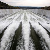 Lake Oroville Water Releases Continue The Department of Water Resources (DWR) continues to make releases from Lake Oroville using the main spillway at Oroville Dam. Ongoing releases ensure continued storage space in Lake Oroville for spring runoff from rain and snowmelt and are closely coordinated with the U.S. Army Corps of Engineers and downstream water operators for flood protection. Total releases to the Feather River amount to 12,500 cubic feet per second (cfs) with 2,200 cfs being routed down the low-flow channel which flows through the City of Oroville. An additional 10,300 cfs is being released from the Thermalito Afterbay River Outlet, located 5 miles downstream from Oroville. Releases to the Feather River will be further reduced to 10,000 cfs on Friday, March 31. DWR continues to closely monitor lake inflow levels and will adjust releases accordingly. Since Dec. 1, Lake Oroville’s storage has increased approximately 200 feet and gained just under 2 million acre-feet of water. The Lake Oroville reservoir is the largest storage facility in the State Water Project (SWP) and supports environmental and water delivery needs to 27 million Californians and reduces flood risks to downstream communities. DWR continues to monitor lake levels, weather forecasts, and mountain snow levels to optimize operations for flood control, water storage, and environmental protection while allowing for carryover storage into next year. 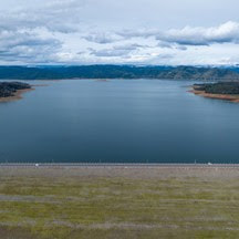 CALIFORNIA INCREASES WATER ALLOCATIONS DWR announced last week a significant boost in the forecasted SWP deliveries this year due to continued winter storms in March and a massive Sierra snowpack. DWR now expects to deliver 75 percent of requested water supplies, up from 35 percent announced in February. The increase translates to an additional 1.7 million acre-feet of water for the 29 public water agencies that serve 27 million Californians. Consistent storms in late February and March have built up the Sierra snowpack to more than double the amount that California typically sees this time of year. Rainfall has also allowed for robust flows through the system, providing adequate water supply for the environment and endangered fish species while allowing the SWP to pump the maximum amount of water allowed under state and federal permits into reservoir storage south of the Sacramento-San Joaquin Delta. “California continues to experience weather whiplash, going from extreme drought to a series of atmospheric rivers since late December. It really demonstrates that in times of plenty, we need to move as much water into storage as is feasible,” said DWR Director Karla Nemeth. “We’ve been able to manage the system to the benefit of communities, agriculture and the environment. It’s certainly been a welcome improvement following the three driest years on record for California.” Read more about the revised allocations in DWR’s press release. 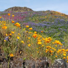 OROVILLE WILDFLOWER & NATURE FESTIVAL The Feather River Recreation & Park District (FRRPD) is hosting its annual Wildflower & Nature Festival at Riverbend Park in Oroville on Saturday, April 1 from 10 a.m. to 4 p.m. Festival admission is free with the event highlighting the area’s natural resources and handmade Butte County products. Activities and entertainment will be available for all ages including children’s crafts, river kayak tours, live music, food trucks, and a beer and wine garden. Make sure to stop by DWR’s booth for information about the Lake Oroville Visitor Center, Lake Oroville and Thermalito recreation opportunities, and a felt craft activity for kids – making a California poppy. More information about the Wildflower & Nature Festival is available on FRRPD’s website. 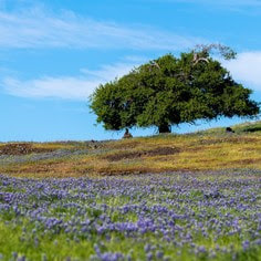 Oroville Recreation
Thanks to significant rainfall this winter, a super bloom of wildflowers may be seen this spring at the North Table Mountain Ecological Reserve. Explore miles of trails across a plateau formed from ancient volcanic rock or hike to waterfalls that cascade off the mountainside to the valley below. More information about visiting the ecological reserve may be found on California Department of Fish & Wildlife’s (CDFW) website. The Lake Oroville Visitor Center is open Monday through Friday between 9 a.m. and 5 p.m. The Visitor Center will be closed Friday, March 31 in observance of Cesar Chavez Day. The Visitor Center offers numerous educational exhibits, a theater featuring videos about the building of Oroville Dam, walking and hiking trails, and a 47-foot-tall observation tower providing unsurpassed panoramic views. DWR, State Parks, and CDFW maintain over 92 miles of trails in the Oroville area. Paved trails at the Lake Oroville Visitor Center, Spillway Day Use Area, and at the North Forebay Day Use Area offer accessible trails with only slight elevation changes. Other trails, such as the Brad Freeman Trail near Oroville Dam, offer steep elevation changes to challenge hikers and mountain bikers. The Saddle Dam Trailhead has facilities for equestrians, including a large parking area to accommodate horse trailers, water troughs, and hitching posts, and easy access to trails designated for hikers and horses. An interactive map of recreation facilities, including open boat ramps, and their permitted uses (hike, bike, horse, multi) is available on DWR’s Lake Oroville Recreation webpage. The marinas at Bidwell Canyon and Lime Saddle are open daily and provide a variety of services such as a shuttle and boat rentals. Current Lake Operations Lake Oroville is at 857 feet elevation and storage is approximately 2.9 million acre-feet (MAF), which is 82 percent of its total capacity and 117 percent of the historical average. Intermittent rain showers are expected over the weekend and into next week. The Feather River releases are at 12,500 cubic feet per second (cfs). Flows through the City of Oroville are 2,200 cfs with 10,300 cfs released from the Thermalito Afterbay Outlet (Outlet) for a total of 12,500 cfs downstream of the Outlet. Feather River releases will be further reduced to 10,000 cfs on Friday, March 31. DWR continues to assess releases to the Feather River daily. The public can track precipitation, snow, reservoir levels, and more at the California Data Exchange Center. The Lake Oroville gage station is identified as “ORO”. All data as of midnight 3/29/2023. 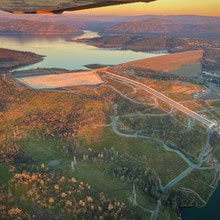 Moderate Increase in State Water Project Allocations Announced The Department of Water Resources (DWR) announced a modest increase in forecasted State Water Project (SWP) deliveries this year due to early gains in the Sierra snowpack. DWR now expects to deliver 35 percent of requested water supplies, up from 30 percent forecasted in January, to the 29 public water agencies that serve 27 million Californians. That would translate to an additional 210,000 acre-feet of water. “We’re hopeful that more storms this week are a sign that the wet weather will return, but there remains a chance that 2023 will be a below average water year in the northern Sierra,” said DWR Director Karla Nemeth. “Careful planning and the use of advanced forecasting tools will enable the Department to balance the needs of our communities, agriculture, and the environment should dry conditions continue this spring and into next year.” The SWP will continue to optimize water storage in Lake Oroville to support environmental needs in the summer and allow for carryover storage for next year if the spring becomes extremely dry. Additionally, the forecasted allocation could be adjusted back down if extreme dry conditions warrant. More information about the SWP allocations may be found in the press release. Oroville Dam Citizens Advisory Commission The California Natural Resources Agency hosted the Oroville Dam Citizens Advisory Commission meeting today at the Southside Oroville Community Center. In addition to public comment, presentations on the January storm events, Lake Oroville reservoir debris maintenance, and spillway capacity were provided. The Citizens Advisory Commission is a forum for questions and feedback from the communities surrounding Oroville Dam. For information on the meeting, please visit https://bit.ly/OrovilleCAC. A transcript of the meeting will be available on the webpage in the coming weeks. 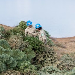 CHRISTMAS TREE FISH HABITAT DWR, the California Conservation Corps (CCC), and the Department of Fish and Wildlife (CDFW) finished constructing fish habitat structures at Lake Oroville and the Thermalito Afterbay using almost 1,800 recycled Christmas trees. The trees were again collected by Chico Boy Scout Troop 2 and delivered free of charge to DWR by Recology, a local waste management company. To create the habitats on Lake Oroville and the Thermalito Afterbay, members of the CCC team bundle the recycled holiday trees together and anchor them in various locations around the lakebed. At Lake Oroville near the Loafer Creek Recreation Area, 1,250 trees were assembled into 63 structures. At the Thermalito Afterbay, 541 trees were assembled into 54 structures. Anchoring the trees allows them to remain submerged, providing juvenile fish safe refuge, and improving fisheries and recreational fishing opportunities. This is the 30th year DWR has worked with local groups to construct fish habitat structures, which is one of the longest continuously running warmwater fish habitat improvement programs in the State of California. 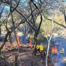 FUEL LOAD MANAGEMENT DWR continues vegetation management and debris cleanup activities around the Feather River Fish Hatchery to remove overgrown ladder fuels and create a more wildfire resilient landscape. In addition, CAL FIRE, Butte County Fire Department, and the California Conservation Corps (CCC) Butte Fire Center continue cutting and pile burning activities in the Loafer Creek area and along Oro Dam Boulevard East near the Hyatt Powerplant. Over the next couple weeks, the Butte County Sheriff crew will be cutting and piling material along Canyon Drive to reduce overgrown vegetation near the community of Kelly Ridge. CAL FIRE will burn the brush piles at a later date. DWR is implementing a Fuel Load Management Plan (FLMP) at its Oroville Facilities to reduce wildfire risk and increase public safety around Lake Oroville and surrounding communities. Vegetation management activities will continue through the spring, weather permitting. Smoke from pile burning activities will continue to be visible in the Oroville area. 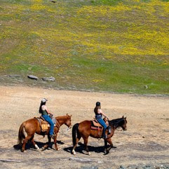 OROVILLE RECREATION DWR, the California Department of Parks and Recreation, and CDFW maintain over 92 miles of trails in the Oroville area. Paved trails at the Lake Oroville Visitor Center and at the North Forebay Day Use Area offer accessible trails with only slight elevation changes. Other trails, such as the Brad Freeman Trail between the Spillway Day Use Area and the Diversion Pool, offer trails with steep elevation changes to challenge hikers and mountain bikers. The Saddle Dam Trailhead has facilities for equestrians, including a large parking area to accommodate horse trailers, water troughs, and hitching posts, and easy access to trails designated for hikers and horses. An interactive map of recreation facilities, including open boat ramps, and their permitted uses (hike, bike, horse, multi) is available on DWR’s Lake Oroville Recreation webpage. The marinas at Bidwell Canyon and Lime Saddle are open daily and provide a variety of services such as a shuttle and boat rentals. The Lake Oroville Visitor Center is open Monday through Friday between 9 a.m. and 5 p.m. The Visitor Center offers numerous educational exhibits, a theater featuring videos about the building of Oroville Dam, walking and hiking trails, and a 47-foot-tall observation tower providing unsurpassed panoramic views. 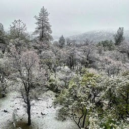 CURRENT LAKE OPERATIONS Oroville’s reservoir is about 828 feet elevation and storage is approximately 2.53 million acre-feet (MAF), which is 71 percent of its total capacity and 115 percent of the historical average. Widespread rain showers and below-average temperatures are ahead for the weekend and into next week. The Feather River releases are currently at 950 cubic feet per second (cfs). Flows through the City of Oroville are 650 cfs with 300 cfs released from the Thermalito Afterbay Outlet (Outlet) for a total of 950 cfs downstream of the Outlet. DWR continues to assess releases to the Feather River daily. The public can track precipitation, snow, reservoir levels, and more at the California Data Exchange Center. The Lake Oroville gage station is identified as “ORO”. All data as of midnight 2/23/2023.  California is in a third year of drought conditions. With water conservation now a way of life in California, everyone is encouraged to find ways to save water. See tips, tools, and ideas on the Save Our Water website. Information about real time local hydrological conditions, forecasts, and water conditions is available on DWR’s new website California Water Watch.
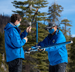
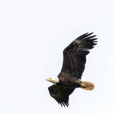 Midwinter Bald Eagle Survey Environmental scientists from DWR recently participated in the National Midwinter Bald Eagle Survey on Jan. 6 and Jan. 9. This nationwide effort, coordinated by the USACE, aims to determine bald eagle distribution and identify areas of important winter habitats. This year’s official count was 176 bald eagles for the Lake Oroville Winter Roost and three at the Thermalito Complex. This is the highest count for the Lake Oroville Winter Roost since DWR began survey participation in 2003. Lake Oroville and the Feather River area provide an ideal habitat for bald eagles. Fish are one of the eagle’s main food sources and large water bodies like Lake Oroville provide a wide variety of fish and other favorite food sources such as waterfowl, small birds, and mammals. The many trees and snags (tall dead trees) near water areas provide prime roosting and hunting locations for the bald eagles that migrate to and through the area during the winter months. 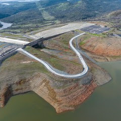 LAKESIDE ACCESS ROAD CLOSED Rising reservoir levels at Lake Oroville have required the closure of the newly constructed Lakeside Access Road, which will not reopen until water levels drop back down later this year. With the road closure in effect, vehicle access to the Spillway Boat Ramp and Day Use Area will now be via Oroville Dam Crest Road. Vehicle access to the Spillway Boat Ramp and Day Use Area is available between 6 a.m. and 8 p.m. There are three other boat ramps at Lake Oroville that are open 24 hours a day: Bidwell Canyon, Loafer Point, and Lime Saddle. At just 60 percent of its total capacity, Lake Oroville still has ample storage to capture storm runoff while providing flood control protection for the Feather River and downstream communities. Water inflows to the reservoir during recent storms have been as high as 50,000 cubic feet per second (cfs) while outflows in the Feather River through Oroville remain at a minimum of 650 cfs. Current outflows are being used to support local water needs and maintain flood control and are not part of water deliveries to Southern California. In addition, DWR Oroville Field Division Civil Maintenance crews are patrolling Lake Oroville daily to collect woody debris as part of normal operations during this time of year. Boaters are advised to be alert for floating debris, which is expected during high reservoir inflows.  FUEL LOAD MANAGEMENT DWR continues vegetation management activities around the Oroville area to remove overgrown vegetation and create a more wildfire resilient landscape. Over the next few months, you may see crews working in various areas including Loafer Creek, Canyon Drive, along Oro Dam Blvd. East, and the Feather River Fish Hatchery. CAL FIRE, Butte County Fire Department, Butte County Sheriff’s Office, California Conservation Corps (CCC), and crews from the Butte Fire Center continue to cut, pile, chip, and pile burn as weather allows. Vegetation management activities will continue through the winter, weather permitting. Smoke from pile burning activities will continue to be visible in the Oroville area. DWR’s Fuel Load Management Plan (FLMP) works to reduce wildfire risk and increase public safety around Lake Oroville. Previous FLMP projects in the Loafer Creek Recreation Area have been identified as contributing to the slowing of the 2020 North Complex Fire as it approached Kelly Ridge, increasing firefighters’ ability to establish a secure fire line and preventing the fire from progressing. Ongoing management of the FLMP remains a high priority for DWR and local partners. 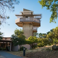 OROVILLE RECREATION The Lake Oroville Visitor Center is open Tuesday through Thursday, 9 a.m. to 5 p.m. and offers visitors numerous educational exhibits, a theater featuring videos about the building of Oroville Dam, walking and hiking trails, and a 47-foot-tall observation tower providing unsurpassed panoramic views. DWR, State Parks, and State Fish & Wildlife maintain over 92 miles of trails in the Oroville area, including those around the Lake Oroville Visitor Center. There are paved, accessible trails with only slight elevation changes by the Visitor Center and the North Forebay Day Use Area. Other trails, such as the Brad Freeman Trail between the Spillway Day Use Area and the Diversion Pool, offer steep elevation changes to challenge hikers and mountain bikers. The Saddle Dam Trailhead has facilities for equestrians, including a large parking area to accommodate horse trailers, water trough, and hitching posts, and easy access to trails designated for hikers and horses. An interactive map of recreation facilities and their permitted uses (hike, bike, horse, multi) is available on DWR’s Lake Oroville Recreation webpage. With rising lake levels, paved boat ramps are available at the Spillway, Loafer Point, Bidwell Canyon, the Thermalito Afterbay, and the Thermalito South Forebay. The Bidwell Canyon Marina is also open from 8 a.m. until sundown and provides a variety of services such as a shuttle and boat rentals. CURRENT LAKE OPERATIONS Oroville’s reservoir is about 793 feet elevation and storage is approximately 2.12 million acre-feet (MAF), which is 60 percent of its total capacity and 107 percent of the historical average. Dry weather and sunshine are returning to the forecast for the upcoming week. The Feather River releases are currently at 950 cubic feet per second (cfs). Flows through the City of Oroville are 650 cfs with 300 cfs released from the Thermalito Afterbay Outlet (Outlet) for a total of 950 cfs downstream of the Outlet. DWR continues to assess releases to the Feather River daily. The public can track precipitation, snow, reservoir levels, and more at the California Data Exchange Center. The Lake Oroville gage station is identified as “ORO”. All data as of midnight 01/19/2023.  California is in its third year of drought conditions. With water conservation now a way of life in California, everyone is encouraged to find ways to save water. See tips, tools, and ideas on the Save Our Water website. Information about real time local hydrological conditions, forecasts, and water conditions is available on DWR’s new website California Water Watch.
 April 8, 2022 Feather River Fish Hatchery Opens The California Department of Fish and Wildlife (CDFW) announced starting April 7, they will be re-opening 21 of the 22 state fish hatcheries. The hatcheries have been closed for nearly two years during the COVID-19 pandemic. The main Feather River Fish Hatchery facility in Oroville is now open from 7:30 a.m. to 4 p.m. seven days a week. The viewing window and overlook side will continue to be open sunrise to sunset. The Feather River Fish Hatchery (FRFH) is divided into 2 sections:
Over 8 million spring-run and fall-run Chinook salmon are produced by the hatchery annually, along with nearly 450,000 steelhead who are returned to the Feather River or planted in the Thermalito Afterbay for recreational users. To mitigate impacts from this third year of drought conditions, the facility will be raising an additional 1.7 million fall-run Chinook salmon to support the Feather River population. An additional 125,000 Inland Chinook will be planted in Lake Oroville this spring. The Feather River Fish Hatchery is a California State Water Project facility owned and maintained by DWR, which funds hatchery operations. CDFW operates the hatchery, including fish spawning, rearing, and stocking activities. DWR built the fish hatchery to mitigate the impact of the Oroville Dam on Chinook salmon and steelhead populations because the dam blocks access to natural spawning grounds further upstream. 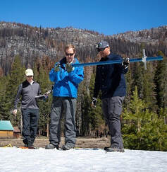 SNOWPACK SURVEY The Department of Water Resources (DWR) conducted the fourth snow survey of the season April 1 at Phillips Station near Echo Summit. Following a January, February, and March that will enter records as the driest documented in state history, the manual survey recorded 2.5 inches of snow depth and a snow water equivalent of 1 inch, which is 4 percent of average for this location for April. The snow water equivalent measures the amount of water contained in the snowpack and is a key component of DWR’s water supply forecast. Statewide, the snowpack was 38 percent of average for the April 1 date. (One week later, due to high temperatures causing more snowmelt, the statewide average was at 27 percent.) “The conditions we are seeing today speak to how severe our drought remains. DWR has been planning for the reality of a third dry year since the start of the water year on October 1,” said DWR Director Karla Nemeth. “While DWR has made significant investments in forecasting technology and other tools to ensure we make the most out of the snowmelt we do receive, water conservation will remain our best tool in the face of this ongoing drought and the statewide impacts of a warming climate. All Californians must focus on conserving water now.” The full snow survey news release can be found on the DWR News page. Governor Gavin Newsom has asked all Californians to cut back water use at least 15 percent compared to 2020 levels. Current water conditions are now available in real time at California Water Watch, a new website launched by DWR. The website will help Californians see their local hydrological conditions, forecasts, and water conditions down to their address or their local watershed. Additional tips on how to conserve can be found at the SaveOurWater webpage. 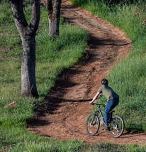 OROVILLE RECREATION The Loafer Point, Bidwell Canyon, and Lime Saddle boat ramps are open (except on April 4 for Loafer Point). The Oroville Dam Spillway boat ramp remains closed for repairs. The Foreman Creek and Stringtown cartop boat ramps are also open. Information on current boat ramp status can be found on the California State Parks’ Lake Oroville State Recreation Area webpage. Scroll down to the link for “Current Launch Ramp Status”. The Lake Oroville Visitor Center is open to the public on Tuesdays, Wednesdays, and Thursdays from 9 a.m. to 5 p.m. Pick up the Lake Oroville Trails Map, which shows more than 91 miles of trails available to equestrians, bicyclists, and hikers, at Lake Oroville State Recreation Area (LOSRA) kiosks, the Oroville Area Chamber of Commerce, and Feather River Recreation and Parks District. The Loafer Creek Recreation Area continues to be closed due to waterline repair (boat ramp and trail access allowed). Visit the California Parks LOSRA webpage for current information on facility status and campground reservations. An interactive map of recreation facilities in DWR’s Oroville-Thermalito Complex is available on DWR’s Lake Oroville Recreation webpage. Information about the 11,000-acre Oroville Wildlife Area is available on the California Department of Fish and Wildlife webpage. CURRENT LAKE OPERATIONS The elevation of Oroville’s reservoir is about 751 feet elevation and storage is about 1.68 million acre-feet, which is 48 percent of its total capacity and 66 percent of historical average. Temperatures over the weekend are forecasted to be in the mid- to upper-70s and decreasing to the 60s and low 70s into next week with a chance of rain mid-week. The average daily inflows this week have been between 3,000 to 5,000 cubic feet per second (cfs) and projected to continue at this rate next week. Inflows are subject to change based upon on actual weather conditions. Starting April 2, 2022, DWR has initiated daily reductions in total flows to the Feather River and flows are projected to be at 1,100 cfs by Sunday. At 1,100 cfs to the Feather River, flow in the low-flow channel through the City of Oroville is 650 cfs and flow through the Thermalito Afterbay Outlet currently is 450 cfs. Flows are assessed daily. The public can track precipitation, snow, reservoir levels, and more at the California Data Exchange Center at www.cdec.water.ca.gov. The Lake Oroville gage station is identified as “ORO”. All data as of midnight 4/8/2022  California is entering its third year of drought conditions. With water conservation now a way of life in California, everyone is encouraged to find ways to save water. See tips, tools, and ideas on the Save Our Water website. Information about real time local hydrological conditions, forecasts, and water conditions is available on DWR’s new website California Water Watch.
 April 1, 2022 Snowpack Survey The Department of Water Resources (DWR) conducted the fourth snow survey of the season Friday at Phillips Station near Echo Summit. Following a January, February, and March that will enter records as the driest documented in state history, the manual survey recorded 2.5 inches of snow depth and a snow water equivalent of 1 inch, which is 4 percent of average for this location for April. The snow water equivalent measures the amount of water contained in the snowpack and is a key component of DWR’s water supply forecast. Statewide, the snowpack is 38 percent of average for this date. “The conditions we are seeing today speak to how severe our drought remains. DWR has been planning for the reality of a third dry year since the start of the water year on October 1,” said DWR Director Karla Nemeth. “While DWR has made significant investments in forecasting technology and other tools to ensure we make the most out of the snowmelt we do receive, water conservation will remain our best tool in the face of this ongoing drought and the statewide impacts of a warming climate. All Californians must focus on conserving water now.” The full snow survey news release can be found on the DWR News page. Governor Gavin Newsom has asked all Californians to cut back water use at least 15 percent compared to 2020 levels. Current water conditions are now available in real time at California Water Watch, a new website launched by DWR. The website will help Californians see their local hydrological conditions, forecasts, and water conditions down to their address or their local watershed. Additional tips on how to conserve can be found at the SaveOurWater webpage. Boat Ramp Closures A speed boat timed trial event on the Thermalito Afterbay is scheduled for April 1 to April 3. The event requires the southern portion of the Afterbay (south of Highway 162) to be closed to the public April 2 and April 3. Both the Monument Hill boat ramp and Larkin Cartop boat launch will be closed. The Wilbur Road boat ramp and areas north of Hwy 162 will remain open. Returning to the Afterbay after two years away due to the COVID-19 pandemic, the 59th Annual Region 9 Bud David Time Trials event is anticipated to draw 40 to 50 boats. Information about the event can be found on the American Power Boat Association webpage at https://www.apba.org/racing-schedule.html The Loafer Point boat launch area will be closed Monday, April 4 for installation of a gate. Boaters are encouraged to use the Bidwell Canyon boat ramp as an alternate launch site on that day. Oroville Dam Citizens Advisory CommissionThe California Natural Resources Agency (CNRA) held its tenth Oroville Dam Citizens Advisory Commission meeting on March 25, 2022. The online public meeting included a facilities update from the Department of Water Resources (DWR), a presentation on addressing flood risks, and a discussion about public safety partnerships. Members of the public also offered comments and asked questions. The Citizens Advisory Commission is a forum to provide public feedback from the communities surrounding Oroville Dam. The meeting transcript and presentations will be available on the Commission’s website in the coming weeks at https://bit.ly/OrovilleCAC. 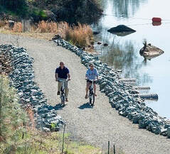 OROVILLE RECREATION The Loafer Point, Bidwell Canyon, and Lime Saddle boat ramps are open (except on April 4 for Loafer Point). The Oroville Dam Spillway boat ramp remains closed for repairs. The Foreman Creek and Stringtown cartop boat ramps are also open. Information on current boat ramp status can be found on the California State Parks’ Lake Oroville State Recreation Area webpage. Scroll down to the link for “Current Launch Ramp Status”. The Lake Oroville Visitor Center is open to the public on Tuesdays, Wednesdays, and Thursdays from 9 a.m. to 5 p.m. Pick up the Lake Oroville Trails Map, which shows more than 91 miles of trails available to equestrians, bicyclists, and hikers, at Lake Oroville State Recreation Area (LOSRA) kiosks, the Oroville Area Chamber of Commerce, and Feather River Recreation and Parks District. The Loafer Creek Recreation Area continues to be closed due to waterline repair (boat ramp and trail access allowed). Visit the California Parks LOSRA webpage for current information on facility status and campground reservations. An interactive map of recreation facilities in DWR’s Oroville-Thermalito Complex is available on DWR’s Lake Oroville Recreation webpage. Information about the 11,000-acre Oroville Wildlife Area is available on the California Department of Fish and Wildlife webpage. CURRENT LAKE OPERATIONS The elevation of Oroville’s reservoir is about 749 feet elevation and storage is about 1.68 million acre-feet, which is 47 percent of its total capacity and 67 percent of historical average. Dry conditions and temperatures in the 80s are forecasted this weekend and next week. The average daily inflows this week have been around 5,000 cubic feet per second (cfs). These higher inflows are attributed to early season snowmelt and projected in the 3,000 to 4,000 cfs range next week. Inflows are subject to change based upon actual weather conditions. Total flows to the Feather River are 3,500 cfs. Flow in the low-flow channel through the City of Oroville is 650 cfs and flow through the Thermalito Afterbay Outlet currently is 2,850 cfs. DWR is planning a reduction of releases to the Feather River in early April. The public can track precipitation, snow, reservoir levels, and more at the California Data Exchange Center at www.cdec.water.ca.gov. The Lake Oroville gage station is identified as “ORO”. All data as of midnight 3/31/2022  California is entering its third year of drought conditions. With water conservation now a way of life in California, everyone is encouraged to find ways to save water. See tips, tools, and ideas on the Save Our Water website. Information about real time local hydrological conditions, forecasts, and water conditions is available on DWR’s new website California Water Watch.
 February 25, 2022 Feather River Hatchery Steelhead Planting The Feather River Fish Hatchery has raised over 630,700 steelhead for release this year. The steelhead were raised for a full year at the hatchery and averaged about 8 to 9 inches in length. Around 129,300 steelhead were released in the Thermalito Afterbay – plantings occurred in December 2021 and February 2022. This is a significant increase from normal planting years and will contribute to a more productive recreational fishery. The remaining approximately 501,400 steelhead were released into the Feather River at Boyd’s Pump Boat Launch Feb. 3 to Feb. 18 to meet mitigation requirements. Releasing these young fish further downstream improves their chance of survival. This shortened migration route allows juvenile fish to avoid predators. Steelhead are a salmonid species and are an ocean-going trout. They will migrate from freshwater to marine (ocean), returning to freshwater environments to spawn. They can spawn several times during their lifetime and can live up to eight years. Their “steelhead” name comes from their appearance, a more streamlined shape than Chinook salmon and with a silvery or brassy color as an adult. The Feather River Fish Hatchery is a California State Water Project (SWP) facility built in the late 1960s to mitigate impacts on fish migration resulting from the construction of Oroville Dam which prevented access to spawning grounds further upstream. The Department of Water Resources (DWR) maintains the facility and funds the hatchery operations, fish spawning, rearing, and stocking activities provided by California Department of Fish and Wildlife staff. 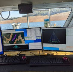 DWR SURVEY OF LAKE OROVILLE DWR is conducting a bathymetric (underwater) survey of Lake Oroville to complete a comprehensive topography, or map, of the lakebed. The underwater survey will complement a December 2021 survey that took advantage of the lake’s low water elevations to perform an ‘above water level’ survey of Lake Oroville’s topography, dams, and related structures. Using highly accurate LiDAR remote sensing, the December survey produced precise, three-dimensional information of Lake Oroville’s lakebed. Similar data will be collected from the bathymetric survey. Data from both surveys will provide DWR with up-to-date information that can be used to determine changes in sedimentation, update the reservoir’s storage-stage relationships, and inform future boat ramp extensions. 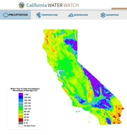 DWR LAUNCHES CALIFORNIA WATER WATCH The Department of Water Resources (DWR) has a new website to better inform Californians about hydrologic conditions, forecasts, and information at the scale of their local watershed. The website, California Water Watch, allows the public to obtain a quick snapshot of local and statewide water conditions and was developed as part of the Governor’s drought emergency proclamation. Information is updated from a variety of data sources and will assist the public to research, learn, and stay informed about California’s most precious resource – water. The website displays current statewide hydroclimate and water supply conditions, including precipitation, temperature, reservoir storage, groundwater conditions, snowpack, streamflow, soil moisture and vegetation conditions. Links to information about drought conditions and how water is used in California are also provided. 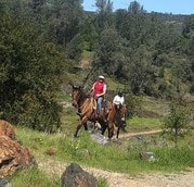 OROVILLE RECREATION
The Loafer Point, Bidwell Canyon, and Lime Saddle boat ramps are open. The Oroville Dam Spillway boat ramp remains closed for repairs. The Foreman Creek and Stringtown cartop boat ramps are also open. Intermittent, short duration closures of the Oroville Dam Crest parking lot may occur to accommodate Lakeside Access Road construction activities. The popular walking/bicycling trail across the top of the dam will remain open and parking will continue to be available at the Upper Overlook. Information on current boat ramp status can be found on the California State Parks’ Lake Oroville State Recreation Area webpage. Scroll down to the link for “Current Launch Ramp Status”. The Lake Oroville Visitor Center is open to the public on Tuesdays, Wednesdays, and Thursdays from 9 a.m. to 5 p.m. Pick up the Lake Oroville Trails Map, which shows more than 97 miles of trails available to equestrians, bicyclists, and hikers, at Lake Oroville State Recreation Area (LOSRA) kiosks, the Oroville Area Chamber of Commerce, and Feather River Recreation and Parks District. The Loafer Creek Recreation Area continues to be closed due to waterline repair (boat ramp and trail access allowed). Visit the California Parks LOSRA webpage for current information on facility status and campground reservations. An interactive map of recreation facilities in DWR’s Oroville-Thermalito Complex is available on DWR’s Lake Oroville Recreation webpage. Information about the 11,000-acre Oroville Wildlife Area is available on the California Department of Fish and Wildlife webpage. CURRENT LAKE OPERATIONS The elevation of Oroville’s reservoir is about 748 feet elevation and storage is about 1.66 million acre-feet, which is 47 percent of its total capacity and 76 percent of historical average. Temperatures over the weekend are forecasted to be in the low 60s to low 40s. Next week’s temperatures are forecasted to range between upper 60’s and low-70s to low or upper-40s at night. A chance of rain is forecasted in the Feather River watershed next week. The average daily inflows this week have been around 4,000 cubic feet per second (cfs). Inflows through the weekend and next week are forecasted to be around 3,500 cfs to 4,000 cfs. Inflows are subject to change based upon on actual weather conditions. Total flows to the Feather River are 4,750 cfs. This increase is for downstream water quality and flow requirements. Flow in the low-flow channel through the City of Oroville is 650 cfs and flow through the Thermalito Afterbay Outlet is 4,100 cfs. Releases are assessed daily. The public can track precipitation, snow, reservoir levels, and more at the California Data Exchange Center at www.cdec.water.ca.gov. The Lake Oroville gage station is identified as “ORO”. All data as of midnight 2/24/2022 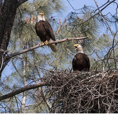 February 11, 2022Five Year Anniversary February 2017 was a challenging time for Oroville residents and the surrounding communities. Over the past five years, the dam safety industry has been transformed statewide and nationally, leading to changes in how dams and related facilities are operated, inspected, and maintained. Public safety and flood protection remain the Department of Water Resources’ (DWR) top priorities in operational decisions regarding the Oroville reservoir. The reconstruction of the Oroville Dam’s main and emergency spillways using a more robust and modern design ensures that the Oroville Dam will continue to be able to provide flood protection to downstream communities. The Oroville Dam Comprehensive Needs Assessment (2020) identified priorities and appropriate solutions to bolster the integrity and resiliency of the Oroville Dam Complex; projects completed or underway include a seismic retrofit study, assessment of the FCO gate structure, installation of piezometers at Oroville Dam to collect data on seepage, and studies of area geology. Transparency, public engagement, and open communication also remain priorities as DWR works to restore trust and build relationships. Although the COVID-19 pandemic has restricted personal outreach and in-person community presentations, DWR continues to share information virtually regarding annual milestones, weather forecasts and operational updates, and engage community members in dialogue about needs and concerns. Residents are encouraged to participate in the Oroville Dam Citizens Advisory Commission that meets every three months. DWR is thankful to all the impacted residents for their patience and partnership as we move forward to achieve our shared goals of public safety, a reliable water supply for the state, environmental protections, and recreation opportunities for residents and visitors. Law Enforcement Training The Butte County Sheriff’s Office held an emergency response training at the Ronald B. Robie Thermalito Pumping-Generating Powerplant today (Feb. 11) which involved law enforcement and public safety personnel and equipment. The Sheriff’s Office advised the public this was a training exercise to provide participants with “real-time” response and rescue experiences to learn and refresh skills related to emergency preparedness and response. The Thermalito Powerplant remains fully operational.  CHRISTMAS TREE FISH HABITAT DWR, the California Conservation Corps (CCC), and the California Department of Fish and Wildlife (CDFW) completed constructing fish habitat structures at Lake Oroville and the Thermalito Afterbay using over 1,240 recycled Christmas trees. The trees were again collected by Chico Boy Scout Troop 2 and delivered free of charge to DWR by Recology, a local waste management company. To create the habitat on Lake Oroville and the Thermalito Afterbay, members of the CCC team bundle the recycled holiday trees together and anchor them in various locations around the lakebed. At Lake Oroville near the Loafer Creek Recreation Area, 916 trees were assembled into 64 structures. At the Thermalito Afterbay, 324 trees were assembled into 32 structures. Anchoring the trees allows them to remain submerged, providing juvenile fish safe refuge, and improving fisheries and recreational fishing opportunities. For nearly 30 years, DWR has worked with local groups to construct fish habitat structures, which is one of the longest continuously running fish habitat improvement programs in the State of California. The 2022 project is anticipated to be completed by Feb. 9. LAKESIDE ACCESS ROAD Construction activities associated with the Lakeside Access Road project continue to result in intermittent closures of the Oroville Dam Crest parking lot on the northwest side of the dam as well as the Spillway Boat Ramp area. These short duration closures are anticipated to continue until the end of February. The popular walking/bicycling trail across the top of the dam will remain open and parking will continue to be available at the Upper Overlook. This project will consist of a new, permanent, paved road from the west side of Oroville Dam to the Spillway Boat Ramp parking lot on the “lakeside,” or waterside, of the Oroville Dam spillways. This new road will allow a more direct route when water levels are low in Lake Oroville. The new road will include two concrete traffic lanes, wide shoulders for walking and biking, guardrails, and safety signage. 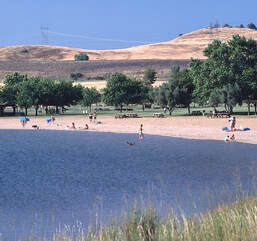 OROVILLE RECREATION
The Loafer Point, Bidwell Canyon, and Lime Saddle boat ramps are open. The Oroville Dam Spillway boat ramp remains closed for repairs. The Foreman Creek and Stringtown cartop boat ramps are also open. Information on current boat ramp status can be found on the California State Parks’ Lake Oroville State Recreation Area webpage. Scroll down to the link for “Current Boat Ramp Status”. The Lake Oroville Visitor Center is open to the public on Tuesdays, Wednesdays, and Thursdays from 9 a.m. to 5 p.m. Pick up the Lake Oroville Trails Map, which shows more than 97 miles of trails available to equestrians, bicyclists, and hikers, at Lake Oroville State Recreation Area (LOSRA) kiosks, the Oroville Area Chamber of Commerce, and Feather River Recreation and Parks District. The Loafer Creek Recreation Area continues to be closed due to waterline repair (boat ramp and trail access allowed). Visit the California Parks LOSRA webpage for current information on facility status and campground reservations. An interactive map of recreation facilities in DWR’s Oroville-Thermalito Complex is available on DWR’s Lake Oroville Recreation webpage. Information about the 11,000-acre Oroville Wildlife Area is available on the California Department of Fish and Wildlife webpage. CURRENT LAKE OPERATIONS The elevation of Oroville’s reservoir is about 745 feet elevation and storage is about 1.63 million acre-feet, which is 46 percent of its total capacity and 77 percent of historical average. Dry and warm conditions are forecasted for this weekend with temperatures in the mid-70s. There’s slight chance of rain on Monday with warm and dry weather returning next week. The average daily inflows this week have been in the range of 2,000 cubic feet per second (cfs) to 3,000 cfs. Inflows through the weekend and next week are forecasted to be around 3,000 to 4,000 cfs. Inflows are subject to change based upon on actual weather conditions. Total flows to the Feather River are 3,500 cfs. This increase is for downstream water quality and flow requirements. Flow in the low-flow channel through the City of Oroville is 650 cfs and flow through the Thermalito Afterbay Outlet is 1,850 cfs. Releases are assessed daily. The public can track precipitation, snow, reservoir levels, and more at the California Data Exchange Center at www.cdec.water.ca.gov. The Lake Oroville gage station is identified as “ORO”. All data as of midnight 2/10/2022 |
Archives
May 2024
Categories
All
|
 RSS Feed