 January 21, 2022 DWR Issues Revised Water Allocation Due to the series of storms in December 2021, the Department of Water Resources (DWR) is increasing the State Water Project (SWP) allocation to 15 percent of requested supplies for 2022, an increase over the December allocation that covered only critical health and safety needs of the 29 water agencies that contract to receive State Water Project supplies. While drought conditions still persist, December’s precipitation enabled DWR to convey and store water in San Luis Reservoir, allowing for the modest increase in water deliveries. DWR continues to plan for a third dry year by preserving storage in Lake Oroville, the State Water Project’s largest reservoir. Water releases from Lake Oroville will be prioritized to maintain Delta water quality, protect endangered species, and meet senior water right needs. Each year, DWR makes an initial SWP allocation on Dec. 1. Allocations are updated as snowpack and runoff information are assessed, with a final allocation typically determined in May or June. Read the full news release on the DWR News webpage. Photo: Dinosaur Point boat launch on San Luis Reservoir (Aug. 2021) Drought Update January’s dry weather reflects California’s weather variability -- not only from year to year but within the water year as well (Oct. 1 to Sept. 30). California has received more precipitation this water year as compared to this time last year but the abrupt change from December’s series of strong storms to a very dry January is a kind of “weather whiplash” that is becoming more common as climate change impacts continue to grow. The remainder of the wet season is still ahead. California receives 75 percent of its precipitation from November through March, half of which is typically received between December through February. Currently the statewide snowpack is around 58 percent of seasonal average and about 113 percent of average for this date. California needs above average precipitation throughout the winter to offset record-setting drought conditions and replenish reservoirs. Currently, Lake Oroville is only filled to 44 percent of its capacity and major reservoirs across the state are at an average of 42 percent capacity. Governor Newsom has called on Californians to voluntarily reduce their water use by 15 percent with simple measures to protect water reserves. The October 2021 emergency proclamation expanded the drought emergency statewide and authorized the State Water Board to ban wasteful water uses, boosting conservation efforts. Learn how to save for the future by visiting the Save Our Water website. 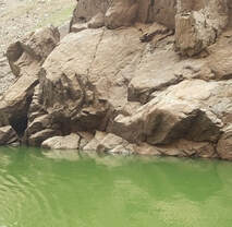 Mid-Winter Bald Eagle Survey Environmental scientists from DWR participated in the National Midwinter Bald Eagle Survey on Jan. 7. This nation-wide effort, coordinated by the U.S. Army Corps of Engineers, aims to determine bald eagle distribution and identify areas of important winter habitats. Because of bad weather on the day of the national survey, this year’s official count at Lake Oroville was only 20 bald eagles; however, an informal survey two days later counted well over 100 migrating eagles at the lake. Lake Oroville, the Feather River, and local area rice fields provide an ideal habitat for bald eagles. Fish are one of the eagle’s main food sources and water bodies like Lake Oroville, rivers, and rice fields provide a wide variety of fish and other favorite food sources such as waterfowl, small birds, and mammals. The many trees and snags (tall dead trees) near water areas provide prime roosting and hunting locations for the bald eagles that migrate to and through the area during the winter months as well as nesting opportunities for Lake Oroville’s resident “nesting pairs” who have established their home here. Protecting the area’s year-round bald eagle population living in the DWR Oroville-Thermalito Complex jurisdiction is the responsibility of DWR environmental scientists. The bald eagle is a protected species under the Migratory Bird Treaty Act of 1918 and Bald and Golden Eagle Protection Act of 1940. They were listed as an endangered species in 1978. Those protections have been successful, and the species is now federally delisted. DWR’s scientists monitor for and, if necessary, act against threats such as public intrusions, habitat loss, or other impacts to the eagles’ nesting areas. Photo: Bald eagle on top of pine tree at Lake Oroville Lakeside Access Road Construction activities associated with the Lakeside Access Road project continue to result in intermittent closures of the Oroville Dam Crest parking lot on the northwest side of the dam. These short duration closures are anticipated to continue until the end of January. The popular walking/bicycling trail across the top of the dam will remain open and parking will continue to be available at the Upper Overlook. This project will consist of a new, permanent, paved road from the west side of Oroville Dam to the Spillway Boat Ramp parking lot on the “lakeside,” or waterside, of the Oroville Dam spillways. This new road will allow a more direct route when water levels are low in Lake Oroville. The new road will include two concrete traffic lanes, wide shoulders for walking and biking, guardrails, and safety signage. Loafer Creek Recreation Area The Loafer Creek Recreation Area at Lake Oroville continues to be temporarily closed due to damages and interruption of the park’s main water supply system. Hikers, bicyclists, and equestrians can still access area trails from the Saddle Dam trailhead facility off Kelly Ridge Road. Trail users are advised to be aware of California Department of Parks and Recreation (State Parks) work trucks and utility vehicles in the area. 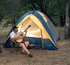 Oroville Recreation
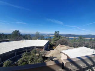
Bidwell Canyon’s Stage II concrete boat ramp and the Lime Saddle Boat Ramp are open. The Spillway boat ramp remains closed for repair and the Loafer Point boat ramp is inaccessible due to continued closure of the Loafer Creek Recreation Area for waterline repairs. The Foreman Creek and Stringtown cartop boat ramps have also reopened. Information on current boat ramp status can be found on the State Park’s Lake Oroville State Recreation Area webpage. Scroll down to the link for “Current Boat Ramp Status”. The Lake Oroville Visitor Center is open to the public on Tuesdays, Wednesdays, and Thursdays from 9 a.m. to 5 p.m. Pick up the Lake Oroville Trails Map, which shows more than 97 miles of trails available to equestrians, bicyclists, and hikers, at Lake Oroville State Recreation Area (LOSRA) kiosks, the Oroville Area Chamber of Commerce, and Feather River Recreation and Parks District. Visit the California Parks LOSRA webpage for current information on facility status and campground reservations. An interactive map of recreation facilities in DWR’s Oroville-Thermalito Complex is available on DWR’s Lake Oroville Recreation webpage. Information about the 11,000-acre Oroville Wildlife Area is available on the California Department of Fish and Wildlife webpage. Photo: Observation Tower at Lake Oroville Visitor Center Current Lake Operations The elevation of Oroville’s reservoir is about 739 feet elevation and storage is about 1.58 million acre-feet, which is 45 percent of its total capacity and 80 percent of historical average. Dry and cool conditions are forecasted over the weekend and continuing into next week. The average daily inflows this week have been in the range of 4,000 cubic feet per second (cfs) to 5,000 cfs. Inflows through the weekend and next week are forecasted to be in the range of 3,000 cfs to 5,000 cfs. Inflows are subject to change based upon on actual weather conditions. Total flows to the Feather River are at 950 cfs for meeting downstream water quality and flow requirements. Flow in the low-flow channel, through the City of Oroville, is 650 cfs and flow through the Thermalito Afterbay Outlet is 300 cfs. Releases are assessed daily. The public can track precipitation, snow, reservoir levels, and more at the California Data Exchange Center at www.cdec.water.ca.gov. The Lake Oroville gage station is identified as “ORO”. All data as of midnight 1/20/2022 ### Know someone who would like to receive Community Updates? They can email their request to oroville@water.ca.gov.  July 2, 2021 Fourth of July Fireworks at Oroville The Oroville Rotary Club will be holding a Fourth of July celebration at the Oroville Municipal Airport on Independence Day. While there will not be public access to the airport facility for the fireworks show, public areas around the airport will be accessible by personal vehicle to tailgate during the event. The nearby Clay Pit State Vehicle Recreation Area will be closed for safety reasons. A fly-in event in the morning at the airport will also take place. The fireworks show will begin 30 minutes after sunset. Information on suggested viewing locations and other event information is available on the Oroville Area Chamber of Commerce website at: https://www.visitoroville.com/oroville-fireworks.html. Photo: On the North Forebay in Oroville waiting for fireworks to start. Oroville Recreation The Bidwell Canyon Boat Ramp will be open over the Fourth of July holiday weekend with future status dependent on lake levels. The gravel, single-lane, 4-wheel drive only, boat ramp at the Spillway opens this afternoon, July 2. Boat ramp information can be obtained by calling the California Department of Parks and Recreation (CA Parks) at (530) 538-2200 or visiting the Lake Oroville State Recreation Area (LOSRA) website at www.parks.ca.gov/LakeOroville. Both the Lime Saddle and Bidwell Canyon marinas will remain open 8 a.m. until sundown. Summer access hours of 5 a.m. to 11 p.m. daily is now in effect for the Spillway Boat Ramp Area - gates close at 11 p.m. The Oroville Dam Crest Road across Oroville Dam is available 5 a.m. to 11 p.m. daily and open to pedestrians and bicyclists 24-hours a day. The Lake Oroville Visitor Center anticipates re-opening later this summer. Visitors to the Thermalito North Forebay will find a full CA Parks facility with restrooms, picnic areas, a swim beach, and the Forebay Aquatic Center with kayaks, paddle boards, and other watercraft available for rent. The Monument Hill facility at the Thermalito Afterbay also provides boat ramp access, restrooms, a picnic area, and a swim beach. Visit the California Parks LOSRA webpage for current information on facility status and campground reservations. An interactive map of recreation facilities in DWR’s Oroville-Thermalito Complex is available on DWR’s Lake Oroville Recreation webpage at https://water.ca.gov/What-We-Do/Recreation/Lake-Oroville-Recreation. Information about the 11,000-acre Oroville Wildlife Area is available on the California Department of Fish and Wildlife webpage at https://wildlife.ca.gov/Lands/Places-to-Visit/Oroville-WA. Photo: Camping at the Lake Oroville State Recreation Area Lake Oroville Visitor Center CA Parks and DWR have issued a news release announcing both will be offering expanded educational opportunities at the Lake Oroville Visitor Center and State Recreation Area in the coming months. DWR is exclusively managing the Visitor Center as CA Parks transitions its educational programming away from the Visitor Center to various LOSRA locations as it further expands outdoor educational programs to educate visitors and provide high-quality outdoor recreation opportunities. DWR is recruiting additional staff to support operations and to assist with enhanced educational opportunities and informational displays at the Visitor Center that highlight California’s water delivery system and the importance of water in our lives. The Visitor Center will reopen later this year. 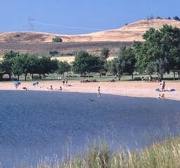 Oroville Wildlife Area Habitat Project The sunflowers and safflowers planted this spring on 60 acres of the Oroville Wildlife Area (OWA) are growing taller. The nearly 12,000-acre OWA in Butte County is a popular stopping place on the Pacific Flyway for migrating and native birds. Managed by the California Department of Fish and Wildlife (CDFW) for the Department of Water Resources (DWR), the OWA also includes DWR’s Thermalito Afterbay reservoir, a prime habitat for migrating waterfowl and several endangered species. CDFW farms more than 300 acres of grains, grasses, and flowering plants in the OWA to provide food (forage), shelter, and nesting cover for migratory and native birds. Recently, 60 acres in various locations around the Thermalito Afterbay were planted with sunflowers and safflowers. Read more about CDFW’s 50 years of using dry-land farming techniques to add diversity to the area’s wildlife habitat on the DWR Updates webpage. DWR will be tracking the success of these 60 acres over the summer and photos can be found on DWR’s public photo sharing site by using the search term “Oroville Wildlife Area Planting”. Photo: Sunflowers grow in the Oroville Wildlife Area to provide forage and habitat for wildlife and birds. Drought Information California is no stranger to drought; it is a recurring feature of our climate. Lake Oroville’s low lake levels are a reminder of this cycle of dry and wet years. This year’s drought conditions are being felt across the western United States, with many areas, including California’s Central Valley, identified as being in “extreme drought” - the highest category of drought conditions. DWR has created a “Drought” webpage where definitions, historical trends, current information, and maps of California’s water systems can be found. Links to resources, DWR activities, research, and data are available. Read about how heatwaves are impacting drought conditions on the DWR Updates webpage. DWR is encouraging water conservation efforts by all Californians. Find out ways you can help by visiting the “Save Our Water” website. 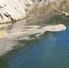 Blue Green Algae Monitoring
DWR environmental scientists regularly monitor for blue-green algae and their toxins during the summer months. There are currently no harmful algal bloom (HAB) advisories for Lake Oroville, the Thermalito Forebay, or the Thermalito Afterbay. Water samples are taken at various locations regularly from Memorial Day through Labor Day and sent to a lab for toxin analysis. If elevated levels of cyanobacteria toxins are found while testing, DWR staff will work with California’s Regional Water Quality Control Board and recreation area managers to notify the public and post advisory signs at affected waterbodies. To learn more about HABs, or to report a HAB visit the Water Board’s website. Photo: Algal bloom on Lake Oroville's West Branch Current Lake Operations The elevation of Oroville’s reservoir is about 681 feet elevation and storage is about 1.12 million acre-feet -- 32 percent full and 39 percent of historical average. Currently, in the Northern Sierra Basin, snowpack is also below average at five percent of normal. Warm temperatures in the ranging in the high 90s and low 100s continue this weekend through next week. Total flow to the Feather River is currently at 3,000 cubic feet per second (cfs) for meeting downstream water quality and flow requirements. Flow down the low flow channel, through the City of Oroville, is 1,550 cfs and flow through the Thermalito Afterbay Outlet is 1,450 cfs. Currently, these flow patterns will hold through the weekend. Current releases are re-assessed on a daily basis. The public can track precipitation, snow, reservoir levels, and more at the California Data Exchange Center at www.cdec.water.ca.gov. Lake Oroville is identified as “ORO”. All data as of midnight 7/1/2021 ### Know someone who would like to receive Community Updates? They can email their request to oroville@water.ca.gov.  June 25, 2021 Oroville Wildlife Area Habitat Project The sunflowers and safflowers planted this spring on 60 acres of the Oroville Wildlife Area (OWA) are growing taller. The nearly 12,000-acre OWA in Butte County is a popular stopping place on the Pacific Flyway for migrating and native birds. Managed by the California Department of Fish and Wildlife (CDFW) for the Department of Water Resources (DWR), the OWA also includes DWR’s Thermalito Afterbay reservoir, a prime habitat for migrating waterfowl and several endangered species. CDFW farms more than 300 acres of grains, grasses, and flowering plants in the OWA to provide food (forage), shelter, and nesting cover for migratory and native birds. Recently, 60 acres in various locations around the Thermalito Afterbay were planted with sunflowers and safflowers. Read more about CDFW’s 50 years of using dry-land farming techniques to add diversity to the area’s wildlife habitat on the DWR Updates webpage. DWR will be tracking the success of these 60 acres over the summer and photos can be found on DWR’s public photo sharing site by using the search term “Oroville Wildlife Area Planting”. Photo: Sunflowers grow in the Oroville Wildlife Area to provide forage and habitat for wildlife and birds. Drought Information California is no stranger to drought; it is a recurring feature of our climate. Lake Oroville’s low lake levels are a reminder of this cycle of dry and wet years. This year’s drought conditions are being felt across the western United States, with many areas, including California’s Central Valley, identified as being in “extreme drought” - the highest category of drought conditions. DWR has created a “Drought” webpage where definitions, historical trends, current information, and maps of California’s water systems can be found. Links to resources, DWR activities, research, and data are available. Read about how heatwaves are impacting drought conditions on the DWR Updates webpage. DWR is encouraging water conservation efforts by all Californians. Find out ways you can help by visiting the “Save Our Water” website.  Oroville Recreation Bidwell Canyon Boat Ramp is currently open with future status dependent on lake levels. Boat ramp information can be obtained by calling the California Department of Parks and Recreation (CA Parks) at (530) 538-2200 or visiting the Lake Oroville State Recreation Area (LOSRA) website at www.parks.ca.gov/LakeOroville. Both the Lime Saddle and Bidwell Canyon marinas will remain open 8 a.m. until sundown. Visitors to the Thermalito North Forebay will find a full CA Parks facility with restrooms, picnic areas, a swim beach, and the Forebay Aquatic Center with kayaks, paddle boards, and other watercraft available for rent. The Monument Hill facility at the Thermalito Afterbay also provides boat ramp access, restrooms, a picnic area, and a swim beach. More than 97 miles of trails and numerous Day Use Area (DUA) facilities with picnic tables and restrooms at Lake Oroville State Recreation Area (LOSRA) are open 8 a.m. to sunset. Bidwell, Lime Saddle, and Loafer Creek Recreation Areas are open 24 hours. Summer access hours of 5 a.m. to 11 p.m. daily is now in effect for the Spillway Boat Ramp Area - gates close at 11 p.m. Vehicle access to Oroville Dam Crest Road across Oroville Dam is available 5 a.m. to 11 p.m. daily and open to pedestrians and bicyclists 24-hours a day. The Lake Oroville Visitor Center remains closed due to COVID-19 restrictions. Visit the California Parks LOSRA webpage for current information on facility status, campground reservations, and to find current requirements to protect public health during the COVID-19 pandemic. An interactive map of recreation facilities in DWR’s Oroville-Thermalito Complex is available on DWR’s Lake Oroville Recreation webpage. Information about the 11,000-acre Oroville Wildlife Area is available on the California Department of Fish and Wildlife webpage. Photo: Swim beach at North Forebay Recreation Area  Grazing Goats Reduce Fire Risk
Hillsides along the Dan Beebe and Bidwell Canyon trails near Kelly Ridge look quite different after 1,600 goats and sheep from the Hanski Family Farms visited the area. The goat grazing project is part of DWR’s Fuel Load Management Plan, which helps reduce wildfire risk, increase public safety, and enhance forest health in areas around Lake Oroville within the Federal Energy Regulatory Commission (FERC) project boundary. In partnership with Butte County Fire Safe Council, DWR utilized grazing as a sustainable method of fuel reduction on about 35 acres to help minimize the risk or lessen the spread of a wildfire. To learn more and see goat grazing in action, visit DWR’s YouTube channel for a video of the March 2021 Lakeland Blvd. goat grazing project. Photo: Grazed and un-grazed hillsides near Kelly Ridge Current Lake Operations The elevation of Oroville’s reservoir is about 690 feet elevation and storage is about 1.18 million acre-feet -- 34 percent full and 41 percent of historical average. Currently, in the Northern Sierra Basin, snowpack is also below average at five percent of normal. An Excessive Heat Watch is in effect beginning this weekend (Saturday) through Wednesday in the Northern and Central Sacramento Valley. Temperatures are forecast to be over 100 degrees throughout the weekend and next week. Total flow to the Feather River is currently at 2,750 cubic feet per second (cfs) for meeting downstream water quality and flow requirements. Flow down the low flow channel, through the City of Oroville, is 2,150 cfs and flow through the Thermalito Afterbay Outlet is 600 cfs. Currently, these flow patterns will hold through the weekend. Plans to reduce flows in the low flow channel at a rate of 300 cfs per day to the Thermalito Afterbay Outlet will be scheduled until its desired level is reached. Current releases are re-assessed on a daily basis. The public can track precipitation, snow, reservoir levels, and more at the California Data Exchange Center at www.cdec.water.ca.gov. Lake Oroville is identified as “ORO”. All data as of midnight - 6/24/2021 ### Know someone who would like to receive Community Updates? They can email their request to oroville@water.ca.gov.  June 18, 2021 Drought Information California is no stranger to drought; it is a recurring feature of our climate. Lake Oroville’s low lake levels are a reminder of this cycle of dry and wet years. This year’s drought conditions are being felt across the western United States, with many areas, including California’s Central Valley, identified as being in “extreme drought” - the highest category of drought conditions. The Department of Water Resources (DWR) has created a “Drought” webpage where definitions, historical trends, current information, and maps of California’s water systems can be found. Links to resources, DWR activities, research, and data are available. DWR is encouraging water conservation efforts by all Californians. Find out ways you can help by visiting the “Save Our Water” website. Lake Oroville Boat Ramp Status Bidwell Canyon Boat Ramp is currently open with future status dependent on lake levels. Boat ramp information can be obtained by calling the CA Department of Parks and Recreation (CA Parks) at (530) 538-2200 or visiting the Lake Oroville State Recreation Area (LOSRA) website at www.parks.ca.gov/LakeOroville. Both the Lime Saddle and Bidwell Canyon marinas will remain open 8 a.m. until sundown. Oroville Recreation Visitors to the Thermalito North Forebay will find a full CA Parks facility with restrooms, picnic areas, a swim beach, and the Forebay Aquatic Center with kayaks, paddle boards, and other watercraft available for rent. The Monument Hill facility at the Thermalito Afterbay also provides boat ramp access, restrooms, picnic area, and a swim beach. More than 97 miles of trails and numerous Day Use Area (DUA) facilities with picnic tables and restrooms at Lake Oroville State Recreation Area (LOSRA) are open 8 a.m. to sunset. Bidwell, Lime Saddle, and Loafer Creek Recreation Areas are open 24 hours. Summer access hours of 5 a.m. to 11 p.m. daily is now in effect for the Spillway Boat Ramp Area - gates close at 11 p.m. Vehicle access to Oroville Dam Crest Road across Oroville Dam is available 5 a.m. to 11 p.m. daily. Exercise enthusiasts can log a round-trip of just over two miles while they enjoy the spectacular views from Oroville Dam Crest Road across the top of the dam, which is open to walkers, joggers, and bicyclists 24-hours a day. Surrounded by trails, the Thermalito Diversion Pool is open for kayaking and other non-motorized boating, trailered boats are not permitted at this location. The Feather River Fish Hatchery’s viewing area and fish ladder are open to the public. The Lake Oroville Visitor Center remains closed due to COVID-19 restrictions. Visit the California Parks LOSRA webpage for current information on facility status, campground reservations, and to find current requirements to protect public health during the COVID-19 pandemic. An interactive map of recreation facilities in DWR’s Oroville-Thermalito Complex is available on DWR’s Lake Oroville Recreation webpage. Information about the 11,000-acre Oroville Wildlife Area is available on the California Department of Fish and Wildlife webpage. Photo: Swim beach at North Forebay Recreation Area Thermalito Afterbay Outlet Work Divers have nearly completed work on the first stage of a 3-year project to increase the operational reliability of the Thermalito Afterbay Outlet radial gates. The gates of the Outlet have been closed this past week to allow divers to perform underwater work. The Outlet’s required flows to the Feather River were routed to the river’s Low Flow Channel that runs from the Thermalito Diversion Dam through Oroville. As work is completed, the gates will be reopened, allowing river flows through the Low Flow Channel to gradually decrease during the week of June 21 as flows from the Thermalito Afterbay Outlet are restored. River users are always advised to be aware of currents and colder water temperatures.  Grazing Goats Reduce Fire Risk Over 1,500 goats and sheep are busy eating their way through dried grasses and brush in the Kelly Ridge area and along the Dan Beebe and Bidwell Canyon trails. DWR staff overseeing the project report the goats are making great progress in reducing overgrown vegetation in the 34-acre target area. The goats started grazing June 13 at Arroyo Drive and are moving south towards the Saddle Dam area. DWR in partnership with Butte County Fire Safe Council, contracted with Hanski Family Farms in Paradise to utilize grazing as a sustainable method of fuel reduction to help minimize the risk or lessen the spread of a wildfire. The goats and sheep will graze on dried grasses, leaves, invasive and non-invasive plants including poison oak and star thistle, and a variety of shrubs and trees. By standing on their hind legs, goats can reduce ladder fuels (overgrown vegetation that allows fire to climb from the forest floor into the taller shrubs and into the tree canopy) up to four feet high. Higher branches are being removed and placed on the ground for further grazing in order to increase fire protection. The grazing area will be cordoned off with an electric fence and monitored by herdsmen and livestock guardian dogs to protect the animals. The public is urged to stay clear of the electric fence and keep pets away, so the goats are not disturbed. This work is part of DWR’s Fuel Load Management Plan which helps reduce wildfire risk, increase public safety, and enhance forest health in areas around Lake Oroville within the Federal Energy Regulatory Commission (FERC) project boundary. Approximately 34 acres will be grazed over the next couple weeks. To learn more and see goat grazing in action, visit DWR’s YouTube channel for a video of the March 2021 Lakeland Blvd. goat grazing project. Photo: Grazing goats feast on grass, shrubs and trees near Kelly Ridge 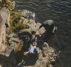 Blue Green Algae Monitoring
DWR environmental scientists regularly monitor for blue-green algae and their toxins during the summer months. There are currently no harmful algal bloom (HAB) advisories for Lake Oroville, the Thermalito Forebay, or the Thermalito Afterbay. Blue-green algae (cyanobacteria) is a natural component of ecosystems. Under certain conditions, including warmer temperatures and increased nutrient loads, algae can grow rapidly causing “blooms.” Keep animals and children away from the water when a suspected harmful algal bloom (HAB) is present and report the possible HAB immediately. Water samples are taken at various locations regularly from Memorial Day through Labor Day and sent to a lab for toxin analysis. If elevated levels of cyanobacteria toxins are found while testing, DWR staff will work with California’s Regional Water Quality Control Board and recreation area managers to notify the public and post advisory signs at affected waterbodies. To learn more about HABs, or to report a HAB visit the Water Board’s website. Photo: Algal bloom on Lake Oroville's North Fork in June 2020 Current Lake Operations The elevation of Oroville’s reservoir is about 698 feet elevation and storage is about 1.24 million acre-feet -- 35 percent full and 43 percent of historical average. Currently, in the Northern Sierra Basin, snowpack is also below average at five percent of normal. Excess heat warnings are in effect until Saturday night. Temperatures are forecast to be in the 100s over the weekend, in the 90s during the week, then increasing to be above 100 over the following next weekend. Total flow to the Feather River is currently at 2,750 cfs for meeting downstream water quality and flow requirements. Due to work being performed at the Thermalito Afterbay River Outlet gates, all flow has been rerouted down the low flow channel, through the City of Oroville. Once the work is completed, flows will be rerouted at a rate of 300 cfs per day from the low flow channel to the Thermalito Afterbay Outlet until desired flows are reached. Current releases are re-assessed on a daily basis. The public can track precipitation, snow, reservoir levels, and more at the California Data Exchange Center at www.cdec.water.ca.gov. Lake Oroville is identified as “ORO”. All data as of midnight 6/17/2021 ### Know someone who would like to receive Community Updates? They can email their request to oroville@water.ca.gov.  April 9, 2021 DWR Begins Monitoring Vernal Pools Some grasslands, including areas around Butte County, have an underlying impervious layer of rock or clay that causes rainwater to pond in the winter and spring, creating seasonal wetlands called vernal pools. Although vernal pools are only a small component of our local grasslands in terms of area, they support a remarkably high diversity of plants and animals, including rare and endangered species and species endemic to California (i.e., found nowhere else in the world). Vernal pool organisms and plants are highly specialized to their unique environment and to the Mediterranean-type climate found in California. They have adapted to living in pools that fill in the winter but are completely dry by the summer, as well as adapting to the sometimes-extreme variability in temperature and rainfall between years. Vernal pools are important targets for conservation because most vernal pools in California have been lost to development, agriculture, and habitat degradation from invasive plants. Vernal pools often support spectacular wildflowers that bloom from March to May. Each spring, Department of Water Resources (DWR) Environmental Scientists from the Oroville Field Division monitor hundreds of vernal pools around the Oroville area and make assessments on how protection measures for these valuable environmental resources are succeeding. Photo: Native flower "tidy tips" in vernal pool area Additional Campgrounds Open at Lake Oroville The California Department of Parks and Recreation (CA Parks) has opened up reservations for the Bloomer Point, Bloomer Knoll, and Bloomer Cove boat-in campgrounds, the Foreman Creek boat-in campground, and the floating campgrounds located around Lake Oroville. Group camping at Loafer Creek Recreation Area opens on April 15. Lime Saddle group camping remains closed. Reservations for camping can be made online by selecting the ‘Reservations’ tab on the Lake Oroville State Recreation Area (LOSRA) webpage. The reservations system needs 48 hours’ notice to process reservations. “Day-of” access to campgrounds is possible if campsites are available.  Oroville Recreation The Lime Saddle, Bidwell Canyon, and Spillway boat ramps are open for use. Bidwell Canyon and Lime Saddle boat ramps are open 24-hours per day and the Spillway boat ramp is open from 6 a.m. to 8 p.m. daily. The Loafer Creek Boat Ramp remains out of the water. Construction of the brand-new Loafer Point Boat Ramp is nearing completion and will be open later this spring. The Roy Rogers Trail in the Loafer Creek Recreation Area, previously closed weekdays for hazardous tree removal, is now open. All day use facilities at Lake Oroville State Recreation Area are open. The Lake Oroville Visitor Center remains closed due to COVID-19 restrictions. DWR and CA Parks invite outdoor enthusiasts to visit the area’s 91 miles of trails, including the 41-mile long Brad Freeman Trail. Mountain bikers, hikers, equestrians, and bicyclists can find trail information on DWR’s interactive map on the Lake Oroville Recreation webpage. Visit the California Parks LOSRA webpage for current information on facility status as well as current requirements to protect public health during the COVID-19 pandemic. For information about the Oroville Wildlife Area, including the Thermalito Afterbay, visit the California Department of Fish and Wildlife webpage. Photo: Family hike on the Brad Freeman Trail near the Thermalito Diversion Pool 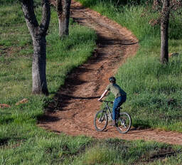 Goats Reduce Vegetation Near Diversion Pool
A herd of 350 to 400 goats from Hanski Family Farms LLC were successful in reducing hazardous fuels in nearly five acres in the Lakeland Boulevard area this past week. DWR partnered with the Butte County Fire Safe Council (BCFSC) on this grazing project to reduce the fire risk from grasses, leaves, invasive and non-invasive plants, and other vegetation. This work is part of DWR’s Fuel Load Management Program, which was started in 2012 to reduce hazardous fuels within the Federal Energy Regulatory Commission (FERC) project boundary. DWR, along with partners CAL FIRE, the California Conservation Corps, BCFSC, Butte County Sheriff’s Office, and California Department of State Parks and Recreation (CA Parks), are all working together to accomplish the same common goal -- reduce wildfire risk, increase public safety, and enhance forest health in areas around Lake Oroville. To date, approximately 675 acres have been treated around the Lake Oroville area by DWR and its partners. Photo: Goats perform fuel reduction grazing on Lakeland Blvd. near the Thermalito Diversion Pool Current Lake Operations The elevation of Oroville’s reservoir is about 725 feet elevation and storage is about 1.46 million acre-feet -- 41 percent full and 54 percent of historical average. Currently, in the Northern Sierra Basin, rainfall is below average, at 50 percent of normal for this time of year and snowpack is also below average at 51 percent of normal. Dry and warm conditions are forecasted this weekend and into the week of April 12. DWR continues to assess releases on a daily basis and still plans to reduce releases to conserve water. As of April 8, total releases to the Feather River are 1,300 cubic feet per second (cfs) to meet Bay-Delta water quality and outflow requirement - 800 cfs down the low flow channel through the City of Oroville and 500 cfs from the Thermalito Afterbay Outlet (Outlet) for a total of 1,300 cfs for the Feather River’s high flow channel downstream of the Outlet. The public can track precipitation, snow, reservoir levels, and more at the California Data Exchange Center at www.cdec.water.ca.gov. Lake Oroville is identified as “ORO”. All data as of midnight 4/8/2021 ### Know someone who would like to receive Community Updates? They can email their request to oroville@water.ca.gov  February 19, 2021 Oroville Dam Citizens Advisory Commission Public Meeting The California Natural Resources Agency held its sixth Oroville Dam Citizens Advisory Commission meeting on Feb. 19. The online public meeting included presentations on fire modernization at the Hyatt Power Plant, winter operations, and a presentation from the Yuba Water Agency on downstream flood management. Members of the public also asked questions and gained information on these and other topics. The Citizens Advisory Commission is a forum for the community to provide feedback and ask questions. The meeting transcript and presentations will be available on the Commission’s website (https://bit.ly/OrovilleCAC) in the coming weeks. Lake Oroville Boat Ramps The Lime Saddle Boat Ramp is now open for use along with Bidwell Canyon and Spillway boat ramps. Bidwell Canyon and Lime Saddle boat ramps are open 24-hours per day and the Spillway boat ramps are open from 6 a.m. to 8 p.m. daily. The Lake Oroville Marina at Lime Saddle is open 8 a.m. to 4:30 p.m. and the Bidwell Canyon Marina is open 7 a.m. to 8 p.m. The Loafer Creek boat ramps remain out of the water. Feather River Fish Planting Millions of fish are raised every year at the Feather River Fish Hatchery, including Chinook fall and spring run salmon, and salmon’s cousin, steelhead trout – another type of anadromous fish that migrates from their river birthplace to the ocean and back to their native river to spawn. Over the last two weeks, hatchery staff transported and released over 430,000 of the steelhead trout raised last year into the Feather River below Yuba City. Releasing the young fish further downstream improves their chances of survival by shortening their migration route to avoid predators. An additional 10,000 steelhead were also released into the Thermalito Afterbay to support that popular recreational fishery. The Feather River Fish Hatchery is a California State Water Project facility built in the late 1960s to mitigate impacts on fish migration resulting from the construction of Oroville Dam which blocked access to spawning grounds further upstream. DWR maintains the facility and funds the hatchery operations, fish spawning, rearing, and stocking activities provided by California Department of Fish and Wildlife staff. Photos of the steelhead trout release are available on the Department of Water Resources (DWR) Pixel webpage – search ‘fish release’. Photo: Dept. Fish and Wildlife release steelhead trout into the Feather River at Boyd's Boat Launch 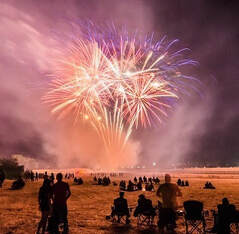 Oroville Recreation The Lake Oroville State Recreation Area (LOSRA) campgrounds at Bidwell Canyon, Loafer Creek – including the Equestrian Campground, and the Lime Saddle Campground are open. Group camping, including floating campgrounds, and boat-in campgrounds remain closed. Reservation capability does not open until April and camping sites will be allocated on a ‘first come-first serve’ basis. The Potters Ravine and North Fork trails are open for use. CA Parks encourages users to remain on the trails. Assessments by CA Parks staff of trail safety will continue through the winter. All day use facilities at Lake Oroville State Recreation Area (LOSRA) are open. The Lake Oroville Visitors Center remains closed. Visit the California Parks LOSRA webpage for current information on facility status as well as current requirements to protect public health during the COVID-19 pandemic. Information about recreation facilities can be found in DWR’s interactive map on the Lake Oroville Recreation webpage. For information about the Oroville Wildlife Area, including the Thermalito Afterbay, visit the California Department of Fish and Wildlife webpage. Photo: Camping at the Lake Oroville State Recreation Area  Thermalito Powerplant Update The Department of Water Resources (DWR) Thermalito Powerplant (THPP), formally named the Ronald B. Robie Thermalito Pumping-Generating Powerplant, has returned to full service after losing operational capacity when it was damaged by fire in November 2012. The powerplant has been re-constructed with modern fire and life safety features, and the plant’s electrical protection, control, and communications systems have been fully replaced. The thousands of connections in the plant’s new systems underwent the strict and rigorous ‘interconnection’ requirements of Pacific Gas & Electric (PG&E) to safely re-connect the powerplant to the state’s electrical grid. The THPP is one of three hydroelectric powerplants in the Oroville-Thermalito Complex, capable of generating 118 megawatts – enough to power roughly 100,000 households and adding value to the approximately 714 megawatts produced by Oroville Dam’s Edward Hyatt Powerplant. Along with the Thermalito Diversion Dam Powerplant, the Oroville-Thermalito Complex is California’s State Water Project’s leading producer of clean hydro-electric power. Photo: Power generation turbines at restored RBR Thermalito Pumping-Generating Powerplant  Wildfire Impacts on Water Quality
The multi-agency “Watershed Working Group”, led by the California Governor’s Office of Emergency Services (CalOES), continues targeted monitoring of rivers, lakes, and other surface waters in the North Complex burn area and downstream. The Central Valley Regional Water Quality Control Board (Water Board), the California Department of Fish and Wildlife (CDFW), and the Department of Water Resources (DWR) collect and test water samples for analysis. The Water Board’s recent news release states elevated results found are not impacting drinking water treatment facilities nor the quality of drinking water. Water testing will continue and the Watershed Working Group will report results in the weeks ahead. The Water Board will alert the public if results show water quality may be impacted. Photo: DWR water quality experts collect water samples on the Feather River's Middle Fork Current Lake Operations The elevation of Oroville’s reservoir is about 708 feet elevation and storage is about 1.31 million acre-feet, 55 percent of historical average. Currently, in the Northern Sierra Basin, rainfall is below average, at 53 percent of normal for this time of year and snowpack is also below average at 67 percent of normal. Chance of light rain and snow showers in the higher elevations is forecasted this Saturday. Next week, beginning Feb. 22, expect dry conditions with a slight chance of rain towards the end of the week. The total releases to the Feather River continues to be at 1,250 cfs to conserve storage in Lake Oroville. The Feather River flows consist of 800 cfs down the Low Flow Channel through the City of Oroville, and 450 cfs from the Thermalito Afterbay Outlet (Outlet) for a total of 1,250 cfs for the Feather River’s high flow channel downstream of the Outlet. The public can track precipitation, snow, reservoir levels, and more at the California Data Exchange Center at www.cdec.water.ca.gov. Lake Oroville is identified as “ORO”. All data as of midnight 2/18/2021 ### Know someone who would like to receive Community Updates? They can email their request to oroville@water.ca.gov.  September 4, 2020 Oroville Recreation Update Oroville area recreation facilities are expected to be popular destinations for the Labor Day holiday. With the exception of the Potters Ravine trail complex near the Oroville Dam Spillway Boat Ramp area (damaged in last month’s Potters Fire), all Lake Oroville State Recreation Area (LOSRA) boat ramps, parking lots, and day use areas are open, including North and South Forebay facilities. The Oroville Dam Spillway Boat Ramp and day use area is open for use 5 a.m. to 11 p.m. daily. The Potters Ravine and North Fork trail complex experienced significant damage from the Potters Fire and will be closed through the winter for rehabilitation work. The recent Potters Fire burned over 900 acres, including areas adjacent to Oroville Dam’s main and emergency spillways, the Spillway Boat Ramp area, and the Thermalito Diversion Pool. California State Parks (CA Parks) has completed repairs to fire-damaged areas on the Thermalito Diversion Pool’s Brad Freeman Trail between Burma Road and the Spillway Boat Ramp trailhead. Bikers and hikers are now able to enjoy this challenging trail with its spectacular views of the valley. The Dan Beebe and Lakeland trails on the south side of the Diversion Pool are also open for use and the Diversion Pool’s car-top boat launch is open for non-motorized boating. Information about and current status of Lake Oroville recreation facilities is available on the Department of Water Resources (DWR) Lake Oroville Recreation webpage and on the LOSRA webpage. The Lake Oroville Visitors Center remains closed and boat-in, floating, and group campsites are not currently available to reduce the spread of COVID-19. For information about available State Parks camping, as well as COVID-19 public health requirements while recreating, visit www.parks.ca.gov/COVID19Camping. Diversion Pool Trails and Area Roadways to Close for Utility Work Pacific Gas & Electric (PG&E) crews are scheduled to remove three conductors from the Caribou-Palermo 115KV transmission line that crosses the Thermalito Diversion Pool Sept. 8 through Sept. 16. Boating activity on the Diversion Pool will be restricted by in-water control boats on Sept. 9. Visitors and area residents will also see helicopter activity in the area during conductor removal. Portions of the Brad Freeman Trail north and south of the Thermalito Diversion Pool, and the Dan Beebe Trail, and areas around the trailhead on Lakeland Boulevard on the south side of the Diversion Pool will also close for various periods Sept. 10 to Sept. 16. Traffic on Lakeland Boulevard west of Reyman Street will experience temporary delays when work is occurring on the conductors crossing the road. Signage regarding upcoming work will be posted on area trails in advance of closures. Visitors are reminded to be safe and obey access restrictions. Bidwell Canyon Boat Ramp Work to Resume in September The Bidwell Canyon Boat Ramp Stage Two Improvement Project’s contractor started mobilizing on Sept. 1 and will begin work in the next couple of weeks depending on Lake Oroville elevation. Work will not occur over the Labor Day weekend. As lake levels decrease, construction will continue on a project that started in Fall 2018 to expand the Stage Two parking area and provide two additional Stage Two boat ramp lanes to 700 feet. Construction was halted in February 2019 due to rising lake levels. Kelly Ridge and Arroyo Drive residents can expect to see large construction equipment, as well as rock and concrete deliveries, in the area beginning early September from 7 a.m. to 7 p.m. weekdays as the contractor works to complete the project by mid-November. Last year, the Stage Two project constructed a new lower-level, concrete parking lot, expanded Bidwell Canyon’s mid-level boat launch from three to five lanes, and added two boarding float lanes. Construction also improved the vertical curve at the top of the boat ramp to accommodate larger trailers.  Oroville Area Algal Blooms Status
DWR’s Oroville Field Division has concluded recreational swim beach cyanotoxin monitoring this week. Monitoring for cyanotoxins at the Thermalito Forebay and Afterbay occurs weekly from Memorial Day to Labor Day. DWR’s Environmental Scientists will continue to assess any reported algal blooms as visitors continue to enjoy these recreation areas. At Lake Oroville, harmful algal blooms (HAB’s) continue to be present in many locations and DWR’s Environmental Scientists will continue to monitor these blooms until they dissipate. If elevated levels of cyanotoxins are found, staff will work with California’s Regional Water Quality Control Board and recreation area managers to notify the public and post advisory signs at the affected waterbody. At this time there are no advisories in place. How can you keep yourself, your family, and your pets safe from HAB’s? Visit the Water Board’s website and DWR’s digital article on the DWR Updates webpage. The public is encouraged to report algal blooms on the HAB reporting webpage. Learn All About Salmon Join us for Water Wednesdays at 1 p.m. on DWR’s YouTube channel and learn all about salmon over the next few weeks. These family-friendly programs are designed for kids 10 to 14 but are appropriate for anyone who would like to learn more about California’s water resources. The fall season began Aug. 26 with a five-part look at the lifecycle of the Chinook salmon that spawn in the Feather River, travel downriver, through the Delta, and finally to the ocean. Interested participants can pre-register through Zoom which will allow them to ask real time questions of the speaker. Visit the DWR Events webpage at https://water.ca.gov/News/Events to join or register for next Wednesday’s chat. Information will also be posted on DWR’s social media pages at @CA_DWR (Twitter) and @CADWR (Facebook). Water Wednesdays began in May 2020 and previous episodes are available on DWR’s YouTube channel – enter Water Wednesdays in the search bar. Current Lake Operations The elevation of Oroville’s reservoir is about 751 feet and storage is about 1.68 million acre-feet. Daily average inflows to the lake have ranged between 1,354 cfs (cubic feet per second) to 2,442 over the past week. High temperatures will continue into the week of September 7. The Northern Sierra Basin rainfall totals remains below average for the year, at 63 percent of normal. The total releases to Feather River are 2,100 cfs to meet downstream Bay-Delta water quality and flow standards. Flows through the City of Oroville are about 950 cfs. Currently, flows from the Thermalito Afterbay Outlet (Outlet) are about 1,150 cfs for a total of 2,100 cfs for the Feather River’s high flow channel downstream of the Outlet. Generating additional hydroelectric power to address increased energy demands due to the heat wave may result in increased river flows over the Labor Day weekend. During the week of September 7, total flows to the Feather River will be reduced from 2,100 cfs to 1,950 cfs to conserve storage. After this decrease, flows through the City of Oroville will be 800 cfs and 1,150 cfs will be from the Outlet for a total of 1,950 cfs to the Feather River below the Outlet. All data as of midnight 9/3/2020 ### Know someone who would like to receive Community Updates? They can email their request to oroville@water.ca.gov.  The following is an update from California State Parks.
UPDATE (May 15, 2020) - As California State Parks begins its phased reopening of parks and beaches in compliance with state and local public health ordinances, it is important for visitors to continue to practice physical distancing and avoid congregating with people outside their immediate household. Everyone has the responsibility to mitigate the spread of COVID-19. Here are some guidelines for people visiting Lake Oroville SRA. What is open now? Lake Oroville State Recreation Area is now open for day-use vehicular access which includes parking lots, boat launches and trails. Bidwell Canyon and Lake Oroville Marinas are preparing to reopen on Monday, May 18. Until then, vessel fueling, pump-out, and shuttle services will not be available. Due to ongoing concerns for the spread of COVID-19, some services will continue to be restricted or suspended for an undetermined time. Please contact the appropriate Marina for the most current information and please plan your visit accordingly. Bidwell Canyon Marina (530) 589-9175 www.bidwellcanyonmarina.com Lake Oroville Marina (530) 877-2883 www.lakeorovillemarina.com What is currently closed at this park and throughout the State Park System?
Are there any new visitor guidelines? Yes, please see below:
Thank you for your patience and continued support of California State Parks as we work to limit your risk for exposure to COVID-19 in the outdoors. For more information, please visit parks.ca.gov/FlattenTheCurve. 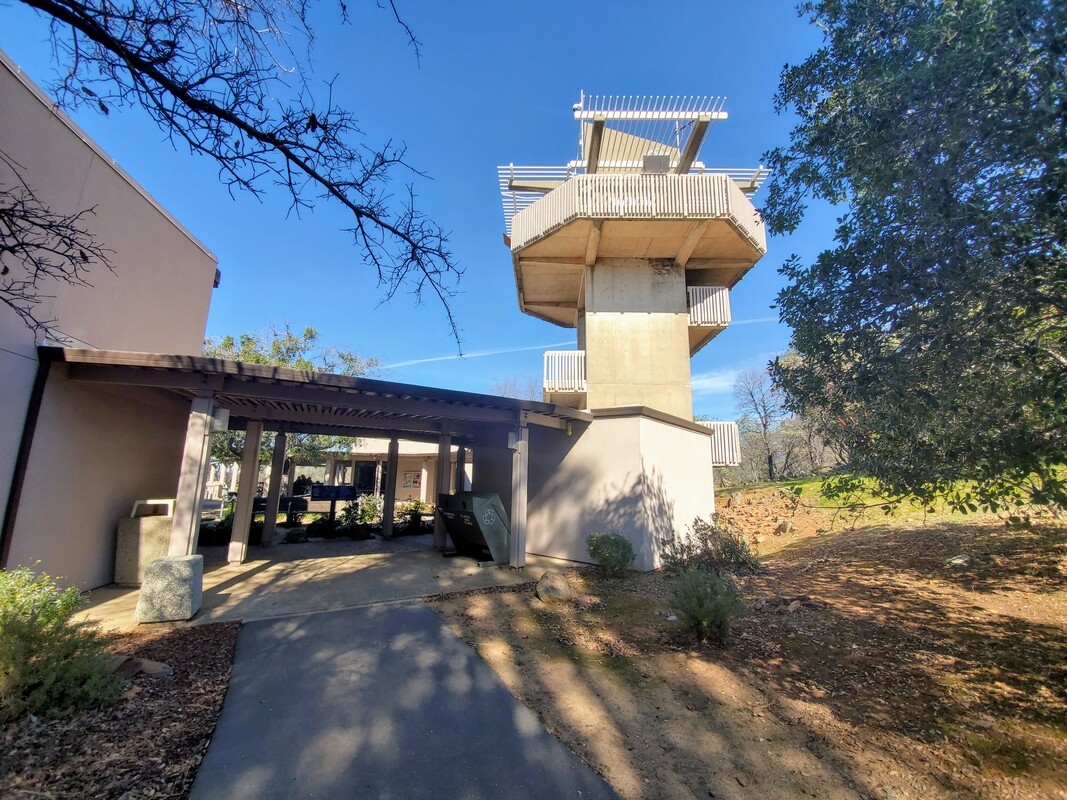 The Lake Oroville Visitor Center is one of the most fascinating points of interest in Oroville. They hold several events throughout the year, have a museum, have access to trails, and do many more things.
To keep up to date on all the programs the Lake Oroville Visitor Center has to offer, Click Here. If you have any questions on local recreation, you can call the Oroville Area Chamber of Commerce at (530) 538-2542 or email at info@orovillechamber.com.
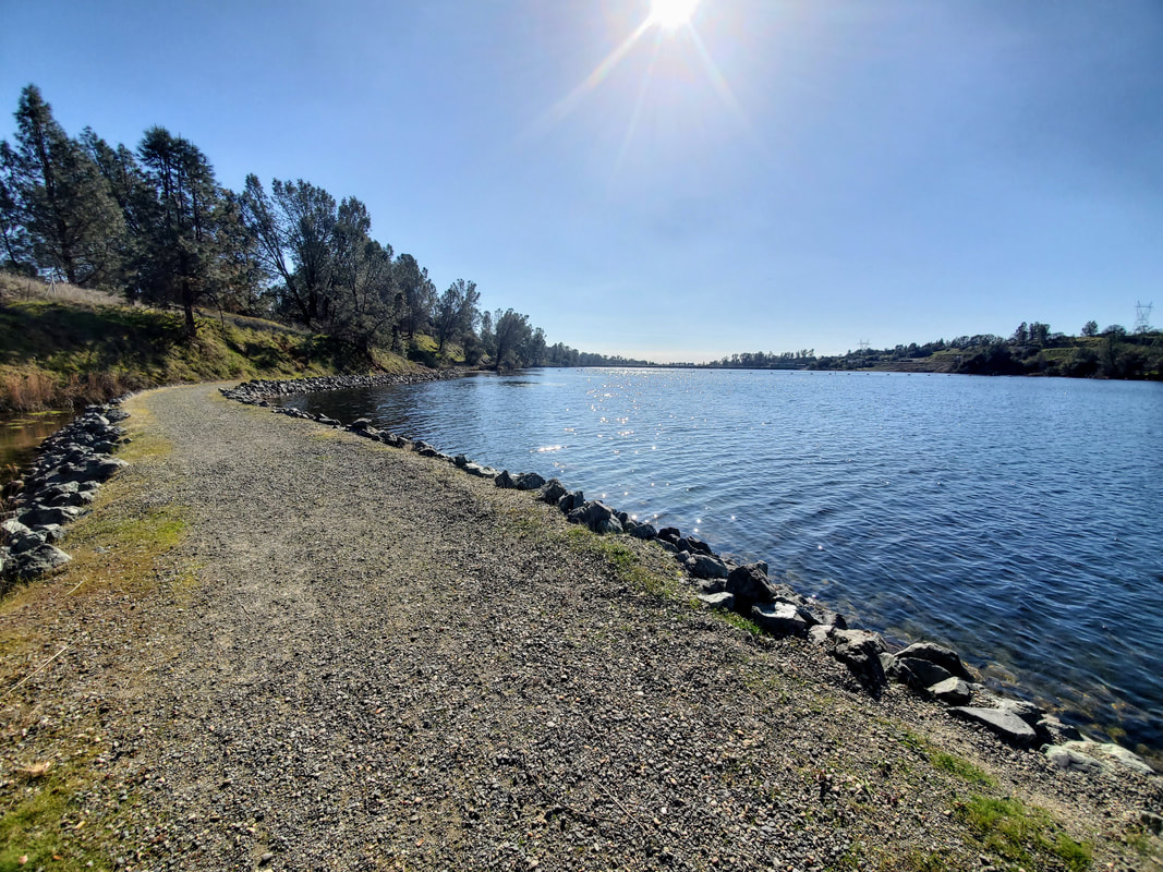
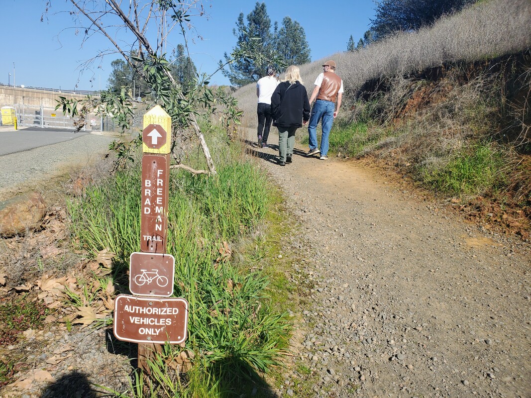 The Brad Freeman/Dan Beebe Trail offers a 44.5 mile loop perfect for scenic hiking and biking. Over the weekend Chamber CEO/President, Eric Smith; Communications Coordinator, Amber Marron; and their families walked a small couple mile portion of the trail up to the old train tunnel.  We started off near the Feather River Bath House off of the roundabout on Montgomery Street. The weather was perfect as well as the view of the Feather River Fish Hatchery and the Diversion Pool. Hummingbirds were also in the air and could be seen in the trees along the pathway.
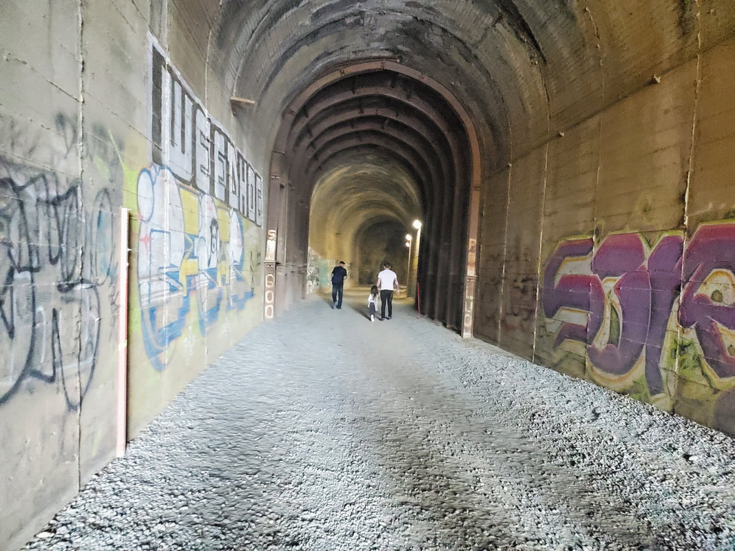
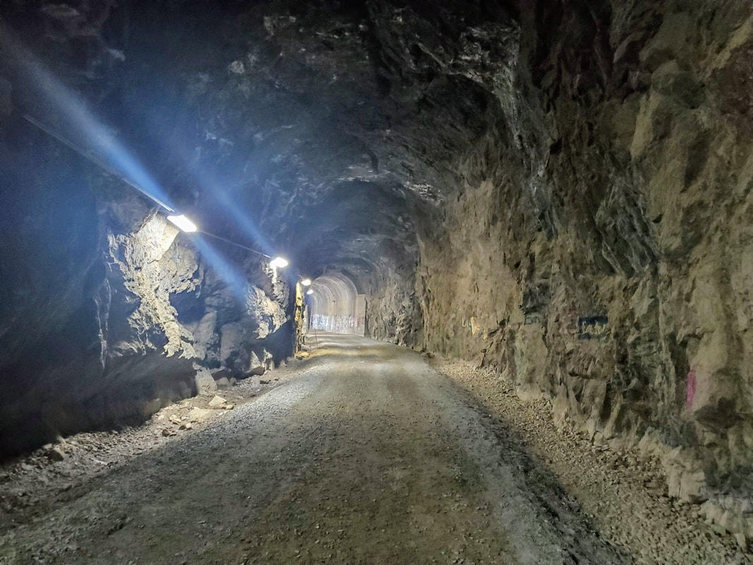
Our hike ended at the old train tunnel that was used to bring in supplies to build the Oroville Dam. Once through the train tunnel the path continues along the beautiful Feather River. You can see a full map of trails from the Department of Water Resources by Clicking Here.
If you have any questions about recreation in Oroville, you can contact the Oroville Area Chamber of Commerce at (530) 538-2542 or at info@orovillechamber.com. |
Archives
April 2024
Categories
All
|
 RSS Feed