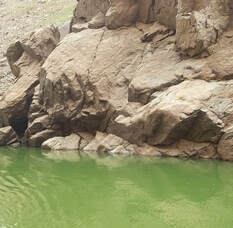
 April 23, 2021 Loafer Creek Fuels Reduction Work The Department of Water Resources (DWR), in partnership with Butte County Fire Safe Council (BCFSC), started a 13-acre vegetation management project along Highway 162 and Loafer Creek Road on April 22. Green Mountain Contracting is using hand crews to thin and chip overgrown and hazardous vegetation. A one-lane road closure will be needed along the entrance to Loafer Creek Recreation Area when crews are chipping. CAL FIRE continues hazardous tree and vegetation fuels reduction activities at Loafer Creek within the North Complex wildfire burn scar. Crews are using heavy equipment and hand crews to cut, pile, and chip burnt vegetation and trees. The piles will be burned this fall when conditions are safe to burn. Both projects are visible to motorists on Highway 162. The public is advised to use caution around work activities and reduce speeds around crews and equipment. This work is part of DWR’s Fuel Load Management Plan (FLMP) to reduce wildfire risk, increase public safety, and enhance forest health in areas around Lake Oroville. To date, approximately 700 acres have been treated around the Lake Oroville area by DWR and its partners including CAL FIRE, the California Conservation Corps, BCFSC, Butte County Sheriff’s Office, and California Department of Parks and Recreation. DWR has the goal of treating and/or retreating an additional 1,000 acres over the next 5 years. Photo: Crews perform brush clearing work at Loafer Creek Recreation Area 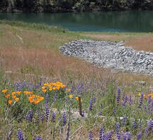 Restoration of Spillway Hillside The hillsides near Oroville Dam’s reconstructed main spillway are blooming with flowers and vegetation in areas which received an application of a hydroseed mix for site stabilization and erosion control in 2019. The hydroseed mix helps to reestablish a root structure in the soil profile to hold it in place Winter and spring rains over the past two winters have made the ‘improved’ soil better able to support the germinating of the native species seeds also included in the 2019 hydroseed mix. Native species such as yarrow, fescue, California poppy, fiddleneck, and lupine help to restore natural ground cover and improve soil conditions. Hydroseeding is one component of the Oroville Spillways Emergency Recovery Project’s site rehabilitation activities that are scheduled over the next several years. Photo: California Poppies and lupine grow above the Thermalito Diversion Pool. Summer Hours In Effect at Spillway Summer access hours of 5 a.m. to 11 p.m. daily are now in effect for the Spillway Boat Ramp Area, Spillway Day Use Area, Potter’s Ravine and North Fork Trails, as well as access to the top of the “Burma Climb” portion of the Brad Freeman Trail which is popular with mountain bikers for its challenging downhill route. Hours of access to Oroville Dam Crest Road for motorists, bicyclists, joggers, and walkers is 5 a.m. to 11 p.m. year-round. Please note that overnight parking in the lot above the main spillway is not permitted. 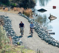 Oroville Recreation The Lime Saddle, Bidwell Canyon, and Spillway boat ramps are open for use. Bidwell Canyon and Lime Saddle boat ramps are open 24-hours per day and the Spillway boat ramp is now open from 5 a.m. to 11 p.m. daily. The Loafer Creek Boat Ramp remains out of the water. Construction of the brand-new Loafer Point Boat Ramp is nearing completion and will be open later this spring. The California Department of Parks and Recreation (CA Parks) has opened their camping reservations for camping areas around Lake Oroville, including the Lake’s floating campgrounds. Lime Saddle group camping remains closed. Reservations for camping can be made online by selecting the ‘Reservations’ tab on the Lake Oroville State Recreation Area (LOSRA) webpage. All day use facilities at Lake Oroville State Recreation Area (LOSRA) are open. The Lake Oroville Visitor Center remains closed due to COVID-19 restrictions. The LOSRA webpage at https://www.parks.ca.gov/?page_id=462 has current information on facility status as well as current requirements to protect public health during the COVID-19 pandemic. Recreation information can be found in DWR’s interactive map at https://water.ca.gov/Programs/State-Water-Project/SWP-Facilities/Oroville/Lake-Oroville-Recreation. For information about the Oroville Wildlife Area, including the Thermalito Afterbay, visit the California Department of Fish and Wildlife webpage at https://wildlife.ca.gov/Lands/Places-to-Visit/Oroville-WA. Photo: Camping at Lake Oroville Current Lake Operations The elevation of Oroville’s reservoir is about 729 feet elevation and storage is about 1.49 million acre-feet -- 42 percent full and 53 percent of historical average. Currently, in the Northern Sierra Basin, rainfall is below average, at 48 percent of normal for this time of year and snowpack is also below average at 27 percent of normal. Rain is forecast this weekend through Monday, April 26, with the heaviest precipitation occurring on Sunday, April 25. Warm, dry weather returns for the remainder of the week. DWR continues to plan to reduce releases to conserve water while maintaining flows to meet Bay-Delta water quality needs and outflow requirements. Currently, the total flows to the Feather River remain at 1,100 cubic feet per second (cfs) - 800 cfs down the low flow channel through the City of Oroville and 300 cfs through the Thermalito Afterbay Outlet (Outlet). From April 26 to April 30, releases to the Feather River will decrease from the current 1,100 cfs to 800 cfs. At that time, flows down the low flow channel through the City of Oroville will be 650 cfs and 150 cfs from the Thermalito Afterbay Outlet (Outlet) for a total of 800 cfs downstream of the Outlet. The public can track precipitation, snow, reservoir levels, and more at the California Data Exchange Center at www.cdec.water.ca.gov. Lake Oroville is identified as “ORO”. All data as of midnight 4/22/2021 ### Know someone who would like to receive Community Updates? They can email their request to [email protected]. 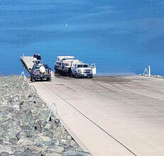 April 16, 2021 Governor Visits Fuels Reduction Work Governor Gavin Newsom visited the Loafer Creek Recreation Area near Lake Oroville to sign a $536 million wildfire package on April 13. This money will go towards forest management projects and efforts to reduce wildfire risks around California, including projects in Butte County. Governor Newsom visited a work site where CAL FIRE, in partnership with Department of Water Resources (DWR), has crews actively working in the Loafer Creek Recreation Area within the North Complex wildfire burn scar. Crews are using heavy machinery and hand crews to cut, pile, and chip burnt vegetation and trees. The piles will be burned after rains begin later this fall. Operations are visible to motorists on Highway 162. This work is part of CAL FIRE’s Vegetation Management Program and DWR’s Fuel Load Management Plan (FLMP). Both plans aim to reduce wildfire risk, increase public safety, and enhance forest health in areas around Lake Oroville. Nearly 3,000 acres are targeted as part of DWR’s FLMP. To date, approximately 700 acres have been treated around the Lake Oroville area by DWR and its partners including CAL FIRE, the California Conservation Corps, Butte County Fire Safe Council (BCFSC), Butte County Sheriff’s Office, and California Department of Parks and Recreation (CA Parks). Previous FLMP work in the Loafer Creek area is credited for helping slow the North Complex wildfire, allowing firefighters time to establish the fire line that protected the communities of Kelly Ridge and Oroville. DWR, in partnership with BCFSC, will begin a vegetation management project along Highway 162 and Loafer Creek Road starting the week of April 19. This 13-acre project will take approximately one month to reduce overgrown vegetation and hazardous fuels. A one-lane road closure may be needed along the entrance to Loafer Creek Recreation Area. The public is advised to use caution around work activities and reduce speeds around crews and equipment. Photo: Reducing fire risk and burned trees at Loafer Creek Recreation Area  DWR Begins Monitoring Vernal Pools Some grasslands, including areas around Butte County, have an underlying impervious layer of rock or clay that causes rainwater to pond in the winter and spring, creating seasonal wetlands called vernal pools. Although vernal pools are only a small component of our local grasslands in terms of area, they support a remarkably high diversity of plants and animals, including rare and endangered species and species endemic to California (i.e., found nowhere else in the world). Vernal pool organisms and plants are highly specialized to their unique environment and to the Mediterranean-type climate found in California. They have adapted to living in pools that fill in the winter but are completely dry by the summer, as well as adapting to the sometimes-extreme variability in temperature and rainfall between years. Vernal pools are important targets for conservation because most vernal pools in California have been lost to development, agriculture, and habitat degradation from invasive plants. Vernal pools often support spectacular wildflowers that bloom from March to May. Each spring, Department of Water Resources (DWR) Environmental Scientists from the Oroville Field Division monitor hundreds of vernal pools around the Oroville area and make assessments on how protection measures for these valuable environmental resources are succeeding. Photo: Native flower "tidy tips" in vernal pool area Additional Campgrounds Open at Lake Oroville The California Department of Parks and Recreation (CA Parks) has opened their camping reservations for group camping at Loafer Creek Recreation Area, including the Equestrian Group campground, the Bloomer Point, Bloomer Knoll, and Bloomer Cove boat-in campgrounds, the Foreman Creek boat-in campground, and the floating campgrounds located around Lake Oroville. Lime Saddle group camping remains closed. Reservations for camping can be made online by selecting the ‘Reservations’ tab on the Lake Oroville State Recreation Area (LOSRA) webpage. The reservations system needs 48 hours’ notice to process reservations. “Day-of” access to campgrounds is possible if campsites are available. 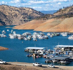 Oroville Recreation The Lime Saddle, Bidwell Canyon, and Spillway boat ramps are open for use. Bidwell Canyon and Lime Saddle boat ramps are open 24-hours per day and the Spillway boat ramp is open from 6 a.m. to 8 p.m. daily. The Loafer Creek Boat Ramp remains out of the water. Construction of the brand-new Loafer Point Boat Ramp is nearing completion and will be open later this spring. The Roy Rogers Trail in the Loafer Creek Recreation Area, previously closed weekdays for hazardous tree removal, is now open. All day use facilities at Lake Oroville State Recreation Area are open. The Lake Oroville Visitor Center remains closed due to COVID-19 restrictions. DWR and CA Parks invite outdoor enthusiasts to visit the area’s 91 miles of trails, including the 41-mile long Brad Freeman Trail. Mountain bikers, hikers, equestrians, and bicyclists can find trail information on DWR’s interactive map on the Lake Oroville Recreation webpage. Visit the California Parks LOSRA webpage for current information on facility status as well as current requirements to protect public health during the COVID-19 pandemic. For information about the Oroville Wildlife Area, including the Thermalito Afterbay, visit the California Department of Fish and Wildlife webpage. Photo: Roy Rogers Trail in Loafer Creek Recreation Area after hazardous trees and underbrush removal project Current Lake Operations The elevation of Oroville’s reservoir is about 728 feet elevation and storage is about 1.48 million acre-feet -- 42 percent full and 54 percent of historical average. Currently, in the Northern Sierra Basin, rainfall is below average, at 49 percent of normal for this time of year and snowpack is also below average at 39 percent of normal. Dry and warm conditions are forecasted this weekend and into the week of April 19. DWR continues plans to reduce releases to conserve water while maintaining flows to meet Bay-Delta water quality needs and outflow requirements. On Friday, total flows to the Feather River were reduced to 1,100 cfs. At this total Feather River flow, there is 800 cfs down the low flow channel through the City of Oroville and 300 cfs through the Thermalito Afterbay Outlet (Outlet). From April 19 to April 21, releases to the Feather River will decrease from the current 1,100 cfs to 800 cfs by Wednesday, April 21. At that time, flows down the low flow channel through the City of Oroville will be 650 cfs and 150 cfs from the Thermalito Afterbay Outlet (Outlet) for a total of 800 cfs downstream of the Outlet. The public can track precipitation, snow, reservoir levels, and more at the California Data Exchange Center at www.cdec.water.ca.gov. Lake Oroville is identified as “ORO”. All data as of midnight 4/15/2021 ### Know someone who would like to receive Community Updates? They can email their request to [email protected]. 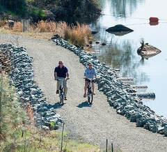 April 9, 2021 DWR Begins Monitoring Vernal Pools Some grasslands, including areas around Butte County, have an underlying impervious layer of rock or clay that causes rainwater to pond in the winter and spring, creating seasonal wetlands called vernal pools. Although vernal pools are only a small component of our local grasslands in terms of area, they support a remarkably high diversity of plants and animals, including rare and endangered species and species endemic to California (i.e., found nowhere else in the world). Vernal pool organisms and plants are highly specialized to their unique environment and to the Mediterranean-type climate found in California. They have adapted to living in pools that fill in the winter but are completely dry by the summer, as well as adapting to the sometimes-extreme variability in temperature and rainfall between years. Vernal pools are important targets for conservation because most vernal pools in California have been lost to development, agriculture, and habitat degradation from invasive plants. Vernal pools often support spectacular wildflowers that bloom from March to May. Each spring, Department of Water Resources (DWR) Environmental Scientists from the Oroville Field Division monitor hundreds of vernal pools around the Oroville area and make assessments on how protection measures for these valuable environmental resources are succeeding. Photo: Native flower "tidy tips" in vernal pool area Additional Campgrounds Open at Lake Oroville The California Department of Parks and Recreation (CA Parks) has opened up reservations for the Bloomer Point, Bloomer Knoll, and Bloomer Cove boat-in campgrounds, the Foreman Creek boat-in campground, and the floating campgrounds located around Lake Oroville. Group camping at Loafer Creek Recreation Area opens on April 15. Lime Saddle group camping remains closed. Reservations for camping can be made online by selecting the ‘Reservations’ tab on the Lake Oroville State Recreation Area (LOSRA) webpage. The reservations system needs 48 hours’ notice to process reservations. “Day-of” access to campgrounds is possible if campsites are available.  Oroville Recreation The Lime Saddle, Bidwell Canyon, and Spillway boat ramps are open for use. Bidwell Canyon and Lime Saddle boat ramps are open 24-hours per day and the Spillway boat ramp is open from 6 a.m. to 8 p.m. daily. The Loafer Creek Boat Ramp remains out of the water. Construction of the brand-new Loafer Point Boat Ramp is nearing completion and will be open later this spring. The Roy Rogers Trail in the Loafer Creek Recreation Area, previously closed weekdays for hazardous tree removal, is now open. All day use facilities at Lake Oroville State Recreation Area are open. The Lake Oroville Visitor Center remains closed due to COVID-19 restrictions. DWR and CA Parks invite outdoor enthusiasts to visit the area’s 91 miles of trails, including the 41-mile long Brad Freeman Trail. Mountain bikers, hikers, equestrians, and bicyclists can find trail information on DWR’s interactive map on the Lake Oroville Recreation webpage. Visit the California Parks LOSRA webpage for current information on facility status as well as current requirements to protect public health during the COVID-19 pandemic. For information about the Oroville Wildlife Area, including the Thermalito Afterbay, visit the California Department of Fish and Wildlife webpage. Photo: Family hike on the Brad Freeman Trail near the Thermalito Diversion Pool 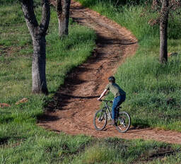 Goats Reduce Vegetation Near Diversion Pool A herd of 350 to 400 goats from Hanski Family Farms LLC were successful in reducing hazardous fuels in nearly five acres in the Lakeland Boulevard area this past week. DWR partnered with the Butte County Fire Safe Council (BCFSC) on this grazing project to reduce the fire risk from grasses, leaves, invasive and non-invasive plants, and other vegetation. This work is part of DWR’s Fuel Load Management Program, which was started in 2012 to reduce hazardous fuels within the Federal Energy Regulatory Commission (FERC) project boundary. DWR, along with partners CAL FIRE, the California Conservation Corps, BCFSC, Butte County Sheriff’s Office, and California Department of State Parks and Recreation (CA Parks), are all working together to accomplish the same common goal -- reduce wildfire risk, increase public safety, and enhance forest health in areas around Lake Oroville. To date, approximately 675 acres have been treated around the Lake Oroville area by DWR and its partners. Photo: Goats perform fuel reduction grazing on Lakeland Blvd. near the Thermalito Diversion Pool Current Lake Operations The elevation of Oroville’s reservoir is about 725 feet elevation and storage is about 1.46 million acre-feet -- 41 percent full and 54 percent of historical average. Currently, in the Northern Sierra Basin, rainfall is below average, at 50 percent of normal for this time of year and snowpack is also below average at 51 percent of normal. Dry and warm conditions are forecasted this weekend and into the week of April 12. DWR continues to assess releases on a daily basis and still plans to reduce releases to conserve water. As of April 8, total releases to the Feather River are 1,300 cubic feet per second (cfs) to meet Bay-Delta water quality and outflow requirement - 800 cfs down the low flow channel through the City of Oroville and 500 cfs from the Thermalito Afterbay Outlet (Outlet) for a total of 1,300 cfs for the Feather River’s high flow channel downstream of the Outlet. The public can track precipitation, snow, reservoir levels, and more at the California Data Exchange Center at www.cdec.water.ca.gov. Lake Oroville is identified as “ORO”. All data as of midnight 4/8/2021 ### Know someone who would like to receive Community Updates? They can email their request to [email protected] 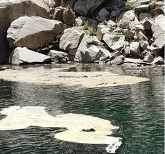 April 2, 2021 DWR April Snow Survey The Department of Water Resources (DWR) conducted the fourth snow survey at the Phillips Station snow course (El Dorado County) on April 1. The manual survey recorded 49.5 inches of snow depth and a snow water equivalent (SWE) of 21 inches, which is 83 percent of average for this location. The SWE measures the amount of water contained in the snowpack and is a key component of DWR’s water supply forecast. April 1 is typically when California’s snowpack is the deepest and has the highest SWE. While the Southern Sierra remains well below average for both rain and snow, the picture is somewhat different in the Northern and Central part of the state where California typically receives 75 percent of the state’s annual precipitation. The few storms that impacted California this year have been colder, bringing more snow than rain. Colder systems are good for the Sierra snowpack, which accounts for 30 percent of California’s fresh water supply in an average year. For Water Year 2021, the snowpack in the Northern and Central Sierra peaked at 70 percent of average; however, rain is below 50 percent of average, which ties this year for the third driest year on record. The amount of water expected to enter California’s reservoirs when the snowpack melts is projected to be just 58 percent of average. The full news release is available on DWR’s website. Photo: DWR staff at April Snow Survey Phillips Station DWR Adjusts State Water Project Allocation As California experiences a second consecutive dry year, DWR announced on March 23 an adjustment to its initial State Water Project (SWP) allocation for the 2021 water year. The Department now expects the SWP to deliver 5 percent of requested supplies this year, down from the initial allocation of 10 percent announced in December. Allocations represent the amount of SWP water that DWR will deliver to 27 million Californians and 750,000 acres of farmland for the year and are reviewed monthly based on several factors, such as water in storage, environmental requirements, and rain and snowmelt runoff projections. Drought conditions have a significant impact on the state’s water supply. Lake Oroville storage is only at 53 percent of its historical average. Beginning April 6, outflows to the Feather River will be further reduced to conserve storage while maintaining the Feather River flows necessary for fishery, environmental, and water delivery needs. More information on the allocation change is available in the DWR News Release. Additional Campgrounds Open at Lake Oroville The California Department of Parks and Recreation (CA Parks) has opened up reservations for the Bloomer Point, Bloomer Knoll, and Bloomer Cove boat-in campgrounds, the Foreman Creek boat-in campground, and the floating campgrounds located around Lake Oroville. Reservations for camping can be made online by selecting the ‘Reservations’ tab on the Lake Oroville State Recreation Area (LOSRA) webpage. Group camping sites remain closed due to COVID-19 pandemic restrictions. 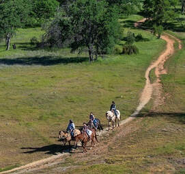 Oroville Recreation The Lime Saddle, Bidwell Canyon, and Spillway boat ramps are open for use. Bidwell Canyon and Lime Saddle boat ramps are open 24-hours per day and the Spillway boat ramp is open from 6 a.m. to 8 p.m. daily. The Loafer Creek Boat Ramp remains out of the water. Construction of the brand-new Loafer Point Boat Ramp is nearing completion and will be open later this spring. All day use facilities at Lake Oroville State Recreation Area (LOSRA) are open. The Lake Oroville Visitor Center remains closed due to COVID-19 restrictions. DWR and CA Parks invite outdoor enthusiasts to visit the area’s 91 miles of trails, including the 41-mile long Brad Freeman Trail. Mountain bikers, hikers, equestrians, and bicyclists can find trail information on DWR’s interactive map on the Lake Oroville Recreation webpage. Visit the California Parks LOSRA webpage for current information on facility status as well as current requirements to protect public health during the COVID-19 pandemic. For information about the Oroville Wildlife Area, including the Thermalito Afterbay, visit the California Department of Fish and Wildlife webpage. Photo: Bicyclists on the Brad Freeman Trail near the Thermalito Diversion Pool 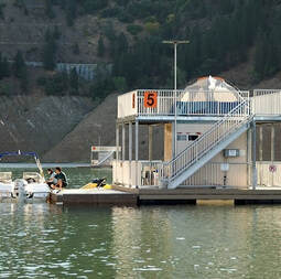 Goats to Remove Vegetation Near Diversion Pool The arrival of 350 to 400 goats from Hanski Family Farms LLC to the Lakeland Boulevard area was delayed this week but is now set to begin on Monday, April 5. DWR partnered with the Butte County Fire Safe Council (BCFSC) on this grazing project to reduce hazardous fuels on approximately five acres. The goats should be in the area for about one week. The goats will graze on grasses, leaves, invasive and non-invasive plants including poison oak, and a variety of shrubs and trees. The grazing area will be cordoned off with an electric fence and monitored by herders and livestock guardian dogs to protect the animals. The public is urged to stay clear of the electric fence and keep pets away, so the goats are not disturbed. This work is part of DWR’s Fuel Load Management Program, which was started in 2012 to reduce hazardous fuels within the Federal Energy Regulatory Commission (FERC) project boundary. DWR, along with partners CAL FIRE, the California Conservation Corps, BCFSC, Butte County Sheriff’s Office, and California Department of State Parks and Recreation (CA Parks), are all working together to accomplish the same common goal -- reduce wildfire risk, increase public safety, and enhance forest health in areas around Lake Oroville. To date, approximately 675 acres have been treated around the Lake Oroville area by DWR and its partners. Photo: Goats perform fuel reduction grazing near Lake Oroville's Lime Saddle Recreation Area in 2019 Current Lake Operations The elevation of Oroville’s reservoir is about 722 feet elevation and storage is about 1.43 million acre-feet -- 41 percent full and 54 percent of historical average. Currently, in the Northern Sierra Basin, rainfall is below average, at 51 percent of normal for this time of year and snowpack is also below average at 63 percent of normal. Less than a half an inch of rain is forecasted Sunday and Monday with cooler temperatures and a slight chance of rain forecasted during the week of April 5. On April 1, DWR increased total releases to the Feather River to 1,500 cfs to provide a pulse flow to assist in the out-migration of Feather River Hatchery Spring-run Chinook salmon that were released on April 1 into the Feather River at the Boyd’s Pump Boat Launch. On April 3, DWR will begin ramping down total releases to the Feather River by 200 cfs a day. By April 6, total flows to the Feather River are planned to be at 800 cfs to conserve storage with 600 cfs down the low flow channel through the City of Oroville and 200 cfs from the Thermalito Afterbay Outlet (Outlet) for a total of 800 cfs for the Feather River’s high flow channel downstream of the outlet. The public can track precipitation, snow, reservoir levels, and more at the California Data Exchange Center at www.cdec.water.ca.gov. Lake Oroville is identified as “ORO”. All data as of midnight 4/1/2021 ### Know someone who would like to receive Community Updates? They can email their request to [email protected]. |
Archives
May 2024
Categories
All
|



 RSS Feed