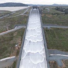
  Spillway Releases Begin at Oroville Dam The Department of Water Resources (DWR) began releasing water from Oroville Dam’s main spillway on Jan. 31. Ongoing releases to the Feather River ensure storage space remains in Lake Oroville for flood control protection to downstream communities. DWR coordinates releases closely with the U.S. Army Corps of Engineers and other water operators and adjusts releases as needed to account for continuing rain. The information below reflects current reservoir level estimates. Forecasts can change quickly and may affect the estimates provided.
Starting the week of Feb. 5, crews may also be seen working near the main spillway. Sections of the spillway’s underdrain system are being re-inspected to capture additional video footage. In addition, crews will be performing maintenance and repairs to the spillway’s lighting system. The Lake Oroville reservoir is the largest storage facility in the State Water Project, providing flood protection while supporting environmental and water delivery needs to 27 million Californians. In 2023, Oroville Dam’s main spillway passed over 2,370,000 acre-feet of water, 67 percent of Lake Oroville’s capacity, with flows as high as 36,000 cfs. The main spillway continues to perform well and operate as designed. DWR continues to monitor lake levels, weather forecasts, and mountain snow levels to optimize water storage while allowing for carryover storage into next year. Oroville Recreation Advisory Committee The Oroville Recreation Advisory Committee (ORAC) met Feb. 2 at the Southside Oroville Community Center. ORAC was established by the Federal Energy Regulatory Commission (FERC) to review and provide recreation plan recommendations for Oroville Facilities owned by DWR. The 13-member committee is made up of representatives from state and local government, recreation groups, and business and community organizations. To obtain a summary of the meeting, send a request to oroville@water.ca.gov. 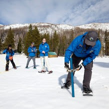 FEBRUARY SNOW SURVEY DWR conducted the second snow survey of the season at Phillips Station on Jan. 30. The manual survey recorded 29 inches of snow depth and a snow water equivalent of 10 inches, which is 58 percent of average for this location. The snow water equivalent measures the amount of water contained in the snowpack and is a key component of DWR’s water supply forecast. The results reflect a modest increase in the snowpack since Jan. 1, but overall conditions are still far below normal. DWR’s electronic readings from 130 stations placed throughout the state indicate that the statewide snowpack’s snow water equivalent is 8.4 inches, or 52 percent of average for this date, an improvement from just 28 percent of average on Jan. 1. One year ago, the snowpack statewide was 214 percent of average on Feb. 1. Despite additional precipitation in January, many storms so far this year have been warmer than average, producing rain rather than snow at higher elevations. Overall statewide precipitation is 82 percent of average for this date. Last year’s snowpack was aided by both above average precipitation and below average temperatures, which created a historic snowpack and improved reservoir storage statewide, which is still above average. Lake Oroville, the State Water Project’s largest reservoir, is currently 131 percent of average. More information about the recent snow survey can be found in DWR’s press release.  OROVILLE RECREATION
DWR, State Parks, and the California Department of Fish and Wildlife (CDFW) maintain over 92 miles of trails in the Oroville area. An interactive map of recreation facilities, including open trails and their permitted uses (hike, bike, horse, multi), is available on DWR’s Lake Oroville Recreation webpage. A paper trail map is available at various locations, including most entrance kiosks and the Lake Oroville Visitor Center. The Lake Oroville Visitor Center is open daily from 9 a.m. to 5 p.m. Staffed by knowledgeable guides, the Visitor Center features interpretive displays on Oroville Dam, area geology, wildlife and habitat, hydroelectric power, and cultural and historical artifacts. View videos in the theater about the construction of Oroville Dam, walk or hike along nearby trails, and visit the 47-foot-tall observation tower that provides unsurpassed panoramic views of surrounding areas. Free guided tours for school and community groups are available by reservation. Parking and admission to the Visitor Center are free. Lake Oroville is one of the State Water Project’s premier recreational destinations and one of California’s best fishing spots. The lake provides both warm-water and cold-water fisheries and is a popular destination for bass tournaments. Below the Oroville Dam, the Thermalito Afterbay and the Feather River offer additional excellent fishing opportunities. The marinas at Bidwell Canyon and Lime Saddle are open daily and provide a variety of services including a convenience store, gas, and boat rentals. Upstream migrating fish totals between Sept. 11, 2023 and Jan. 27, 2024 are:
CURRENT LAKE OPERATIONS Lake Oroville is at 842 feet elevation and storage is approximately 2.7 million acre-feet (MAF), which is 76 percent of its total capacity and 131 percent of the historical average. Feather River flows remain at 650 cfs through the City of Oroville with 9,350 cfs being released from the Thermalito Afterbay River Outlet (Outlet) for a total Feather River release of 10,000 cfs downstream. DWR continues to assess releases to the Feather River daily. Visitors to Oroville Dam may also notice minor amounts of water flowing from drains built into the emergency spillway, which is normal and expected with the emergency spillway design. The dam and emergency spillway continue to operate as intended. The public can track precipitation, snow, reservoir levels, and more at the California Data Exchange Center. The Lake Oroville gage station is identified as “ORO.” All data as of midnight 2/1/2024. 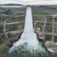 Lake Oroville Operations Update
The Department of Water Resources (DWR) began releasing water from Oroville Dam’s main spillway at 8 a.m. today. Releases to the Feather River ensure storage space remains in Lake Oroville for flood control protection. DWR coordinates releases closely with the U.S. Army Corps of Engineers and other water operators and adjusts releases as needed to account for continuing rain and snowmelt. Digital photos and b-roll from today’s spillway release are available on Pixel and Box. The information below reflects current reservoir level estimates. Forecasts can change quickly and may affect the estimates provided.
The Lake Oroville reservoir is the largest storage facility in the State Water Project, providing flood protection while supporting environmental and water delivery needs to 27 million Californians. In 2023, Oroville Dam’s main spillway passed over 2,370,000 acre-feet of water, 67 percent of Lake Oroville’s capacity, with flows as high as 36,000 cfs. The main spillway continues to perform well and operate as designed. DWR continues to monitor lake levels, weather forecasts, and mountain snow levels to optimize water storage while allowing for carryover storage into next year. 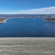 Lake Oroville Operations Update
Ahead of forecasted winter storms this week, the Department of Water Resources (DWR) began increasing water releases to the Feather River today from the Oroville-Thermalito Complex. These releases provide flood control protection for downstream communities and are coordinated closely with the U.S. Army Corps of Engineers and other water operators. Feather River recreation users are advised to remain alert as river flows are expected to be swift and cold and may change based on projected weather forecasts. The information below reflects current reservoir level estimates. Forecasts can change quickly and may affect the estimates provided.
Oroville Recreation Advisory Committee The Oroville Recreation Advisory Committee (ORAC) will hold a meeting on Friday, Feb. 2 at 10 a.m. at the Southside Oroville Community Center located at 2959 Lower Wyandotte Road, Oroville, CA, 95966. ORAC was established by the Federal Energy Regulatory Commission (FERC) to review and provide recreation plan recommendations for Oroville Facilities owned by the Department of Water Resources (DWR). The 13-member committee is made up of representatives from state and local government, recreation groups, and business and community organizations.  BROOD PONDS SUPPORT NATIVE WILDLIFE Within the Oroville-Thermalito Complex, DWR maintains several areas that preserve and enhance wildlife habitat. Encompassed within the Thermalito Afterbay’s 17 miles of shoreline and 4,300 surface acres of water are numerous brood ponds that provide prime habitat and breeding areas for waterfowl and giant garter snakes, a protected species. While water levels at the Afterbay may fluctuate based on agriculture and hydropower operations, DWR ensures brood pond habitats remain stable. A flap gate outlet system permits water to flow into brood pond areas, raising water levels, while preventing water from being released and maintaining a stable elevation for waterfowl nests and giant garter snakes. These measures ensure these species continue to thrive, upholding DWR’s commitment to protect, restore, and enhance the natural and human environments.  SNOW GOOSE FESTIVAL Celebrate one of the greatest migratory bird pathways in the world at the Snow Goose Festival of the Pacific Flyway happening Jan. 25 to Jan. 28. The festival hosts a variety of activities throughout the four-day event, including guided field trips to view the waterfowl, raptors and Snow Geese that migrate through the Northern Sacramento Valley during the winter months. DWR’s Lake Oroville Visitor Center Guides will host a free educational booth featuring kids’ activities between 9 a.m. and 3 p.m. on Saturday, Jan. 27 and Sunday, Jan. 28 at the Patrick Ranch Museum in Chico. Join festival attendees with visits to the Thermalito Forebay and Afterbay, and Oroville Wildlife Area offering possible sightings of rough-legged hawk, ferruginous hawk, merlin, bald eagle, golden eagle, red-tailed hawk, burrowing owl, ducks, grebes, and other deep-water birds. Check out the Snow Goose Festival website for more details about activities, an avian art exhibit, and guided field trips during the four-day event. 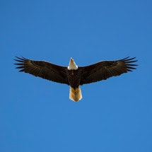 MIDWINTER BALD EAGLE SURVEY Environmental scientists from DWR participated in the National Midwinter Bald Eagle Survey on Jan. 5 and Jan. 8. This nationwide effort, coordinated by the U.S. Army Corps of Engineers, aims to determine bald eagle distribution and identify areas of important winter habitats. This year’s official count was 77 bald eagles for the Lake Oroville Winter Roost and 16 at the Thermalito Complex. Lake Oroville and the Sacramento Valley area provide an ideal habitat for bald eagles. Fish and waterfowl are the eagle’s main food source during this time of the year and large water bodies like Lake Oroville provide a wide variety of fish and the nearby wetlands and flooded rice fields provide an abundant supply of waterfowl for eagle foraging. The many trees and snags (tall dead trees) near water areas provide prime roosting locations for the bald eagles that migrate to and through the area during the winter months. 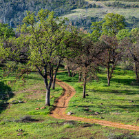 OROVILLE RECREATION
DWR, State Parks, and the California Department of Fish and Wildlife (CDFW) maintain over 92 miles of trails in the Oroville area. An interactive map of recreation facilities, including open trails and their permitted uses (hike, bike, horse, multi), is available on DWR’s Lake Oroville Recreation webpage. A paper trail map is available at various locations, including most entrance kiosks and the Lake Oroville Visitor Center. The Lake Oroville Visitor Center is open daily from 9 a.m. to 5 p.m. Staffed by knowledgeable guides, the Visitor Center features interpretive displays on Oroville Dam, area geology, wildlife and habitat, hydroelectric power, and cultural and historical artifacts. View videos in the theater about the construction of Oroville Dam, walk or hike along nearby trails, and visit the 47-foot-tall observation tower that provides unsurpassed panoramic views of surrounding areas. Free guided tours for school and community groups are available by reservation. Parking and admission to the Visitor Center are free. Lake Oroville is one of the State Water Project’s premier recreational destinations and one of California’s best fishing spots. The lake provides both warm-water and cold-water fisheries. Below the Oroville Dam, the Thermalito Forebay, Thermalito Afterbay and the Feather River offer additional excellent fishing opportunities. The marinas at Bidwell Canyon and Lime Saddle are open daily and provide a variety of services including a convenience store, gas, and boat rentals. Upstream migrating fish totals between Sept. 11, 2023 and Jan. 20, 2024 are:
CURRENT LAKE OPERATIONS Lake Oroville is at 838 feet elevation and storage is approximately 2.65 million acre-feet (MAF), which is 75 percent of its total capacity and 131 percent of the historical average. Feather River flows remain at 650 cubic feet per second (cfs) through the City of Oroville with 1,100 cfs being released from the Thermalito Afterbay River Outlet (Outlet) for a total Feather River release of 1,750 cfs downstream. DWR continues to assess releases to the Feather River daily. Winter storms have caused Lake Oroville’s elevation to rise above the level of the spillway’s main gates. While the gates are closed, water may still be seen on the main spillway outlet as the seals on the eight radial gates are not designed to be watertight. The seals do not play a role in the structural integrity of the gates, which continue to operate as intended. DWR periodically maintains and adjusts the seals during low-reservoir conditions to improve their sealing capability. Visitors to Oroville Dam may also notice minor amounts of water flowing from drains built into the emergency spillway, which is normal and expected with the emergency spillway design. The dam and emergency spillway continue to operate as intended. All data as of midnight 1/25/2024.  Midwinter Bald Eagle Survey Environmental scientists from the Department of Water Resources (DWR) participated in the National Midwinter Bald Eagle Survey on Jan. 5 and Jan. 8. This nationwide effort, coordinated by the U.S. Army Corps of Engineers, aims to determine bald eagle distribution and identify areas of important winter habitats. This year’s official count was 77 bald eagles for the Lake Oroville Winter Roost and 16 at the Thermalito Complex. Lake Oroville and the Sacramento Valley area provide an ideal habitat for bald eagles. Fish and waterfowl are the eagle’s main food source during this time of the year and large water bodies like Lake Oroville provide a wide variety of fish, and the nearby wetlands and flooded rice fields provide an abundant supply of waterfowl for eagle foraging. The many trees and snags (tall dead trees) near water areas provide prime roosting locations for the bald eagles that migrate to and through the area during the winter months.  SNOW GOOSE FESTIVAL Celebrate one of the greatest migratory bird pathways in the world at the Snow Goose Festival of the Pacific Flyway happening Jan. 25 to Jan. 28. The festival hosts a variety of activities throughout the four-day event, including guided field trips to view the waterfowl, raptors, and Snow Geese that migrate through the Northern Sacramento Valley during the winter months. DWR’s Lake Oroville Visitor Center Guides will host a free educational booth featuring kids’ activities between 9 a.m. and 4 p.m. Saturday, Jan. 27 and Sunday, Jan. 28 at the Patrick Ranch Museum in Durham. Join festival attendees with visits to the Thermalito Forebay and Afterbay and Oroville Wildlife Area offering possible sightings of Rough-legged Hawk, Ferruginous Hawk, Merlin, Bald and Golden Eagle, Red-tailed Hawk, Burrowing Owl, ducks, grebes, and other deep-water birds. Check out the Snow Goose Festival website for more details about activities, an avian art exhibit, and guided field trips during the four-day event. 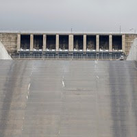 MAIN SPILLWAY GATE TESTING DWR will conduct routine testing on Oroville Dam’s main spillway gate hoist system on Wednesday, Jan. 24 between 10:30 a.m. and noon. During testing, two main spillway gates will be lifted one foot, releasing approximately 800 cubic feet per second of water down the spillway chute. The gates will remain open for approximately 15 minutes before being closed. Due to the minimal amount of water being released, water will appear to trickle from the chute. DWR will sound Oroville Dam’s alarm prior to spillway releases and gate testing. Oroville Dam’s eight main spillway radial gates were also inspected and tested in Nov. 2023. Recent storms have caused Lake Oroville’s elevation to rise above the level of the spillway’s main gates. While the gates are closed, water may still be seen on the main spillway outlet as the seals on the eight radial gates are not designed to be watertight. The seals do not play a role in the structural integrity of the gates, which continue to operate as intended. DWR periodically maintains and adjusts the seals during low-reservoir conditions to improve their sealing capability. 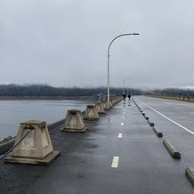 EXERCISING AT OROVILLE DAM While Oroville Dam plays a critical role in providing flood protection to downstream communities, it may not also come to mind as a prime location for physical fitness. However, a 1.3-mile paved road and separated two-lane multi-use path runs the length of the dam’s crest, offering an opportunity for exercise while enjoying scenic views of both Lake Oroville and the valley. Free parking is available on either side of the dam’s crest with restroom facilities located at the intersection of Canyon Drive and Oroville Dam Crest Road. For early birds or late-night fitness enthusiasts, the dam crest path is fully lit, making it a great location for free outdoor recreation during the shorter daylight hours of the winter months. Those looking for additional hiking or biking opportunities may use the Oroville Dam Crest trail to connect to an additional 92 miles of trails throughout the Oroville area. An interactive map of recreation facilities, including open trails and their permitted uses (hike, bike, horse, multi), is available on DWR’s Lake Oroville Recreation webpage. A paper trail map is available at various locations, including most entrance kiosks and the Lake Oroville Visitor Center. 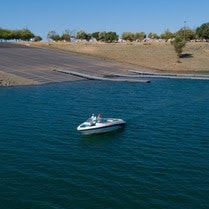 OROVILLE RECREATION
The Lake Oroville Visitor Center is open daily from 9 a.m. to 5 p.m. Staffed by knowledgeable guides, the Visitor Center features interpretive displays on Oroville Dam, area geology, wildlife and habitat, hydroelectric power, and cultural and historical artifacts. View videos in the theater about the construction of Oroville Dam, walk or hike along nearby trails, and visit the 47-foot-tall observation tower that provides unsurpassed panoramic views of surrounding areas. Free guided tours for school and community groups are available by reservation. Parking and admission to the Visitor Center are free. Lake Oroville is one of the State Water Project’s premier recreational destinations and one of California’s best fishing spots. The lake provides both warm-water and cold-water fisheries. Below the Oroville Dam, the Thermalito Forebay, Thermalito Afterbay and the Feather River offer additional excellent fishing opportunities. The marinas at Bidwell Canyon and Lime Saddle are open daily and provide a variety of services including a convenience store, gas, and boat rentals. Upstream migrating fish totals between Sept. 11, 2023 and Jan. 13, 2024 are:
CURRENT LAKE OPERATIONS Lake Oroville is at 825 feet elevation and storage is approximately 2.49 million acre-feet (MAF), which is 70 percent of its total capacity and 126 percent of the historical average. Feather River flows remain at 650 cubic feet per second (cfs) through the City of Oroville with 1,100 cfs being released from the Thermalito Afterbay River Outlet (Outlet) for a total Feather River release of 1,750 cfs downstream. DWR continues to assess releases to the Feather River daily. Visitors to Oroville Dam may also notice minor amounts of water flowing from drains built into the emergency spillway, which is normal and expected with the emergency spillway design. The dam and emergency spillway continue to operate as intended. The public can track precipitation, snow, reservoir levels, and more at the California Data Exchange Center. The Lake Oroville gage station is identified as “ORO.” All data as of midnight 1/18/2024.  Exercising at Oroville Dam While Oroville Dam plays a critical role in providing flood protection to downstream communities, it is also a prime location for physical fitness. A 1.3-mile paved road and separated two-lane multi-use path runs the length of the dam’s crest, offering an opportunity for exercise while enjoying scenic views of both Lake Oroville and the valley. Free parking is available on either side of the dam’s crest with restroom facilities located at the intersection of Canyon Drive and Oroville Dam Crest Road. Additional nearby parking is available at the Oroville Dam Crest Overlook, with a short path connecting to the dam crest road. For early birds or late-night fitness enthusiasts, the dam crest path has full lighting, making it a great location for free outdoor recreation during the shorter daylight hours of the winter months. Those looking for additional hiking or biking opportunities may use the Oroville Dam Crest trail to connect to an additional 92 miles of trails throughout the Oroville area. An interactive map of recreation facilities, including open trails and their permitted uses (hike, bike, horse, multi), is available on the Lake Oroville Recreation webpage. A paper trail map is available at various locations, including most entrance kiosks and the Lake Oroville Visitor Center.  BIKING AROUND LAKE OROVILLE While the spring and summer months may seem ideal for outdoor activities, winter remains a prime period for mountain biking throughout the Oroville area. Bikers not only enjoy cooler weather, but the dirt on recreation trails gets compacted by rainfall, offering increased traction following a few days of dry weather. With more than 70 miles of biking-designated trails throughout the Lake Oroville Recreation and Oroville Wildlife Areas, cyclists have a variety of trails and experiences to choose from. The Brad Freeman Trail loops throughout both recreation areas offering a 41-mile trek from the Oroville Dam Spillway area, past the Thermalito Diversion Pool, around the Thermalito Forebay and Afterbay, and through the remote Oroville Wildlife Area. Along the west side of Lake Oroville, the Potter’s Ravine system is a 15-mile trail with intermittent views of Lake Oroville. Cyclists can also bike another 8 miles from Potter’s Ravine along the North Fork Trail to the Bloomer Cove area showcasing the north fork arm of Lake Oroville. Those seeking a shorter trip may also bike from the Lake Oroville Visitor Center down to the Bidwell Canyon Saddle Dam, offering spectacular views of Lake Oroville during the ride. 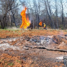 VEGETATION MANAGEMENT ACTIVITIES The Department of Water Resources (DWR) and CAL FIRE crews continue hand cutting, heavy equipment, and pile burning activities. Crews will be working in several areas throughout the Oroville Recreation Area – Loafer Creek along Highway 162 (Oro Quincy Highway) and around the Loafer Creek Campground, near Hyatt Powerplant along Oroville Dam Blvd. East, at the Lake Oroville Visitor Center, and throughout Bidwell Canyon. Work schedules are subject to change depending on weather, crew, and equipment availability. Work may cause intermittent trail closures within project areas. Recreational trail users should be cautious when entering work areas and obey all posted trail signage. Smoke from pile burning activities will be visible in the Oroville area. DWR’s Fuel Load Management Plan works to reduce wildfire risk, increase public safety, and enhance forest health around the Lake Oroville area. Ongoing vegetation management of this critical area remains a high priority for DWR and its partners at CAL FIRE, Butte County Fire Department, Butte County Sheriff’s Office, California Conservation Corps (CCC), California Department of Parks and Recreation (State Parks), and the Butte County Fire Safe Council.  OROVILLE RECREATION
The Lake Oroville Visitor Center is open daily from 9 a.m. to 5 p.m. Staffed by knowledgeable guides, the Visitor Center features interpretive displays on Oroville Dam, area geology, wildlife and habitat, hydroelectric power, and cultural and historical artifacts. View videos in the theater about the construction of Oroville Dam, walk or hike along nearby trails, and visit the 47-foot-tall observation tower that provides unsurpassed panoramic views of surrounding areas. Free guided tours for school and community groups are available by reservation. Parking and admission to the Visitor Center are free. Lake Oroville is one of the State Water Project’s premier recreational destinations and one of California’s best fishing spots. The lake provides both warm-water and cold-water fisheries. Below the Oroville Dam, the Thermalito Forebay, Thermalito Afterbay and the Feather River offer additional excellent fishing opportunities for Chinook salmon and steelhead. The marinas at Bidwell Canyon and Lime Saddle are open daily and provide a variety of services including a convenience store, gas, and boat rentals. Upstream migrating fish totals between Sept. 11, 2023 and Jan. 6, 2024 are:
CURRENT LAKE OPERATIONS Lake Oroville is at 821 feet elevation and storage is approximately 2.45 million acre-feet (MAF), which is 69 percent of its total capacity and 127 percent of the historical average. Feather River flows remain at 650 cubic feet per second (cfs) through the City of Oroville with 1,100 cfs being released from the Thermalito Afterbay River Outlet (Outlet) for a total Feather River release of 1,750 cfs downstream. DWR continues to assess releases to the Feather River daily. With rising water levels from recent storms, water may be seen on the main spillway outlet as the seals on the eight radial gates are not designed to be watertight. The gate seals do not play a role in the structural integrity of the gates, which continue to operate as intended. DWR periodically maintains and adjusts the seals during low-reservoir conditions to improve their sealing capability. Visitors to Oroville Dam may also notice minor amounts of water flowing from drains built into the emergency spillway, which is normal and expected with the emergency spillway design. The dam and emergency spillway continue to operate as intended. The public can track precipitation, snow, reservoir levels, and more at the California Data Exchange Center. The Lake Oroville gage station is identified as “ORO.” All data as of midnight 1/11/2024. 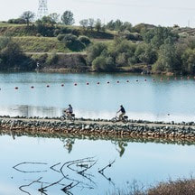 Biking Around Lake Oroville While the spring and summer months may seem ideal for outdoor activities, winter remains a prime period for mountain biking throughout the Oroville area. Bikers not only enjoy cooler weather, but the dirt on recreation trails gets compacted by rainfall, offering increased traction following a few days of dry weather. With more than 70 miles of biking-designated trails throughout the Lake Oroville Recreation and Oroville Wildlife Areas, cyclists have a variety of trails and experiences to choose from. The Brad Freeman Trail loops throughout both recreation areas offering a 41-mile trek from the Oroville Dam Spillway area, past the Thermalito Diversion Pool, around the Thermalito Forebay and Afterbay, and through the remote Oroville Wildlife Area. Along the west side of Lake Oroville, the Potter’s Ravine system is a 15-mile trail with intermittent views of Lake Oroville. Cyclists can also bike another 8 miles from Potter’s Ravine along the North Fork Trail to the Bloomer Cove area showcasing the north fork arm of Lake Oroville. Those seeking a shorter trip may also bike from the Lake Oroville Visitor Center down to the Bidwell Canyon Saddle Dam, offering spectacular views of Lake Oroville during the ride. 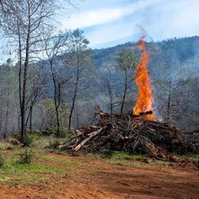 VEGETATION MANAGEMENT ACTIVITIES The Department of Water Resources (DWR) and CAL FIRE crews are resuming hand cutting, heavy equipment, and pile burning activities following the holiday season. Crews will be working in several areas throughout the Oroville Recreation Area – Loafer Creek along Highway 162 (Oro Quincy Highway) and around the Loafer Creek Campground, near Hyatt Powerplant along Oroville Dam Blvd. East, at the Lake Oroville Visitor Center, and throughout Bidwell Canyon. Work schedules are subject to change depending on weather, crew, and equipment availability. Work may cause intermittent trail closures within project areas. Recreational trail users should be cautious when entering work areas and obey all posted trail signage. Smoke from pile burning activities will be visible in the Oroville area. DWR’s Fuel Load Management Plan works to reduce wildfire risk, increase public safety, and enhance forest health around the Lake Oroville area. Ongoing vegetation management of this critical area remains a high priority for DWR and its partners at CAL FIRE, Butte County Fire Department, Butte County Sheriff’s Office, California Conservation Corps (CCC), California Department of Parks and Recreation (State Parks), and the Butte County Fire Safe Council. 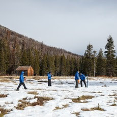 SNOW SURVEY DWR conducted the first snow survey of the season at Phillips Station on Jan. 2. The manual survey recorded 7.5 inches of snow depth and a snow water equivalent of 3 inches, which is 30 percent of average for this location. The snow water equivalent measures the amount of water contained in the snowpack and is a key component of DWR’s water supply forecast. Statewide the snowpack is 25 percent of average for this date. After one of the largest snowpacks on record last season, the start of this water year has been dry despite some recent storms in the last weeks of December that provided a small boost in the snowpack. While state reservoirs are still above average for this time of year and strong El Niño conditions are present in the Pacific Ocean, the outlook for the rest of the winter remains highly uncertain. More information about the first snow survey can be found in DWR’s press release. 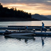 OROVILLE RECREATION
DWR, State Parks, and the California Department of Fish and Wildlife (CDFW) maintain over 92 miles of trails in the Oroville area. An interactive map of recreation facilities, including open trails and their permitted uses (hike, bike, horse, multi), is available on DWR’s Lake Oroville Recreation webpage. A paper trail map is available at various locations, including most entrance kiosks and the Lake Oroville Visitor Center. The marinas at Bidwell Canyon and Lime Saddle are open daily and provide a variety of services including a convenience store, gas, and boat rentals. The Lake Oroville Visitor Center is open daily from 9 a.m. to 5 p.m. Staffed by knowledgeable guides, the Visitor Center features interpretive displays on Oroville Dam, area geology, wildlife and habitat, hydroelectric power, and cultural and historical artifacts. View videos in the theater about the construction of Oroville Dam, walk or hike along nearby trails, and visit the 47-foot-tall observation tower that provides unsurpassed panoramic views of surrounding areas. Free guided tours for school and community groups are available by reservation. Parking and admission to the Visitor Center are free. Upstream migrating fish totals between Sept. 11 and Dec. 26 are:
CURRENT LAKE OPERATIONS Lake Oroville is at 820 feet elevation and storage is approximately 2.42 million acre-feet (MAF), which is 69 percent of its total capacity and 129 percent of the historical average. Feather River flows remain at 650 cubic feet per second (cfs) through the City of Oroville with 1,100 cfs being released from the Thermalito Afterbay River Outlet (Outlet) for a total Feather River release of 1,750 cfs downstream. DWR continues to assess releases to the Feather River daily. With rising water levels from recent storms, water may be seen on the main spillway outlet as the seals on the eight radial gates are not designed to be watertight. The gate seals do not play a role in the structural integrity of the gates, which continue to operate as intended. DWR periodically maintains and adjusts the seals during low-reservoir conditions to improve their sealing capability. Visitors to Oroville Dam may also notice minor amounts of water flowing from drains built into the emergency spillway, which is normal and expected with the emergency spillway design. The dam and emergency spillway continue to operate as intended. The public can track precipitation, snow, reservoir levels, and more at the California Data Exchange Center. The Lake Oroville gage station is identified as “ORO.” All data as of midnight 1/4/2024. 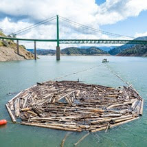 A Year in Review The arrival of 2023 ushered in continued heavy rain and snowfall throughout California including in the Northern Sierra and Feather River Watershed that feed Lake Oroville. Between December 2022 and mid-January 2023, Lake Oroville experienced a 100-foot rise in elevation, marking the start of a significant turnaround in water storage at the State Water Project’s (SWP) largest facility following several years of drought. Quickly rising water levels at the beginning of the year also initiated a huge driftwood removal endeavor for DWR’s civil maintenance crews. Beginning in January, Oroville Field Division’s civil maintenance crews spent four months corralling acres of floating driftwood at Lake Oroville. Due to the large influx in debris, maintenance staff and boats were pulled from Southern and San Joaquin Field Divisions and the Sutter and Sacramento Flood yards to assist with driftwood collection. In total, civil maintenance crews collected over 5,400 cubic yards of driftwood to ensure continued infrastructure operations and the safety of the recreating public on Lake Oroville. 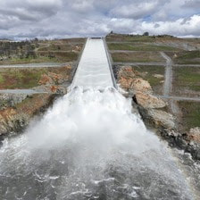 In early March, water levels brought the Loafer Point Stage I boat ramp into service for the first time since its construction in 2020. Open for water elevations above 805 feet, Loafer Point Stage I offers three boat launch lanes, a boarding dock, a lighted parking area for vehicles and boat trailers, and a restroom facility. This facility along with the adjacent lower Stage II boat ramp are a perfect complement to the Loafer Creek Recreation Area, providing access to many trails, campgrounds, a swimming beach, and the nearby Bidwell Canyon Marina and store. On March 10, rising reservoir levels and flood control manual requirements prompted DWR to release water from Oroville Dam’s main spillway for the first time since 2019. By June, melting snowpack and water runoff into Lake Oroville had filled the reservoir to 100 percent capacity. Over the course of the spring and summer seasons, DWR released over 2,370,000 acre-feet of water from the main spillway, approximately 67 percent of Lake Oroville’s capacity. Construction continued on the River Valve Outlet System (RVOS) at Oroville Dam. The system is a series of two parallel outlet conduits, each with two valves, that have the capacity to draw water from deep in Lake Oroville for release. The RVOS is a critical feature of the dam, providing the ability to discharge cold water to support Feather River temperatures necessary for fish health. It also ensures the ability to maintain Feather River flows through RVOS releases during drought years, especially if reservoir levels drop below Hyatt Powerplant’s water intake structures. 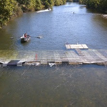 Around the end of July, DWR completed installation of a fish monitoring station in the Feather River about five miles downstream of Oroville. The fish monitoring structure guides fish past an underwater video camera, allowing biologists to review footage and determine abundance, run timing, and origin (hatchery or natural) of steelhead and Chinook salmon populations. This information will improve management of these important fish populations in the Feather River and at the Feather River Fish Hatchery. At the end of August, DWR also completed construction on a salmonid habitat improvement project in the Feather River near the Feather River Fish Hatchery and Bedrock Park in Oroville. The project placed approximately 9,000 cubic yards of gravel at multiple locations to improve existing spawning habitat sites. Salmonid access to existing river side channels was also improved by excavating and redistributing accumulated streambed material. High levels of in-river spawning were seen this fall in project areas. Between mid-September and early December, DWR performed routine concrete and slab and wall joint sealant repair work on localized areas of Oroville Dam’s main spillway identified during annual inspections. While the main spillway continues to perform well and operate as designed, periodic concrete and sealant repairs of the spillway are expected due to seasonal temperature variations, spillway releases, and sun exposure. In addition, inspections of the 51,000 feet of piping that supports the spillway’s improved drainage system were completed this season. 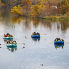 This fall, DWR partnered with Friends of Butte Creek and the Oroville Chamber of Commerce to offer educational Floating Classroom tours on the Feather River. Rafting trips floated through Feather River spawning habitat while DWR scientists provided information on Chinook salmon conservation efforts, ongoing and planned research, and restoration and monitoring projects. Profits from weekend public tours were used to provide free floating classroom experiences to 15 classes from nine local schools during the peak salmon spawning season. DWR was also awarded Hazard Mitigation Grant Program (HMGP) funds totaling $900,000 from the Federal Emergency Management Agency (FEMA) to complete a 305-acre hazardous fuels reduction project in the Lake Oroville area. This multi-year project reduces the risk of a catastrophic wildfire by improving defensible space around infrastructure, roads, and residential areas, with work performed in conjunction with Oroville Field Division’s ongoing Fuel Load Management Plan. 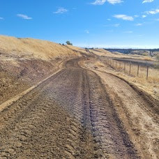 Construction work on a 1.5-mile section of the Brad Freeman Trail between Cherokee Road and the Highway 70 Garden Drive overpass began in October. Planned improvements include upgrading the existing gravel/dirt trail to include an 8-foot-wide asphalt path for cyclists and a 4-foot-wide decomposed granite path for pedestrians. Existing entrance bollards will also be replaced with wider, accessible box gates. The improvement project is supported by a Land and Water Conservation Fund grant through the National Park Service, with remaining funding for the $700,000 project provided by DWR. Project completion is expected in June 2025.
DWR and the California Department of Fish and Wildlife (CDFW) completed spawning activities this fall for spring, inland, and fall-run Chinook salmon at the Feather River Fish Hatchery in Oroville. The Hatchery collected enough eggs to meet its production goals and anticipates meeting target release numbers of 2 million spring-run, 125,000 inland Chinook destined for Lake Oroville, and 6 million fall-run, with an additional 3.5 million fall-run to be released to mitigate declines in Chinook salmon populations during recent drought years. Chinook salmon fingerlings raised at the Hatchery will later be released in the Feather River and San Francisco Bays to support inland and ocean fisheries. The Feather River Fish Hatchery is a California SWP facility owned and maintained by DWR, which funds hatchery operations. CDFW operates the hatchery, including fish spawning, rearing, and stocking activities. DWR looks forward to initiating and completing more projects in 2024 at the Oroville-Thermalito Complex. The Lake Oroville Community Update will continue to share news and information with the community. OROVILLE RECREATION The Lake Oroville Visitor Center will close at 1 p.m. Sunday, Dec. 24 and close all day for the Christmas and New Year holidays. Visitors may still access nearby trails during the holiday closures. Open seven days a week from 9 a.m. to 5 p.m., the Visitor Center features interpretive displays on Oroville Dam, area geology, wildlife and habitat, hydroelectric power, and cultural and historical artifacts. View videos in the theater about the construction of Oroville Dam, walk or hike along nearby trails, and visit the 47-foot-tall observation tower that provides unsurpassed panoramic views of surrounding areas. Free guided tours for school and community groups are available by reservation. Parking and admission to the Visitor Center are free. The Spillway Day Use Area and Boat Ramp will be open from 6 a.m. to 6 p.m. on Christmas Eve and Christmas Day. Daily winter hours for the Spillway Day Use Area are currently 6 a.m. to 8 p.m. through April 30, 2024. DWR, the California Department of Parks and Recreation, and CDFW maintain over 92 miles of trails in the Oroville area. An interactive map of recreation facilities, including open trails and their permitted uses (hike, bike, horse, multi), is available on DWR’s Lake Oroville Recreation webpage. A paper trail map is available at various locations, including most entrance kiosks and the Lake Oroville Visitor Center. The marinas at Bidwell Canyon and Lime Saddle are open daily and provide a variety of services including a convenience store, gas, and boat rentals. Upstream migrating fish totals between Sept. 11 and Dec. 13 are:
CURRENT LAKE OPERATIONS Lake Oroville is at 815 feet elevation and storage is approximately 2.37 million acre-feet (MAF), which is 67 percent of its total capacity and 130 percent of the historical average. Feather River flows remain at 650 cubic feet per second (cfs) through the City of Oroville with 1,100 cfs being released from the Thermalito Afterbay River Outlet (Outlet) for a total Feather River release of 1,750 cfs downstream. DWR continues to assess releases to the Feather River daily. With rising water levels from recent storms, water may be seen on the main spillway outlet as the seals on the eight radial gates are not designed to be watertight. The gate seals do not play a role in the structural integrity of the gates, which continue to operate as intended. DWR periodically maintains and adjusts the seals during low-reservoir conditions to improve their sealing capability. Visitors to Oroville Dam may also notice minor amounts of water flowing from drains built into the emergency spillway, which is normal and expected with the emergency spillway design. The dam and emergency spillway continue to operate as intended. The public can track precipitation, snow, reservoir levels, and more at the California Data Exchange Center. The Lake Oroville gage station is identified as “ORO.” All data as of midnight 12/21/2023. DWR wishes everyone a happy holiday season. The Lake Oroville Community Update will return on January 5, 2024  Salmon Spawning Operations The Department of Water Resources (DWR) and the California Department of Fish and Wildlife (CDFW) completed spawning activities for spring, inland, and fall-run Chinook salmon at the Feather River Fish Hatchery in Oroville. The Hatchery collected enough eggs to meet its production goals and anticipates meeting target release numbers of 2 million spring-run, 125,000 inland Chinook destined for Lake Oroville, and 6 million fall-run, with an additional 3.5 million fall-run to be released to mitigate declines in Chinook salmon populations during recent drought years. Chinook salmon fingerlings raised at the Hatchery will later be released in the Feather River and San Francisco Bays to support inland and ocean fisheries. In addition, DWR and CDFW continued thiamine treatment to combat B1 vitamin deficiencies. This treatment improves the health of the fish, increasing the survival of Chinook salmon from egg to juvenile. Thanks to a recently completed spawning gravel improvement project in the Feather River, combined with the substantial number of salmon that returned to the Feather River this fall, high levels of in-river spawning have been seen over the last few months. DWR’s newly installed Feather River Fish Monitoring Station counted upstream migrating fish totals of 31,003 Chinook salmon and 787 steelhead between Sept. 11 and Dec. 6. The monitoring totals help improve management of these important fish populations in the Feather River and at the Feather River Fish Hatchery. 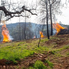 VEGETATION MANAGEMENT ACTIVITIES DWR and CAL FIRE’s Magalia Fire Center began vegetation cutting, piling, and burning activities last week near the Hyatt Powerplant along Oro Dam Blvd. East. Crews will be onsite Tuesday through Thursday each week, with vegetation management activities continuing for several months. In addition, fuel reduction activities are continuing in the Loafer Creek Recreation Area along Highway 162 (Oro Quincy Highway) with work also beginning soon in the Bidwell Canyon and Kelly Ridge areas. Work schedules are subject to change depending on weather, crew, and equipment availability. Work may cause intermittent trail closures within project areas. Recreational trail users should be cautious when entering work areas and obey all posted trail signage. Smoke from pile burning activities will be visible in the Oroville area. DWR’s Fuel Load Management Plan works to reduce wildfire risk, increase public safety, and enhance forest health around the Lake Oroville area. Ongoing vegetation management of this critical area remains a high priority for DWR and its partners at CAL FIRE, Butte County Fire Department, Butte County Sheriff’s Office, California Conservation Corps (CCC), California Department of Parks and Recreation (State Parks), and the Butte County Fire Safe Council.  MAINTENANCE WORK ON MAIN SPILLWAY COMPLETE FOR THE SEASON DWR has completed routine maintenance work on Oroville Dam’s main spillway for the 2023 season. Work this year included routine concrete repair, complete sealant replacement on concrete slabs and wall joints, and a complete inspection of the 51,000 feet of piping that supports the spillway’s improved drainage system. Oroville Dam’s main spillway performed well and operated as designed in 2023, passing over 2,370,000 acre-feet of water – approximately 67 percent of the capacity of Lake Oroville. Due to seasonal temperature variations, spillway releases, and sun exposure, periodic concrete and joint sealant repairs of the main spillway are expected. The spillway was rebuilt to the highest engineering and safety standards with oversight and guidance by the Federal Energy Regulatory Commission (FERC), Division of Safety of Dams (DSOD), and an independent board of consultants. DWR performed a significant amount of inspection and testing throughout construction to verify compliance with project specifications. DWR also provides regular updates to the Oroville Dam Citizens Advisory Commission, a public forum for discussing operations, maintenance, and public safety activities at Oroville Dam and its facilities.  SALMON SURVEYS DWR scientists are performing weekly surveys in the Feather River through Dec. 22 to record the number of Chinook salmon returning to spawn this season. Approximately two to three boats will be on the river during weekdays conducting surveys. The weekday survey schedule is as follows, but is subject to change due to crew availability and the number of fish encountered:
 OROVILLE RECREATION
DWR, State Parks, and CDFW maintain over 92 miles of trails in the Oroville area. An interactive map of recreation facilities, including open trails and their permitted uses (hike, bike, horse, multi), is available on DWR’s Lake Oroville Recreation webpage. A paper trail map is available at various locations, including most entrance kiosks and the Lake Oroville Visitor Center. The marinas at Bidwell Canyon and Lime Saddle are open daily and provide a variety of services including a convenience store, gas, and boat rentals. The Lake Oroville Visitor Center is open seven days a week from 9 a.m. to 5 p.m. Staffed by knowledgeable guides, the Visitor Center features interpretive displays on Oroville Dam, area geology, wildlife and habitat, hydroelectric power, and cultural and historical artifacts. View videos in the theater about the construction of Oroville Dam, walk or hike along nearby trails, and visit the 47-foot-tall observation tower that provides unsurpassed panoramic views of surrounding areas. Free guided tours for school and community groups are available by reservation. Parking and admission to the Visitor Center are free. CURRENT LAKE OPERATIONS Lake Oroville is at 812 feet elevation and storage is approximately 2.32 million acre-feet (MAF), which is 66 percent of its total capacity and 129 percent of the historical average. Feather River flows remain at 650 cubic feet per second (cfs) through the City of Oroville with 1,100 cfs being released from the Thermalito Afterbay River Outlet (Outlet) for a total Feather River release of 1,750 cfs downstream. DWR continues to assess releases to the Feather River daily. Visitors to Oroville Dam may also notice minor amounts of water flowing from drains built into the emergency spillway, which is normal and expected with the emergency spillway design. The dam and emergency spillway continue to operate as intended. The public can track precipitation, snow, reservoir levels, and more at the California Data Exchange Center. The Lake Oroville gage station is identified as “ORO.” All data as of midnight 12/14/2023  DWR Announces Initial State Water Project Allocations The Department of Water Resources (DWR) announced on Dec. 1 an initial State Water Project (SWP) allocation forecast of 10 percent of requested supplies for 2024. The SWP provides water to 29 public water agencies that serve 27 million Californians. The initial water supply forecast is the first allocation of the new water year, which began Oct. 1, and is based on current reservoir storage and an assumption of very dry conditions. So far in October and November, storms have not brought as much rain and snow. The allocation has no bearing on current water supplies or water captured in 2023. Most reservoirs in the state remain above average for this time of year following last water year’s wet winter. More information on the initial SWP allocation announcement may be found in DWR’s press release.  MAINTENANCE WORK ON MAIN SPILLWAY COMPLETE FOR THE SEASON DWR has completed routine maintenance work on Oroville Dam’s main spillway for the 2023 season. Work this year included routine concrete repair, complete sealant replacement on concrete slabs and wall joints, and a complete inspection of the 51,000 feet of piping that supports the spillway’s improved drainage system. Oroville Dam’s main spillway performed well and operated as designed in 2023, passing over 2,370,000 acre-feet of water – approximately 67 percent of the capacity of Lake Oroville. Due to seasonal temperature variations, spillway releases, and sun exposure, periodic concrete and joint sealant repairs of the main spillway are expected. The spillway was rebuilt to the highest engineering and safety standards with oversight and guidance by the Federal Energy Regulatory Commission (FERC), Division of Safety of Dams (DSOD), and an independent board of consultants. DWR performed a significant amount of inspection and testing throughout construction to verify compliance with project specifications. DWR also provides regular updates to the Oroville Dam Citizens Advisory Commission, a public forum for discussing operations, maintenance, and public safety activities at Oroville Dam and its facilities. OROVILLE PARADE OF LIGHTS Don’t miss Oroville’s annual Parade of Lights event this Saturday, Dec. 9, starting at 6 p.m. in downtown Oroville. This family-friendly event features a beautiful array of decorated floats with dancers, performers, and a marching band continuing the festive entertainment throughout the route. This year’s parade theme is “Christmas Throughout the Year: A Holiday Extravaganza” with floats representing each month of the year. Parade of Lights is organized by the Oroville Chamber of Commerce with event resource support provided by DWR. For more information about the Parade of Lights event, visit visitoroville.com. 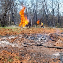 VEGETATION MANAGEMENT ACTIVITIES DWR and CAL FIRE’s Magalia Fire Center began vegetation cutting, piling, and burning activities this week near the Hyatt Powerplant along Oro Dam Blvd. East. Crews will be onsite Tuesday through Thursday each week, with vegetation management activities continuing for several months. In addition, fuel reduction activities are continuing in the Loafer Creek Recreation Area along Highway 162 (Oro Quincy Highway) for the next couple of weeks. Work schedules are subject to change depending on weather, crew, and equipment availability. Work may cause intermittent trail closures within project areas. Recreational trail users should be cautious when entering work areas and obey all posted trail signage. Smoke from pile burning activities will be visible in the Oroville area. DWR’s Fuel Load Management Plan works to reduce wildfire risk, increase public safety, and enhance forest health around the Lake Oroville area. Ongoing vegetation management of this critical area remains a high priority for DWR and its partners at CAL FIRE, Butte County Fire Department, Butte County Sheriff’s Office, California Conservation Corps (CCC), California Department of Parks and Recreation (State Parks), and the Butte County Fire Safe Council. 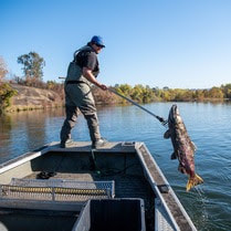 SALMON SURVEYS DWR scientists are performing weekly surveys in the Feather River through Dec. 22 to record the number of Chinook salmon returning to spawn this season. Approximately two to three boats will be on the river during weekdays conducting surveys. The weekday survey schedule is as follows, but is subject to change due to crew availability and the number of fish encountered:
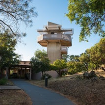 OROVILLE RECREATION The Lake Oroville Visitor Center will be temporarily closed Friday, Dec. 15 between 7 a.m. and noon for DWR staff training. Visitors may still access nearby trails and outside facilities during the temporary closure. Open seven days a week from 9 a.m. to 5 p.m., the Visitor Center features interpretive displays on Oroville Dam, area geology, wildlife and habitat, hydroelectric power, and cultural and historical artifacts. View videos in the theater about the construction of Oroville Dam, walk or hike along nearby trails, and visit the 47-foot-tall observation tower that provides unsurpassed panoramic views of surrounding areas. Free guided tours for school and community groups are available by reservation. Parking and admission to the Visitor Center are free.
DWR biologists are using the Feather River Fish Monitoring Station to determine abundance, run timing, and origin (hatchery or natural) of steelhead and Chinook salmon populations. This information will improve the management of these important fish populations. Upstream migrating fish totals between Sept. 11 and Dec. 2 are:
DWR, State Parks, and the Department of Fish and Wildlife maintain over 92 miles of trails in the Oroville area. An interactive map of recreation facilities, including open trails and their permitted uses (hike, bike, horse, multi), is available on DWR’s Lake Oroville Recreation webpage. A paper trail map is available at various locations, including most entrance kiosks and the Lake Oroville Visitor Center. The marinas at Bidwell Canyon and Lime Saddle are open daily and provide a variety of services including a convenience store, gas, and boat rentals. CURRENT LAKE OPERATIONS Lake Oroville is at 812 feet elevation and storage is approximately 2.33 million acre-feet (MAF), which is 66 percent of its total capacity and 131 percent of the historical average. Feather River flows remain at 650 cubic feet per second (cfs) through the City of Oroville with 1,100 cfs being released from the Thermalito Afterbay River Outlet (Outlet) for a total Feather River release of 1,750 cfs downstream. DWR continues to assess releases to the Feather River daily. Visitors to Oroville Dam may also notice minor amounts of water flowing from drains built into the emergency spillway, which is normal and expected with the emergency spillway design. The dam and emergency spillway continue to operate as intended. The public can track precipitation, snow, reservoir levels, and more at the California Data Exchange Center. The Lake Oroville gage station is identified as “ORO.” All data as of midnight 12/7/2023. |
Archives
April 2024
Categories
All
|
 RSS Feed