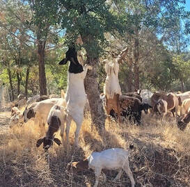
 February 5, 2021 Oroville Dam Citizens Advisory Commission Public Meeting The California Natural Resources Agency is hosting its sixth Oroville Dam Citizens Advisory Commission meeting on Feb. 19 from 9 a.m. to 11 a.m. The public meeting will be held online and will include presentations and public comment. The Commission will receive an update on fire modernization at the Hyatt Power Plant, winter operations, and a presentation from the Yuba Water Agency on downstream flood management. The Citizens Advisory Commission is a forum for the community to provide feedback and ask questions. For information on how to join the virtual meeting, please visit https://bit.ly/OrovilleCAC. Oroville Recreation Advisory Committee to Meet The Oroville Recreation Advisory Committee (ORAC) met on Feb. 5. Due to the COVID-19 pandemic, the meeting was not open to the public to protect public health. ORAC was established by the Federal Energy Regulatory Commission (FERC) to review and provide recommendations regarding the Department of Water Resources (DWR) Recreation Plan for the Lake Oroville State Recreation Area. To obtain a summary of the meeting, send a request to [email protected]. Wildfire Impacts on Water Quality In late 2020, several members of the multi-agency “Watershed Working Group”, led by the California Governor’s Office of Emergency Services (CalOES), conducted targeted monitoring of rivers, lakes, and other surface waters in the North Complex burn area and downstream. The Central Valley Regional Water Quality Control Board (Water Board), California Department of Water Resources (DWR), and the California Department of Fish and Wildlife (CDFW) collected and tested samples of surface waters throughout the North Complex Fire’s burn scar in Butte and Plumas counties. Results revealed some contaminant levels are elevated, but are lower than anticipated. The Water Board issued a news release today stating these elevated results are not impacting drinking water treatment facilities nor the quality of drinking water. While major wildfires often lead to subsequent water quality challenges in lakes, streams and other waterways, the lower than expected levels of contaminants could be linked to the relatively dry winter months in 2020. Water testing will continue and the Watershed Working Group will report results in the weeks ahead. The Water Board will alert the public if results show water quality may be further impacted. Photo: DWR water quality experts collect water samples at Lake Oroville  Lake Oroville Boat Ramps Winter precipitation inflows into Lake Oroville have increased the lake’s elevation. The paved Oroville Dam Spillway boat launch ramps are now in the water and two lanes are open for use. The alternate, single lane, gravel boat ramp near the spillway gates will remain closed. The Spillway Boat Ramp area is open from 6 a.m. to 8 p.m. daily. Additionally, visitors and users of the Bidwell Canyon boat ramp area can also enjoy full access to the expanded, Stage II paved parking area and new boat ramp lanes when the lake drops as low as 705 feet elevation. Currently, boaters are using the Stage III boat ramp at Bidwell Canyon which is open 24 hours per day and provides access to elevation 665 feet. The Lime Saddle boat ramp is still out of the water. Photo: CA Parks staff re-install boarding floats at the open Oroville Dam Spillway boat ramp on Feb. 4 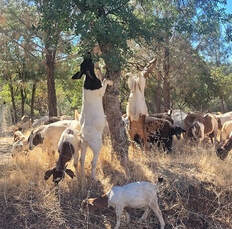 Oroville Recreation
The California Department of Parks and Recreation (CA Parks), in compliance with the modification for the Greater Sacramento Region’s COVID-19 public safety restrictions, has opened Lake Oroville State Recreation Area (LOSRA) campgrounds at Bidwell Canyon, Loafer Creek, including the Equestrian Campground, and the Lime Saddle Campground. Enroute camping at the North Forebay and Spillway facilities is permitted. Group camping remains closed. Reservation capability does not open until April and camping sites will be allocated on a ‘first come-first serve’ basis. The Potters Ravine and North Fork trails are open for use. CA Parks encourages users to remain on the trails. Assessments by CA Parks staff of trail safety will continue through the winter. Additionally, day use facilities at Foreman Creek, Stringtown, and Enterprise, damaged by the September North Complex Fire, are now open to the public. The Lake Oroville Visitors Center remains closed. Visit the California Parks Lake Oroville State Recreation Area (LOSRA) webpage for current information on facility status as well as current requirements to protect public health during the COVID-19 pandemic. Information about recreation facilities can be found in DWR’s interactive map on the Lake Oroville Recreation webpage. For information about the Oroville Wildlife Area, including the Thermalito Afterbay, visit the California Department of Fish and Wildlife webpage. Photo: Equestrian campground at LOSRA's Loafer Creek Recreation Area Current Lake Operations The elevation of Oroville’s reservoir is about 701 feet elevation and storage is about 1.26 million acre-feet, 54 percent of historical average. Currently, in the Northern Sierra Basin, rainfall is below average, at 53 percent of normal for this time of year and snowpack is also below average at 69 percent of normal. Dry conditions will continue this weekend and are expected to remain into the week of Feb. 8. The total releases to the Feather River continues to be at 1,250 cfs to conserve storage in Lake Oroville. The Feather River flows consist of 800 cfs down the Low Flow Channel through the City of Oroville, and 450 cfs from the Thermalito Afterbay Outlet (Outlet) for a total of 1,250 cfs for the Feather River’s high flow channel downstream of the Outlet. The public can track precipitation, snow, reservoir levels, and more at the California Data Exchange Center at www.cdec.water.ca.gov. Lake Oroville is identified as “ORO”. All data as of midnight 2/4/2021 ### Know someone who would like to receive Community Updates? They can email their request to [email protected]. Comments are closed.
|
Archives
May 2024
Categories
All
|
 RSS Feed